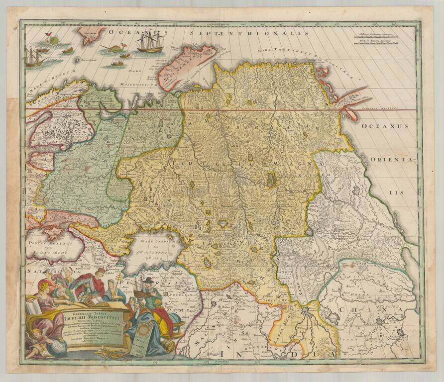
Decorative map of Russia and Central Asia, showing the Northeast Passage. Extends from the Black Sea and th Baltic to Kamchatka, China, Northern India and the mouth of the Indus River. Includes remarkable detail in areas still then not yet explored....
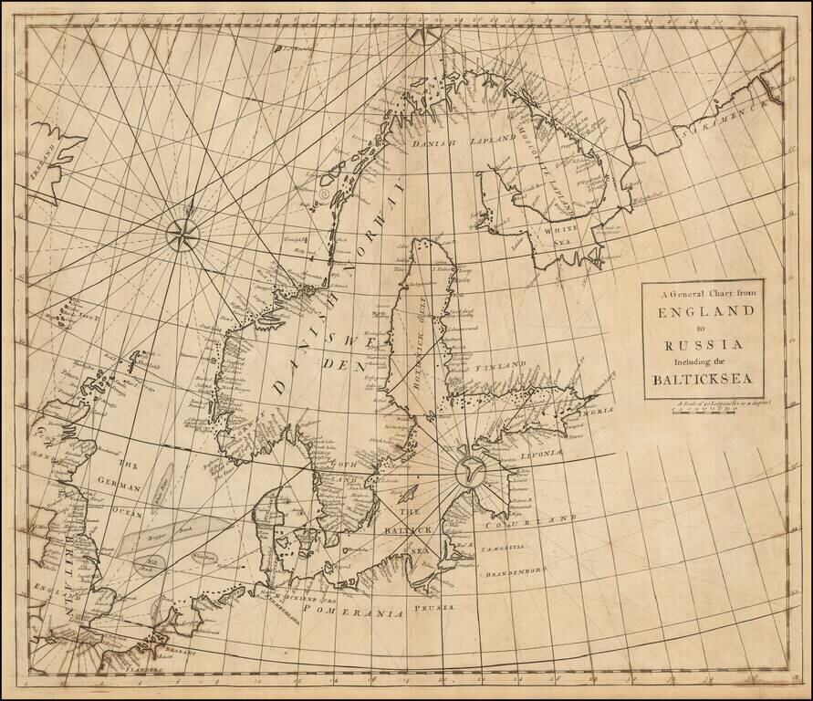
Rare Chart of Northern Europe from an Influential Atlas Scarce engraved sea chart comprising Scandinavia, the Baltic Sea, and the North Sea (here "German Ocean"). Interestingly, Norway is separate from Danish Norway, and there is a separation drawn...
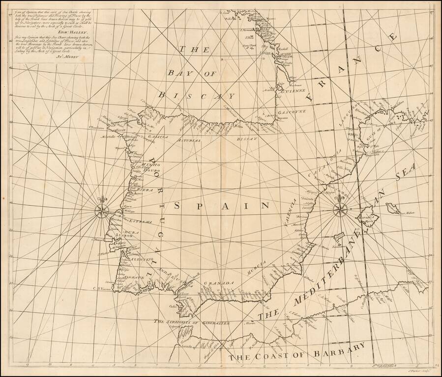
Southern Sheet of Scarce Sea Chart Exhibiting a New Projection Rare chart showing the Iberian Peninsula on a 'globular projection' (i.e. on the same projection as a double-hemisphere map). The charts consists of two sheets, and this is the...
![The Severn or Channel of Bristol [with a chart of the Irish Sea.]](/map/small/47485.jpg)
Fine Charts of British and Irish Waterways Scarce pair of sea charts printed on a single sheet, comprising a chart of the Severn estuary and another of the eastern Irish Sea. The former includes Bristol, while the latter features the Isle of Man. The...
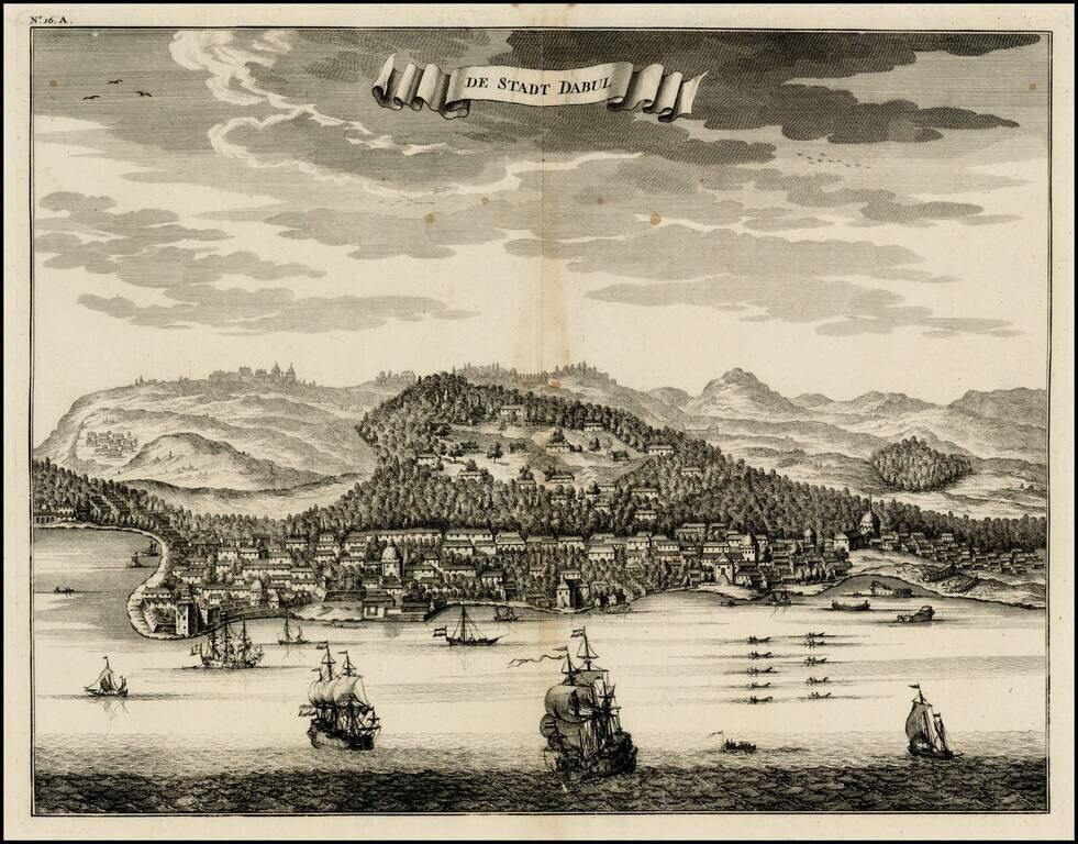
Nice bird's eye-view of the Town of Dabul , from Francois Valentyn's Oud en Nieuw Oost Indien, part V : Beschryving van Coromandel, Pegu, Arrakan, Bengale, Mocha, Persien, Malakka, Sumatra, Ceylon. Francois Valentijn (1666-1727) was a minister,...
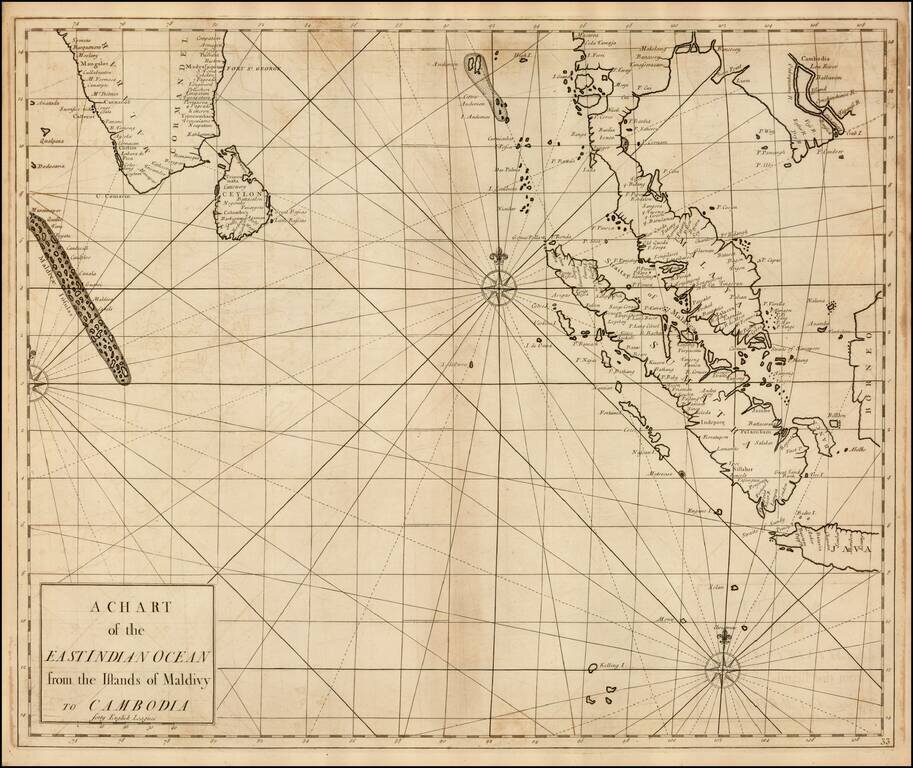
Fine Chart of the Indian Ocean in an Influential Atlas Scarce sea chart of the Straits of Singapore, the Malay Peninsula, Sumatra, the southern part of India and the Maldives, from the Atlas Maritimus & Commercialis, published in London in 1728....
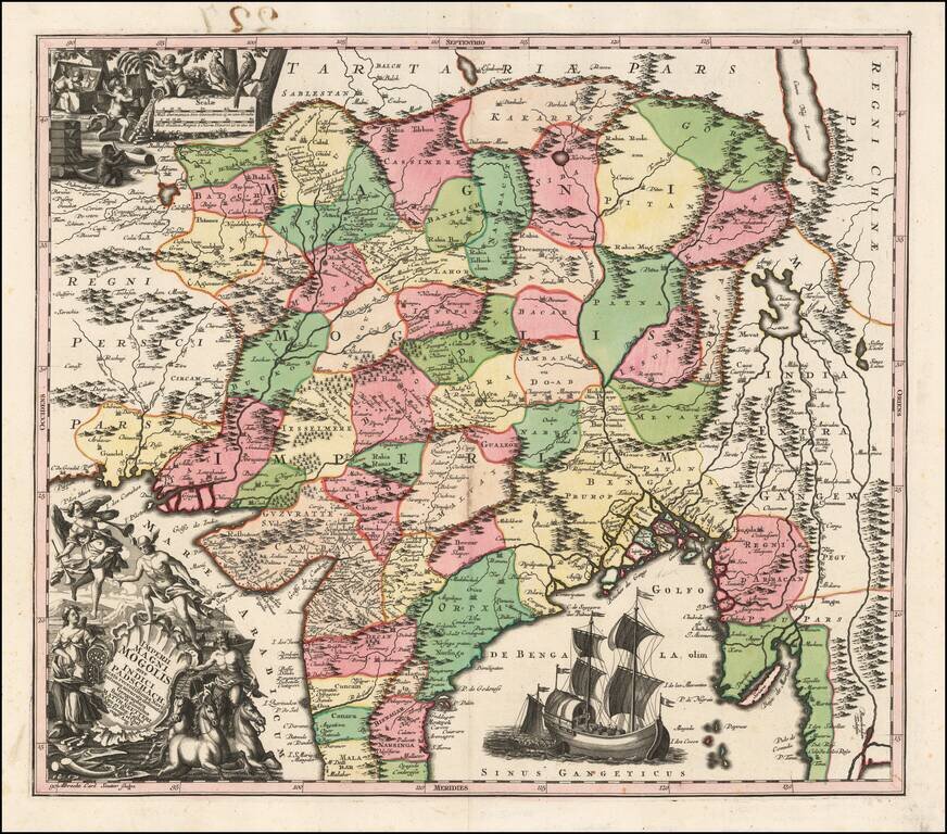
Detailed map of India, extending from the Ganges to Eastern Persia and North to the Mont de Caucause (Himalayas). Colored by provinces. Includes 2 large decorative vignettes and a sailing ship.
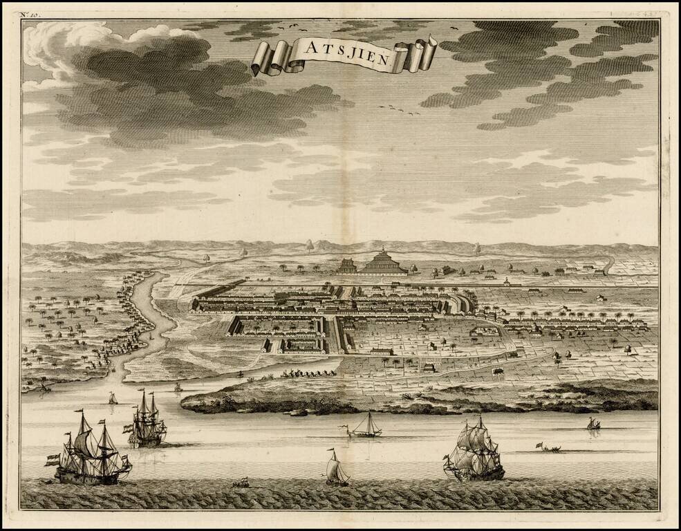
Nice bird's eye-view of the Town of Atjien on the northernmost point of Sumatra, from Francois Valentyn's Oud en Nieuw Oost Indien, part V : Beschryving van Coromandel, Pegu, Arrakan, Bengale, Mocha, Persien, Malakka, Sumatra, Ceylon. Francois...
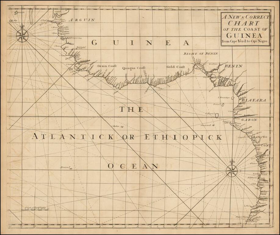
English Chart of the African Coast from an Influential Atlas Scarce sea chart of the west coast of Africa from Senegal to Angola, from the Atlas Maritimus & Commercialis . . . , published in London in 1728. Atlas Maritimus et Commercialis This...
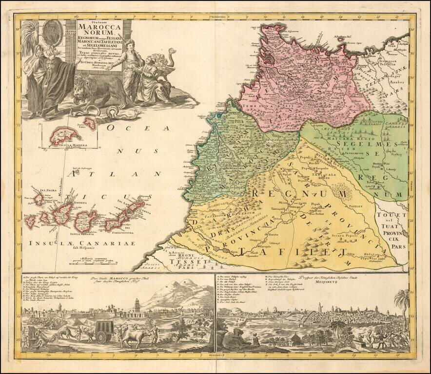
Scarce map of Morocco, with two city views below. Includes a striking allegorical cartouche and inset map of Madeira.

Scarce decorative celestial map by Melchior Rein, published In 1728. The map is drawn from an the work of Georg Christoph Einmarkt, first published circa 1707. In this rare variant, Rein is credited as engraver under the lower center diagram....
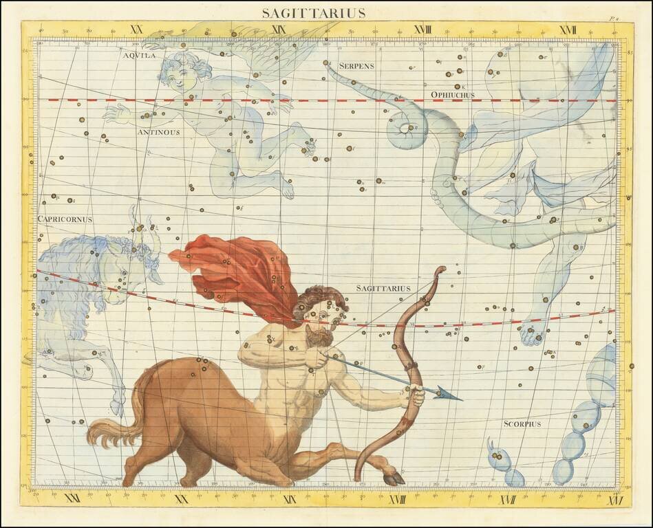
Decorative large format map of the constellations, showing Sagittarius, with Capricornius Antinous, Serpens, Ophiuchus, Aquila and part of Scorpius, from Flamsteed's rare celestial atlas. Flamsteed was the first Astronomer Royal at the London...