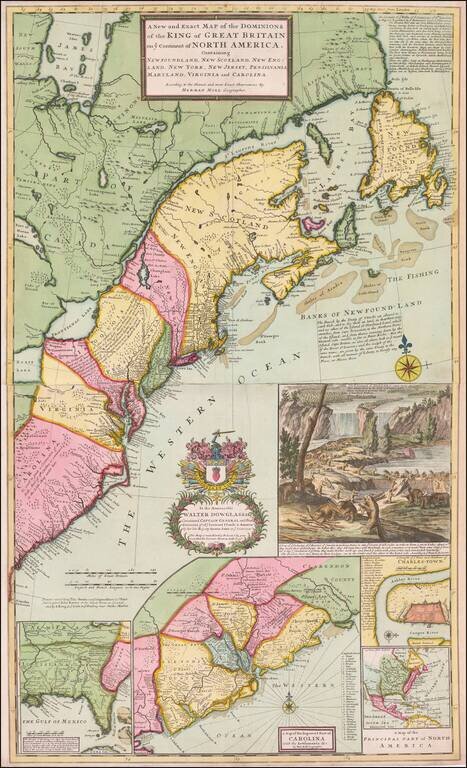
Finely colored example of Moll's seminal map of the British Colonies in America, the first large-scale map to show English developments in North America and the first to show the American postal routes. Moll's map was the first and one of the most...
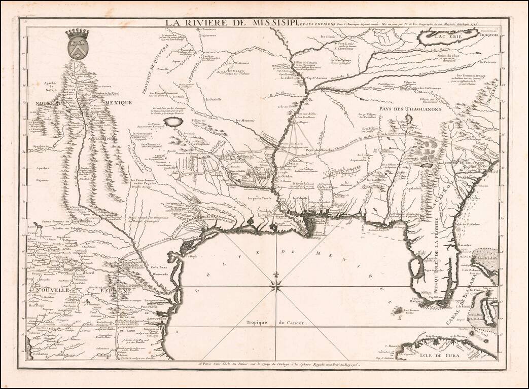
Nicolas De Fer's Landmark 1715 Map of the Mississippi River Valley and the French Regions in the Interior of North America. Fine example of De Fer's rare map of the southern part of the French regions in North America, one of the most important maps...
![[Indian Wars in Carolina] De gruwlyke aanvalle der Indiaanen op de Engelse in Carolina . . .](/map/small/69953.jpg)
A series of nine current event broadsides, most notably the image showing the English battling Indians in the Carolinas at the top left. The Carolina image shows a Dutch view of the Yamasee War. The full title, translated from the Dutch, reads "The...
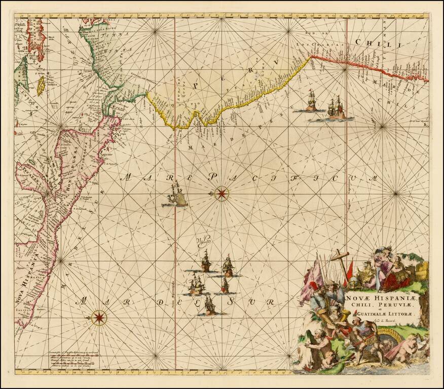
Nice example of this sea chart of the western coastlines of South and Central America, published by Louis Renard. The map covers the Pacific Coast from Xalisco, Mexico, to Puerta Bairres and Rio Cachapool in Chile, covering over two thirds of the...
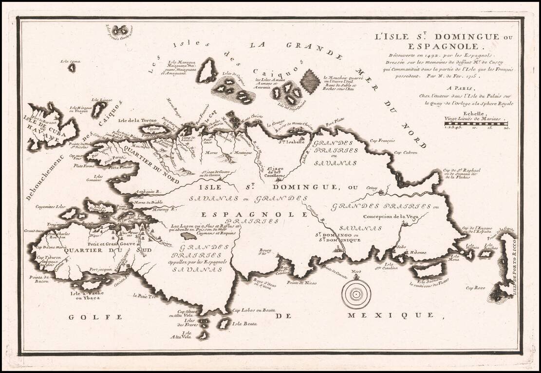
Antique Map of Haiti & Santa Domingo Detailed separate map of Hispaniola, from Nicolas De Fer's Atlas Curieux.

Rare large format map of the British Isles and the contiguous coastline of Europe from Brittany and the Channel Islands east to Norway and Denmark, with the seas marked with rhumb lines. Originally published by Inselin c.1713, this separate-issue map...
![[Majorca] Ergebung der auf dem Mittellandischen Meer gelegenen Balearischn Insul Maiorica](/map/small/46077.jpg)
Admiral John Leake's Attack on Majorca Finely executed engraved map and naval battle scene, depicting the September 1706 Seige of Majorca by the British Fleet under the command of Sir John Leake. The siege was part of the War of the Spanish...
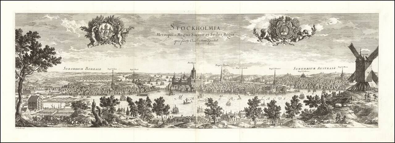
Fine early view of Stockholm, engraved in Paris in 1715 for Dahlberg's Suecia Antiqua et Hodierna. Includes two elegant cartouches decorated with cherubs. The cherub on the left has a coat of arms. The cherub on the right has the bust of a queen.
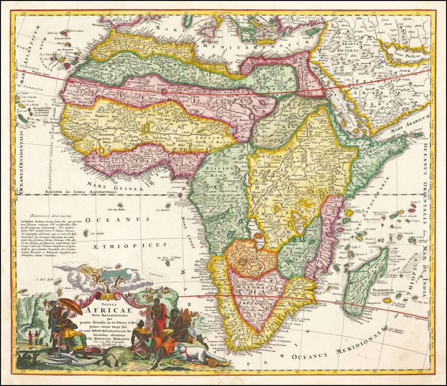
Striking example of Homann's first map of Africa. The map includes an extensive note on the accuracy of the Nile, the first map to have such a note. A highly innacurate map, both in shape and nomenclature. Shows both real and fictitious St. Helena...
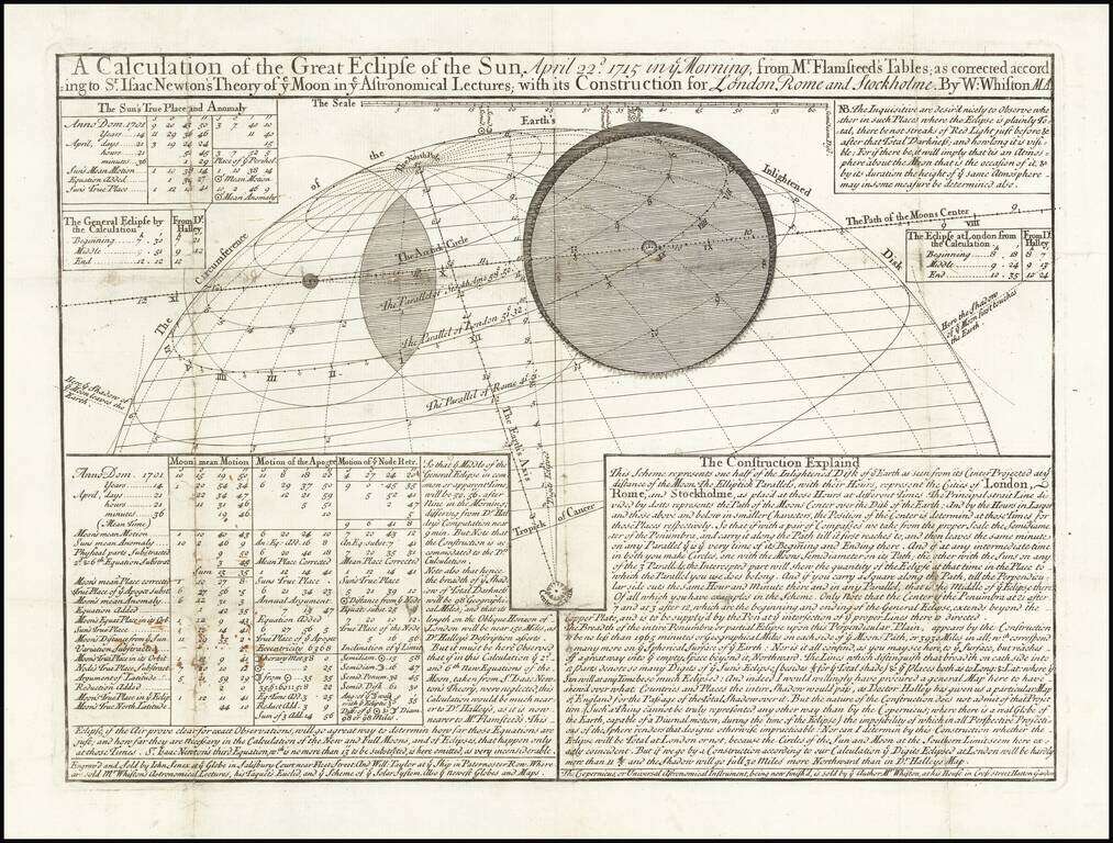
Rare Eclipse Map of the 1715 Solar Eclipse by Polymath William Whiston Important early astronomical broadside, prepared by William Whiston (1667-1752), a prominent and prolific English theologian and mathematician, of the first solar eclipse to be...