
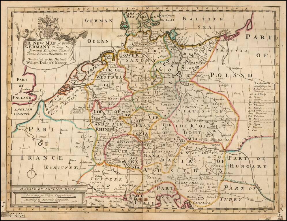
Prepared To Educate A Future King Decorative map of Europe at the beginning of the 18th Century. This map was part of an atlas dedicated to the Duke of Glocester, who was then attending school in Oxford.
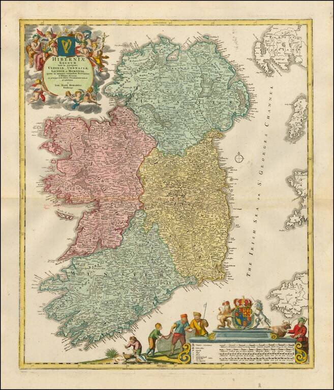
Fine early 18th Century map of Ireland, colored by regions and showing the towns, roads, counties, rivers, lakes, castles, etc. Includes two marvelous cartouches, coats of arms and allegorical details.
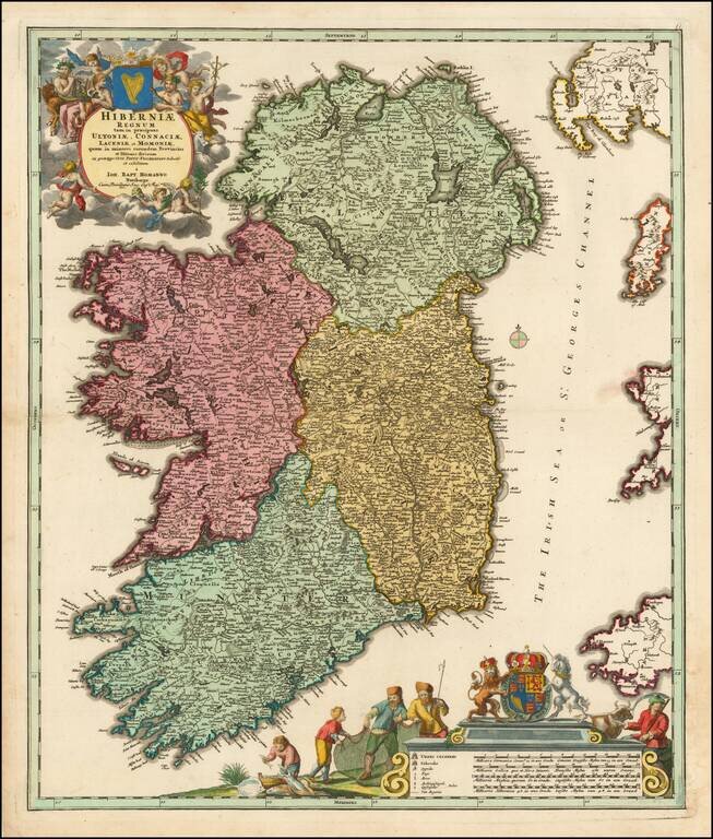
Finely colored early 18th Century map of Ireland, colored by regions and showing the towns, roads, counties, rivers, lakes, castles, etc. Includes two marvelous cartouches, coats of arms and allegorical details.
Decorative map of the region centered on Poland and Russia, extending from the Black Sea and the Gulf of Venice to the Baltic Sea. Two title cartouches and decorative coat of arms. This map was part of an atlas dedicated to the Duke of Glocester, who...
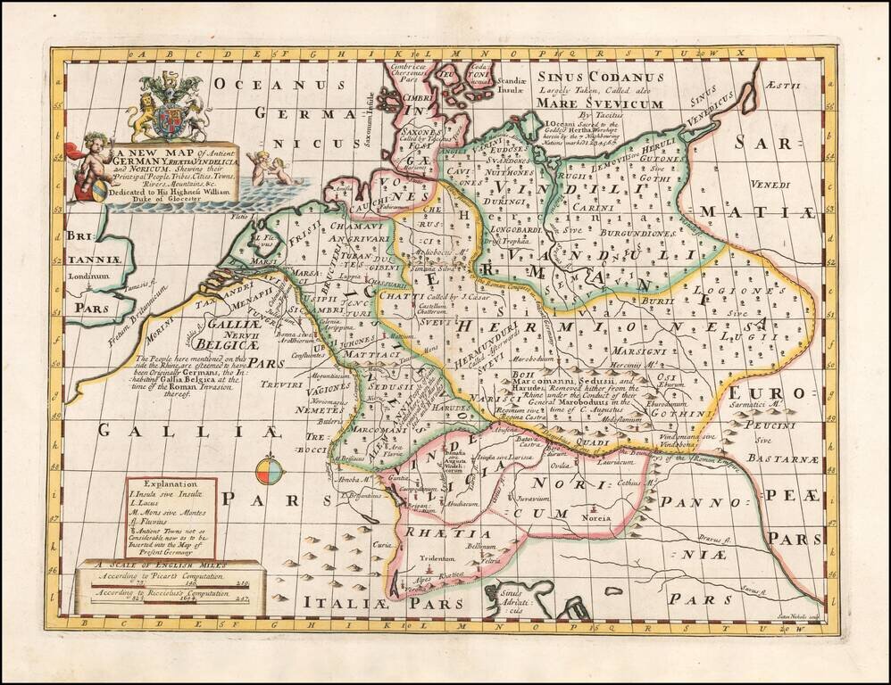
From An Atlas Designed To Educate A Future King of England Decorative map of Ancient Germany. Includes decorative title cartouche and decorative coat of arms. This map was part of an atlas dedicated to the Duke of Glocester, who was then attending...
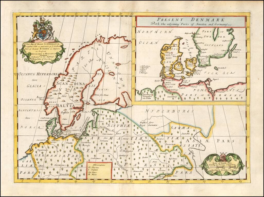
Decorative map of Scandinavia and Northern Europe, with an inset of Denmark and part of Norway and Sweden. Two decorative cartouches. Wells map is 1 of a set of 22 maps dedicated to William, Duke of Glouchester, who at the time of publication of the...
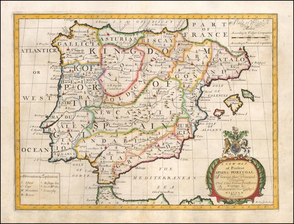
Decorative map of the Iberian Peninsula, colored by regions. This decorative map was part of a set of 22 maps dedicated to William, Duke of Glouchester, who was then an 11 year old student at Oxford.
![A New Map Shewing all the several Counties, Cities, Towns, and other Places mentioned in the New Testament . . . [shows Cyprus]](/map/small/57664mp2.jpg)
Interesting map of the Eastern Mediterreanean, with smaller inset maps of the Holy Land and the whole of the Mediterreanean. Includes a title cartouche and coat of arms.
![[Port Mahon, Menorca] Plan de la Fortification Fait par les Anglois sur la Fort St. Philippo Situe a Lembouchire du Port de Mahon dans l'Isle de Minorque.](/map/small/59725.jpg)
Extremely Rare Map of Fort St. Philip in Minorca Rare, fine map of Fort St. Philip (Castle of St. Philip) and the surrounding area in Port Mahón, Minorca, by Peter Schenk. The sharply-geometric star fort sits at the center of the map and is...
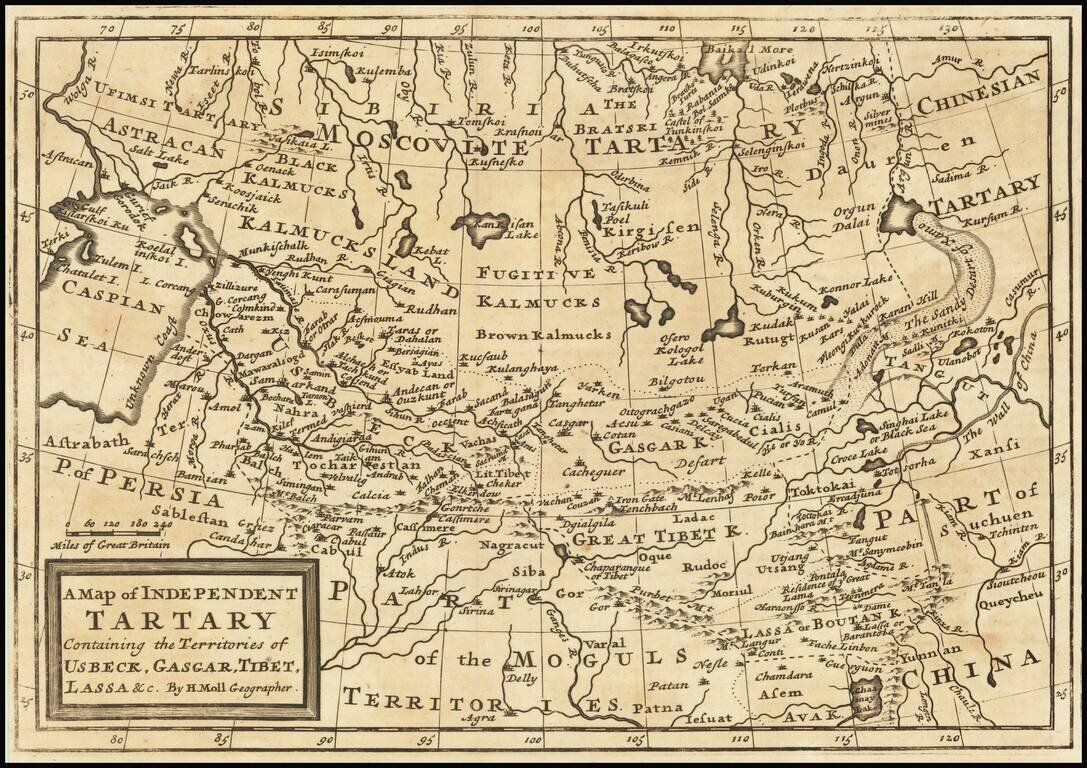
Scarce map of Central Asia, Tibet, Mongolia, Usbeck, etc. The map covers the region from the Caspian Sea to the Great Wall of China. The region is mostly the domain of the Kalmyk people with various areas denoted for Black Kalmucks, Fugitive Kalmucks,...
![Genealogie Des Empereurs Mogols Depuis Tamberlan ou Tamerlan . . . [maps of the Empire of the Grand Mogol, Kingdom of Kachemire and 3 indigenous views]](/map/small/43161.jpg)
Interesting pair of maps, Genealogical tree and 3 indigenous views of the Mogol Empire, from Chatelain's Atlas Historique. The upper maps show the Empire of the Great Mogol and the Kingdom of Kachimere. The center includes a tree showing the Mogol...
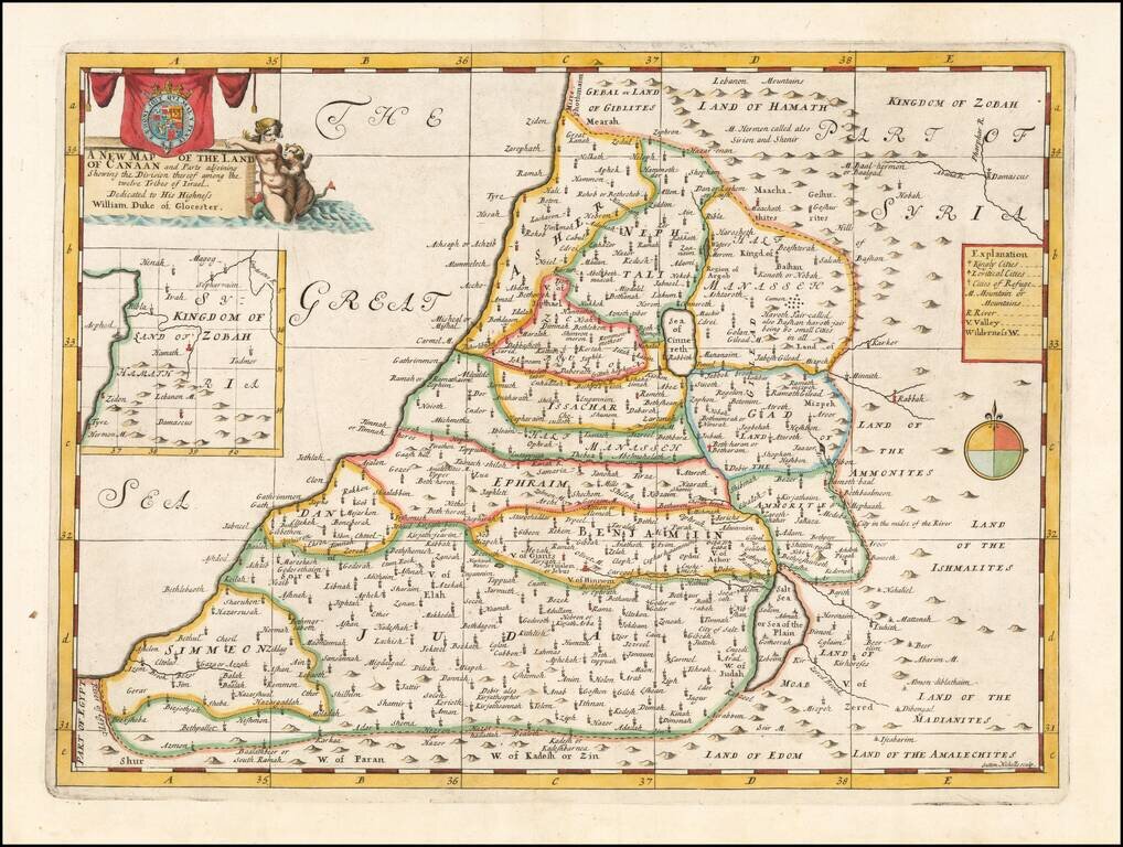
Map of the Holy Land, Published For The Education of A Future King of England. Decorative map of the Holy Land, colored by Tribes. The map was part of an atlas dedicated to the Duke of Glocester, who was then attending school in Oxford. The maps...
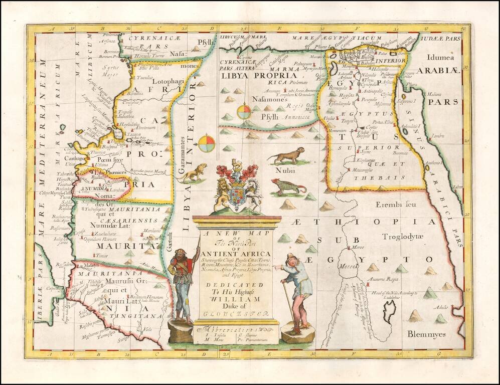
Decorative map of the north part of Ancient Africa. This decorative map was part of a set of 22 maps dedicated to William, Duke of Glouchester, who was then an 11 year old student at Oxford.