![Carte Du Mexique et de la Floride des Terres Angloises et des Isles Antilles du Cours et des Environs de la Riviere Mississipi . . . Rue Des Canettes . . . 1703 [1st State]](/map/small/66307op.jpg)
A Cartographic Landmark -- The First Map To Accurately Depict the Course and Mouth of the Mississippi River Rare first state of the first printed map to accurately depict the course and mouth of the Mississippi River, published by Guillaume De L'Isle...
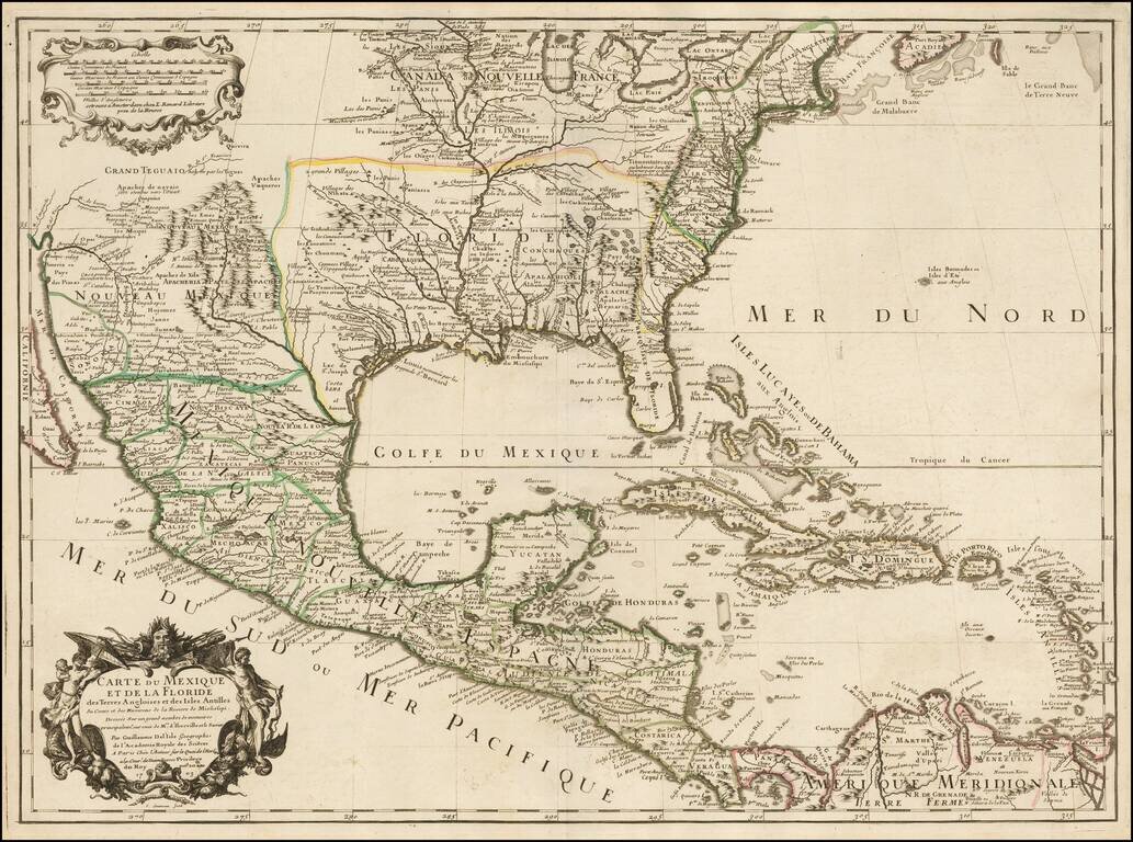
Rare Second State. Fine example of the second state of Guillaume De L'Isle's landmark map, the first printed map to accurately depict the course and mouth of the Mississippi River. De L'Isle's Carte du Mexique . . . is drawn from the reports brought...
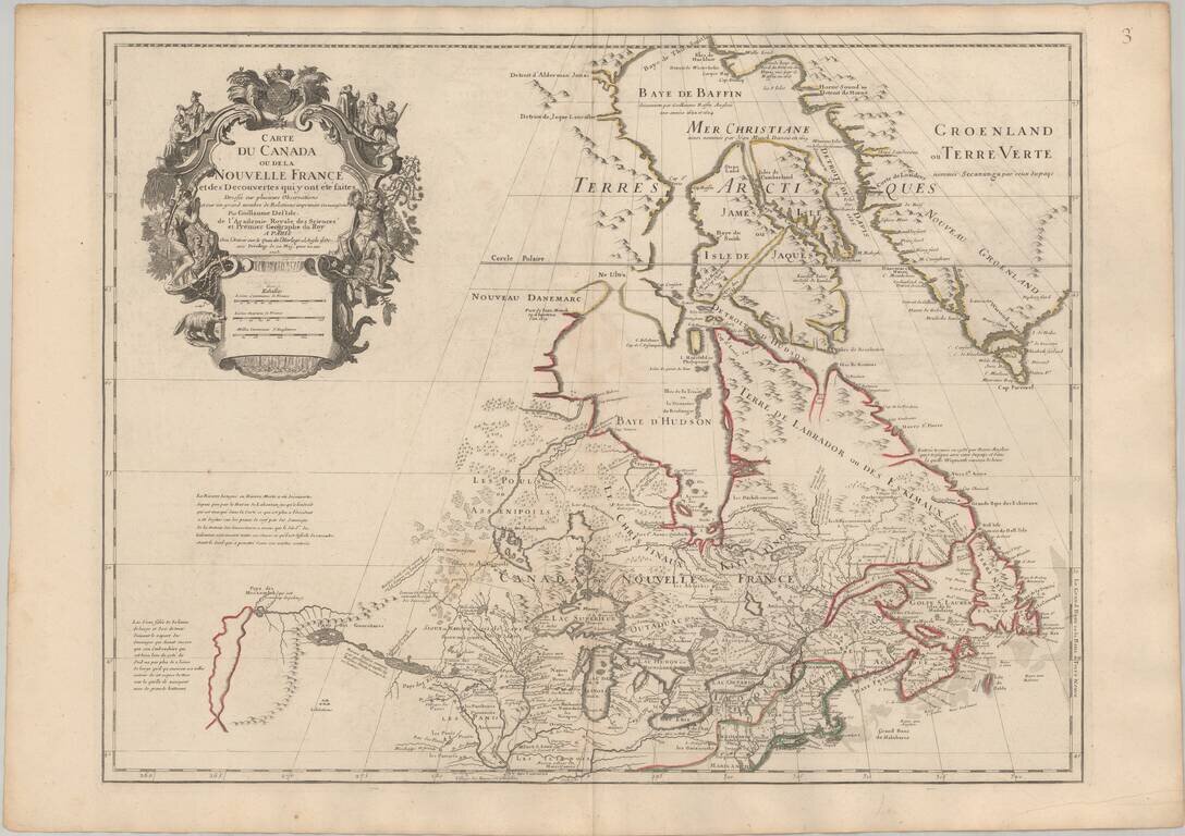
Seminal Early Map of Canada & The Great Lakes -- One of The First Maps To Reference The Rocky Mountains Nice example of Guillaume De L'Isle's map of Canada, the Great Lakes and Upper Midwest, one of the most important and influential maps of...
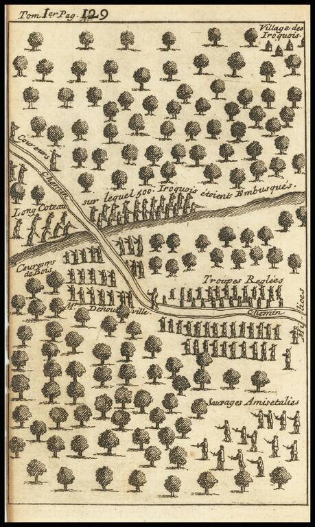
Striking Illustration of an Iroquis Battle Scene from the Work of Lahontan Interesting engraving depicting the forest near an Iroquois village, with several lines of soldiers facing off. Upon a hill, toward the top of the engraving, are Iriquois...
![[Battle of Placentia]](/map/small/70282.jpg)
Lahontan's Account of the Battle of Placentia Nice example of Baron Lahontan's illustration of the Battle of Placentia (September 1692), which was fought between the English and the French at Fort St. Louis (Castle Hill) in Placentia, Newfoundland...
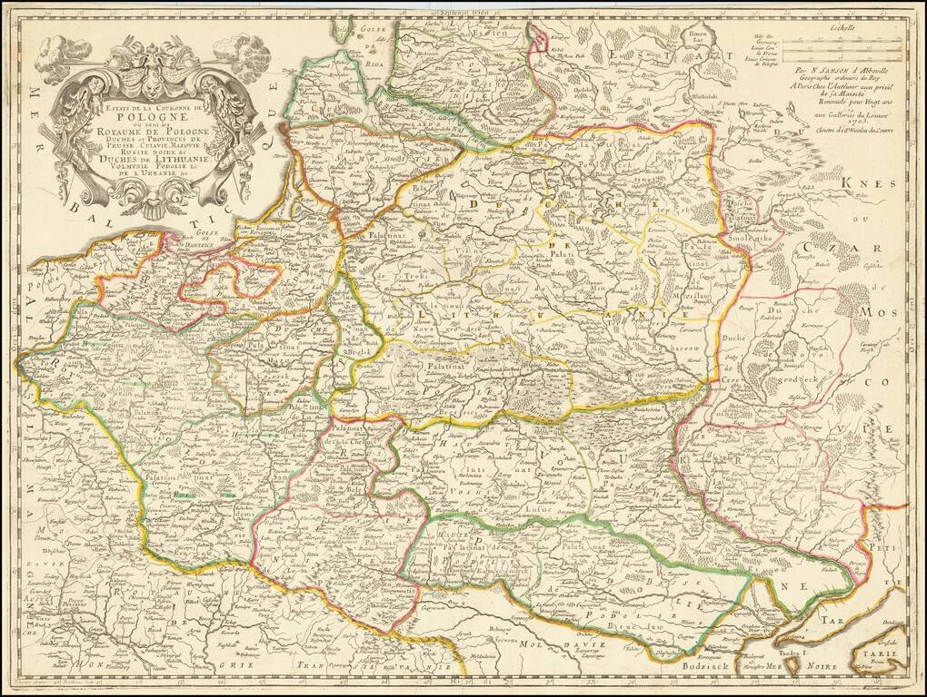
Rare late edition of Sanson's second map of the Polish Empire, Lithuania, Ukraine, etc. Sanson created this scarce map of modern day Poland, Lithuania, Belarus and Ukraine, etc. in 1655 and revised several times over the next 50 years. The date 1679...
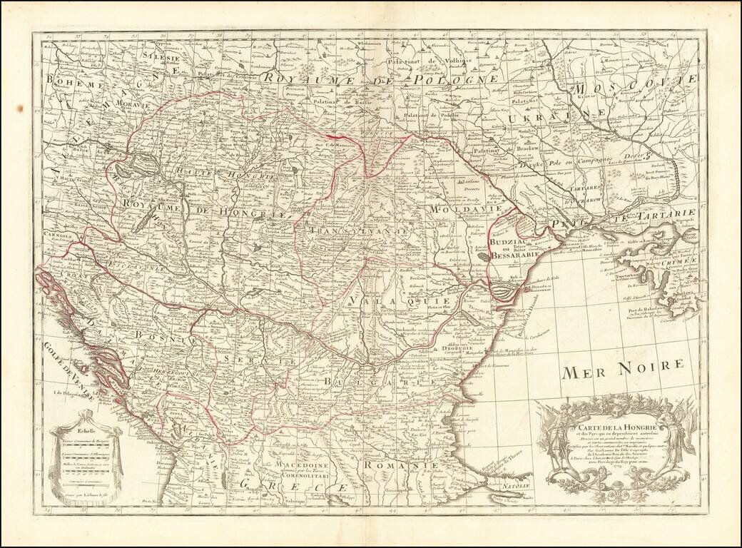
Detailed map of Southern Europe published by Guillaume De L'Isle. Shows Hungary, along with part of Dalmatia, Serbia, Macedonia, Romania, Constantinople, the Black Sea, Crimea, the Ukraine, Poland, Hungary, Transylvania, Moravia, Moldovia, the...
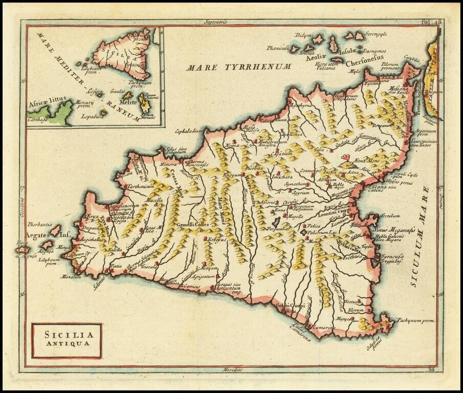
Terrific map of Sicily and its neighboring islands, with ancient place names from antiquity. The map appeared in an early edition of Cellarius' Notitia Orbis Antiqui, Sive Geographia Plenior...et Novis Tabulis Geographicis, which was published in...

Scarce map of Asia, typically attributed to Robert Morden. Korea is referenced as an island, but appears to have been reattached to the mainland. The Great Wall of China is shown. Nice detail in the Philippines. Oversized Maldive islands configuration.
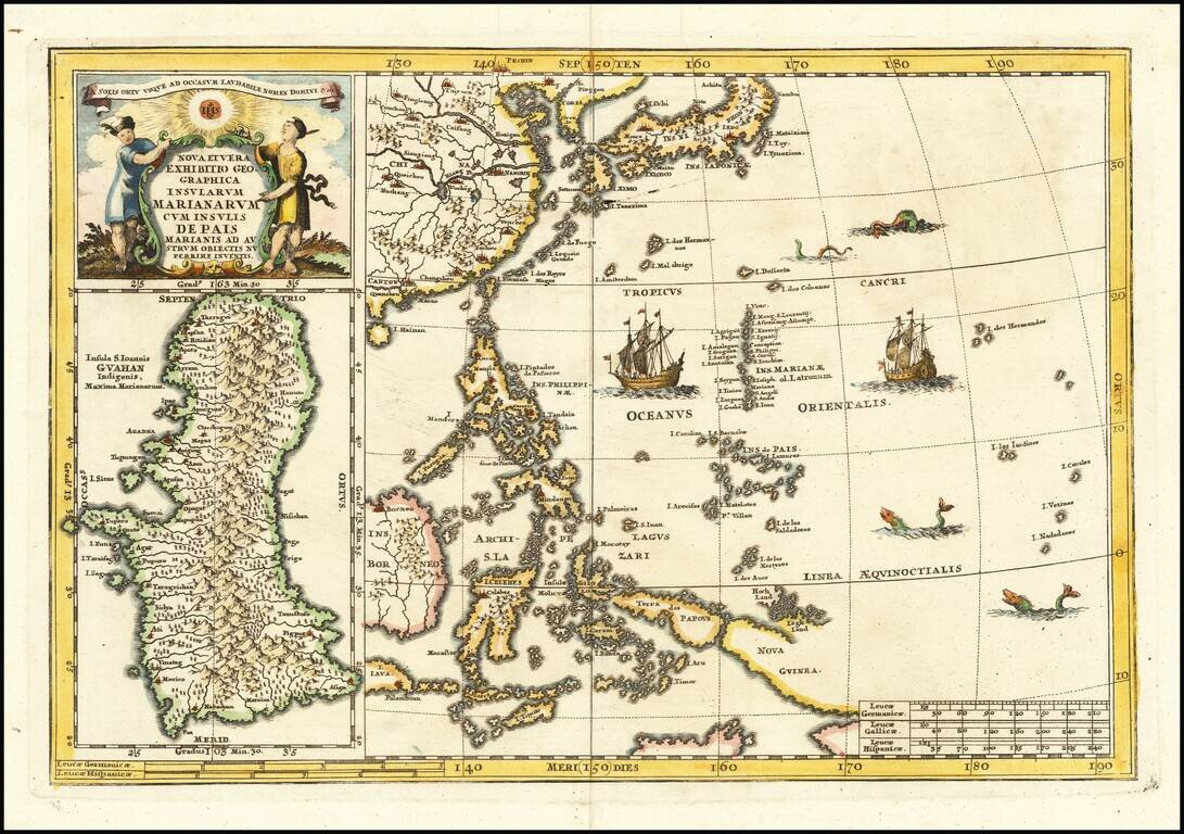
Fascinating map of the the Philippines, China, Japan and Korea, with a large inset of Guam, from Heinrich Scherer's monumental work. Includes a large inset of Guam. Heinrich Scherer (1628-1704) was a Professor of Hebrew, Mathematics and Ethics at the...