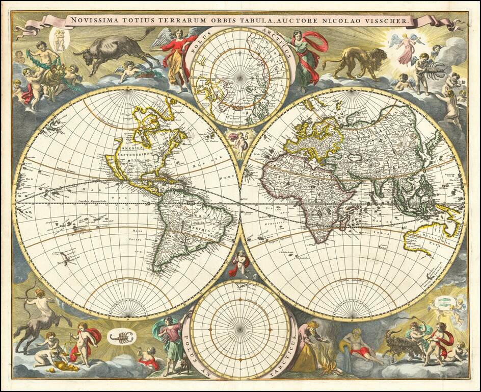
Gorgeous example of Nicholas Visscher's World map, which appeared in his Atlas Minor after 1679. The map is similar to Visscher's World map of 1659 (Shirley 406), only with the Straits of Anian being reduced to cover only 10 degrees. The surrounding...
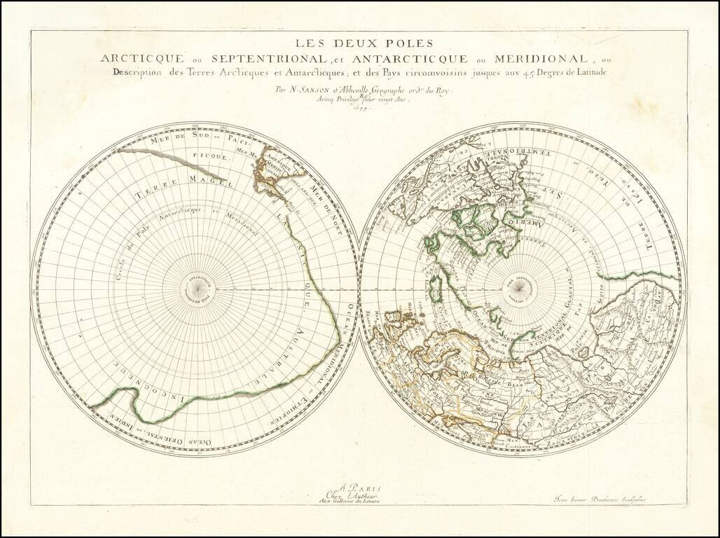
Sanson's Map of the Poles, the First Dual Polar Projection Fine old color example of this fascinating map of the Polar Regions, extending from the poles to 45 degrees latitude, first published by Sanson in 1657. Sanson is widely considered as the...
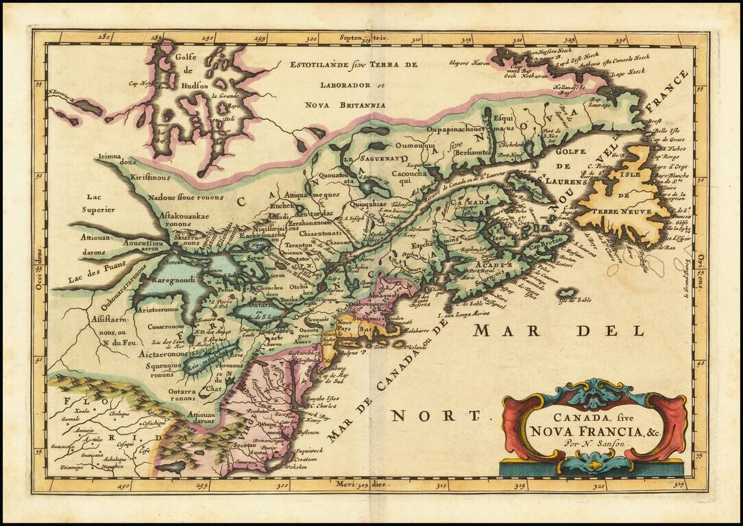
First state of the Frankfurt edition of Nicolas Sanson's map of Canada and the Great Lakes (first issued in Paris in 1657), which would influence regional cartography for the next 100 years. Along with Sanson's larger map issued in 1656, this map...
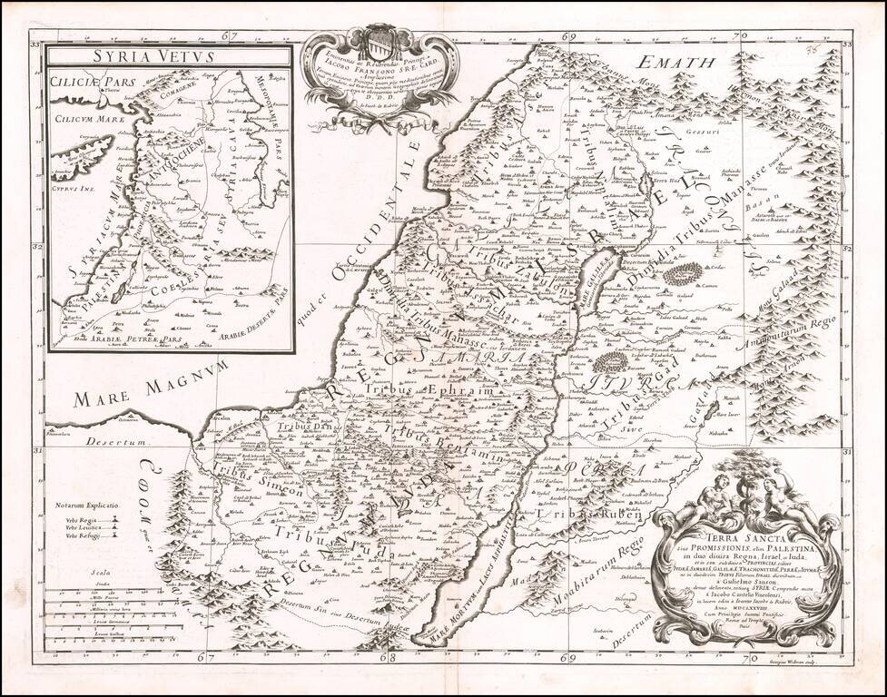
Decorative map of the Holy Land, published by Giacomo Rossi in Rome in 1679. The map includes an elaborate title cartouche and a large inset map of Ancient Syria.