![L'Amerique Autrement Le Nouveau Monde et Indes Occidentales . . . 1664 [1st complete state]](/map/small/68897.jpg)
Early state of Du Val's scarce map of America. Du Val's map of America was first issued in 1655, in the second edition of his Cartes Geographiques. Between 1655 and 1687, the map went through at least 12 recorded examples. Both the 1st and 2nd states...
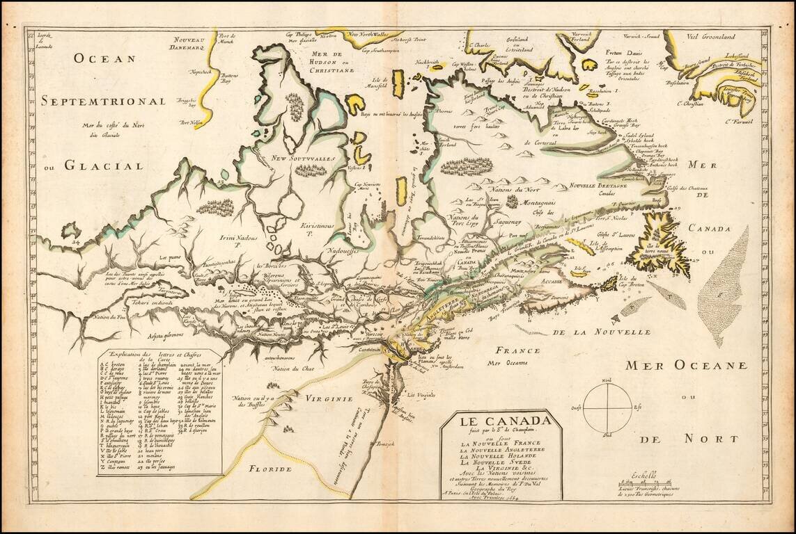
One of the Most Important Early Maps of Canada and the Great Lakes. Fine example of this highly important map of Canada, the Great Lakes and Northeastern United States, originally engraved for Samuel de Champlain's 1619 Les Voyages. Du Val's Le...
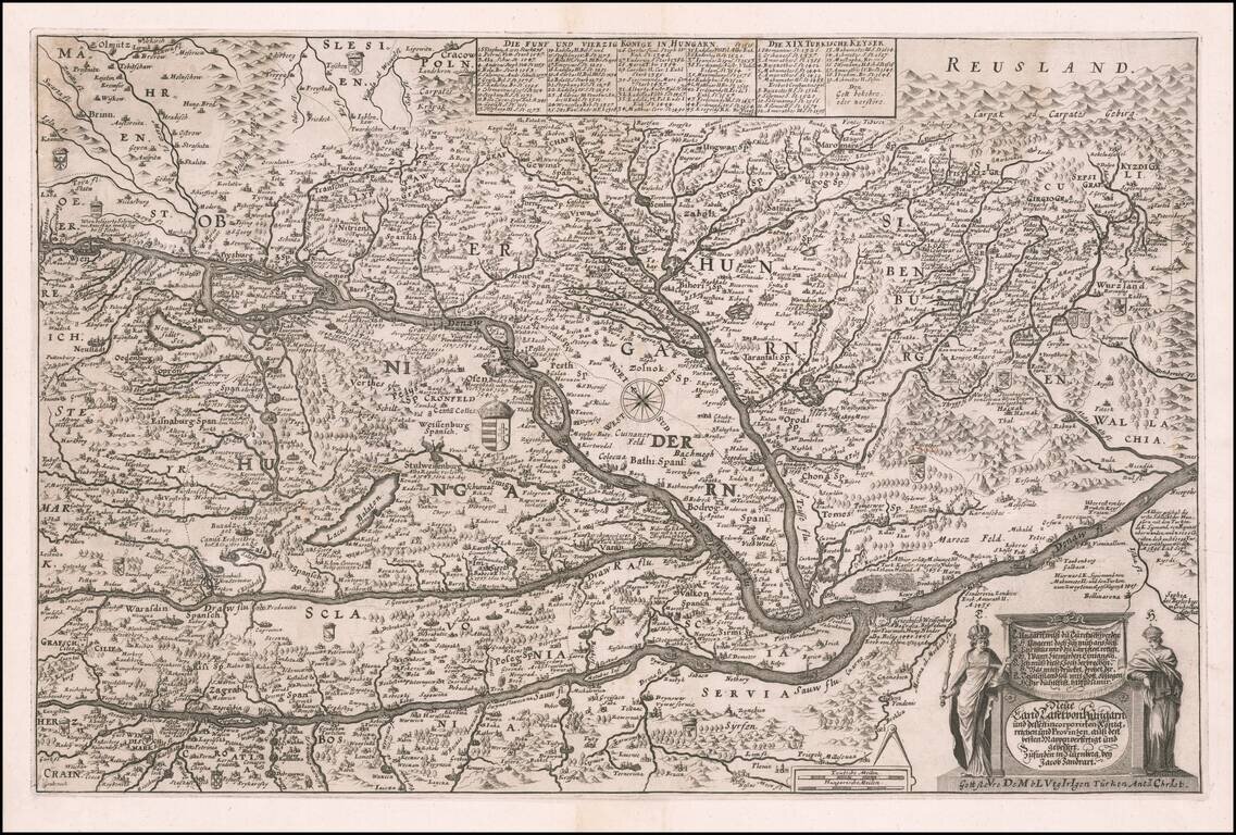
Rare map of Hungary by Jacob von Sandrart, published in Nuremberg. The map includes fine details, many coats of arms, towns, rivers, bridges, lakes, mountains and other details, including historical annotations with dates reflecting the battles fought...
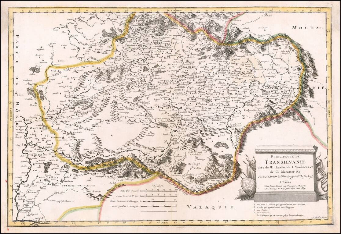
Finely detailed map of Transylvania, published by Nicolas Sanson in Paris. Sanson utilized the prior maps of several important mapmakers, including Wolfgang Lazius (1514-1565), Johannes Sambucus (1531-1584), Gerhard Mercator (1512-1594).
![[Heightened with Gold Leaf!] Episcopatus Balbastrensis, Ribagorca Comit et Sobrarbe cum Adjecentibus](/map/small/69195.jpg)
Fine old color, gold heightened example of Blaeu's map of the Spanish Pyrenees Mountains, Huesca etc. The map is oriented with west at the top, and is centered on the town of Barbastro, in Huesca.