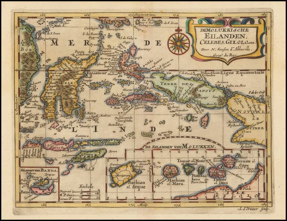
Fine example of the Spice Islandsa and Vicinity, first published by Nicholas Sanson in 1657. Sanson was the Royal Geographer to the King of France and perhaps the most important commercial mapmaker of his generation.
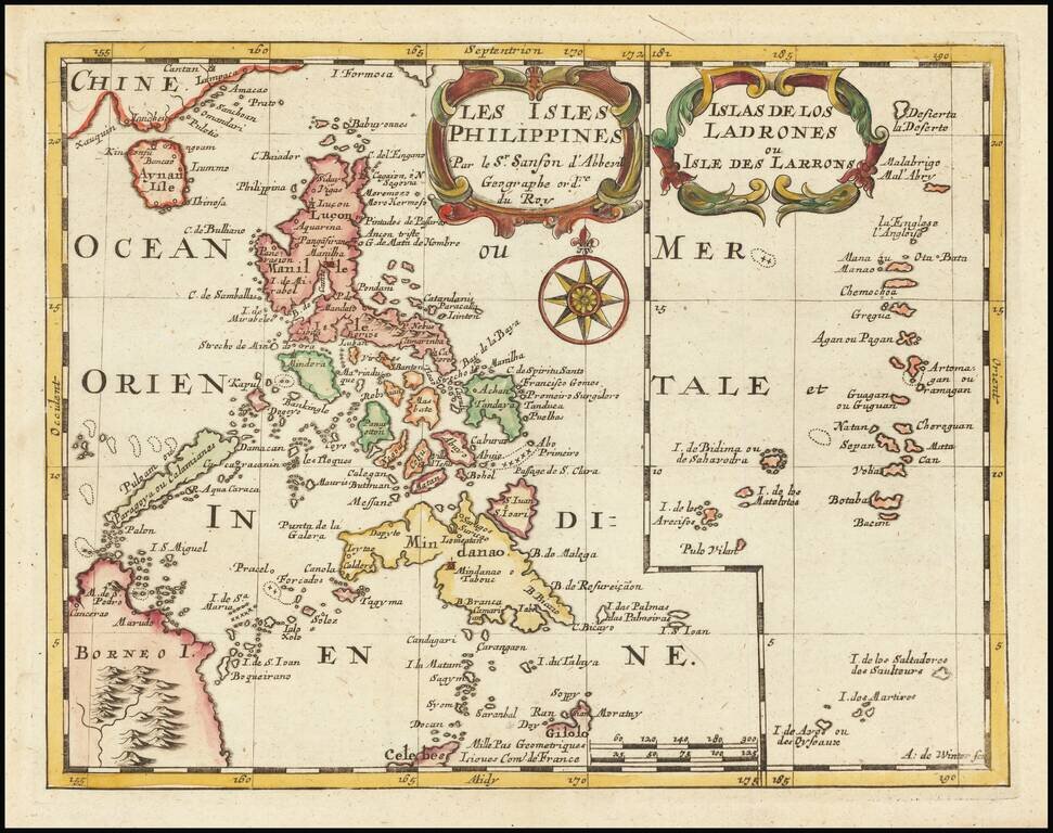
Highly detailed map of the Philippines on the left side, with a map of the Ladrones on the right side of the map, from Sanson's L'Asie en plusieurs cartes nouvelles, et exactes & en divers traittés de Géographie, et d'Histoire, first published in...
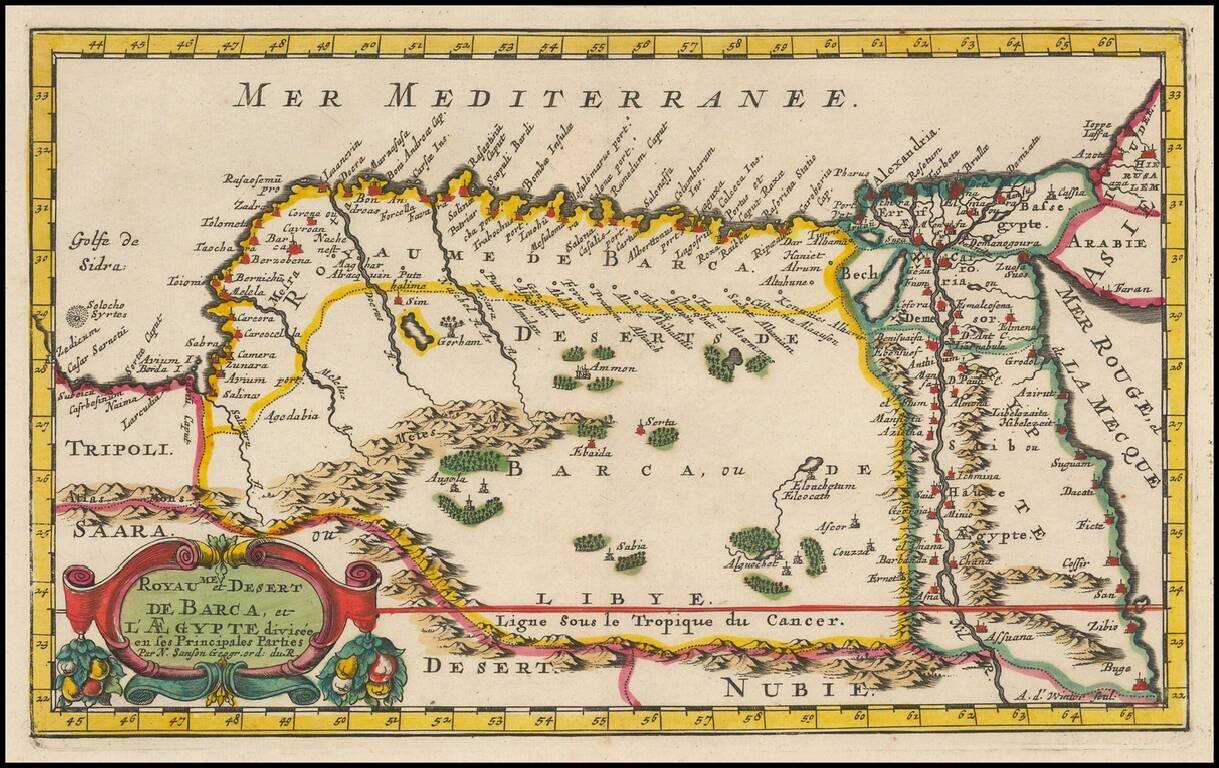
Fine example of Egypt and eastern Libya first published by Nicholas Sanson in 1657. Sanson was the Royal Geographer to the King of France and perhaps the most important commercial mapmaker of his generation.
Fine ENGLISH color example of Jansson's map of Sicily and North Africa. Decorative map showing the North African coast (Tunisia), Malta and its neighboring islands, and a part of Sicily. Decorative title cartouche and text box. Maps in early English...
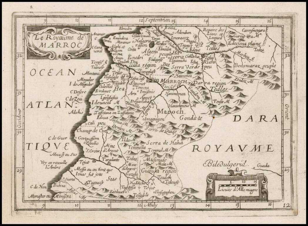
Rare map of part of North Africa, which appeared in Picart's Tresor des carte Geographiques, published in Paris. Picart's map is based upon Jansson's map, published in his Atlas Minor in 1628. The first French version of the map was published by...
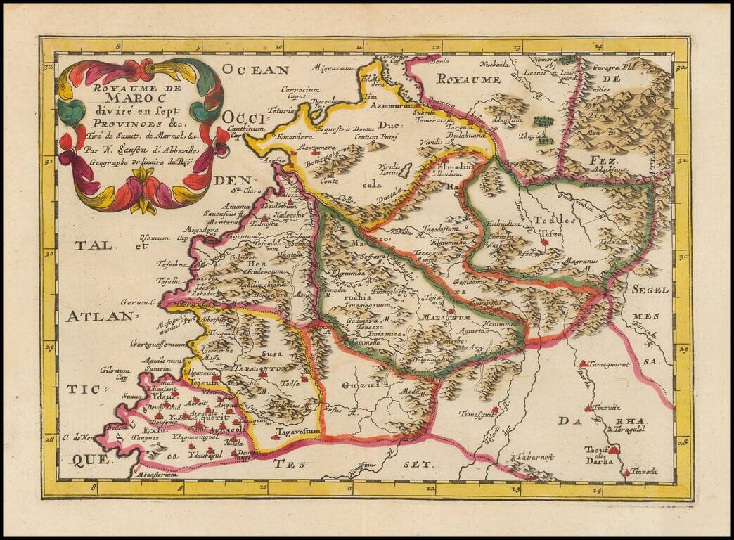
Fine old color example of this finely engraved map of Morocco, first published by Nicholas Sanson in 1654. Sanson was the Royal Geographer to the King of France and perhaps the most important commercial mapmaker of his generation. The map is based in...
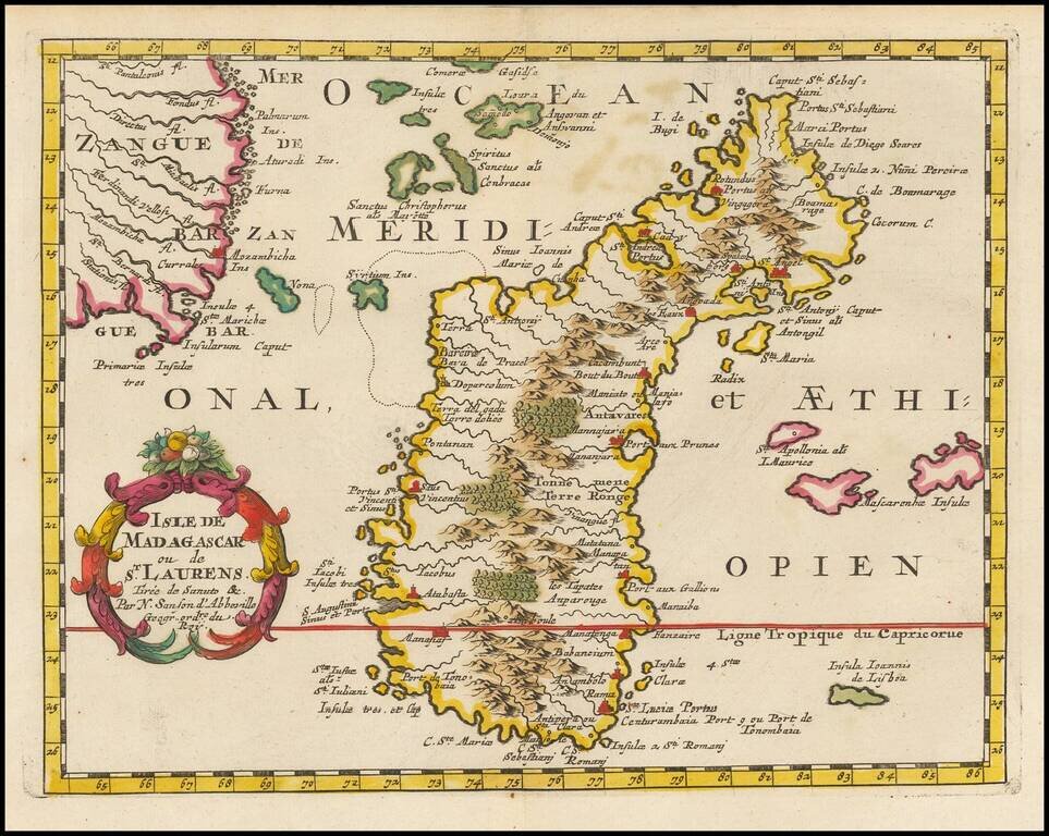
Exceptional old color example of this finely engraved map of Madagascar, first published by Sanson in 1657. Sanson notes the source of his map as Livio Sanuto and others. Livio Sanuto was a mid-16th Century Italian cosmographer and mathematician who...
![[South Polar Regions]](/map/small/43970.jpg)
Decorative example of Jansson's map of the South Polar region, including the earliest appearance of New Zealand and Van Dieman's Land. The supposed coastline of the unknown southern continent continues to appear. Includes notes regarding the...
![[Untitled Map of South Pole]](/map/small/69130.jpg)
Old color example of this rare late edition of Hondius' decorative map of the South Polar region, including the earliest appearance of New Zealand and Van Dieman's Land on this map. The supposed coastline of the unknown southern continent continues to...