![[Naples] Neapolis](/map/small/64927.jpg)

Striking birdseye view of Burgos, from Merian's Neuwe Archontologica Cosmica . . ., published in 1638. Shows town and hillside, buildings, churches, etc.
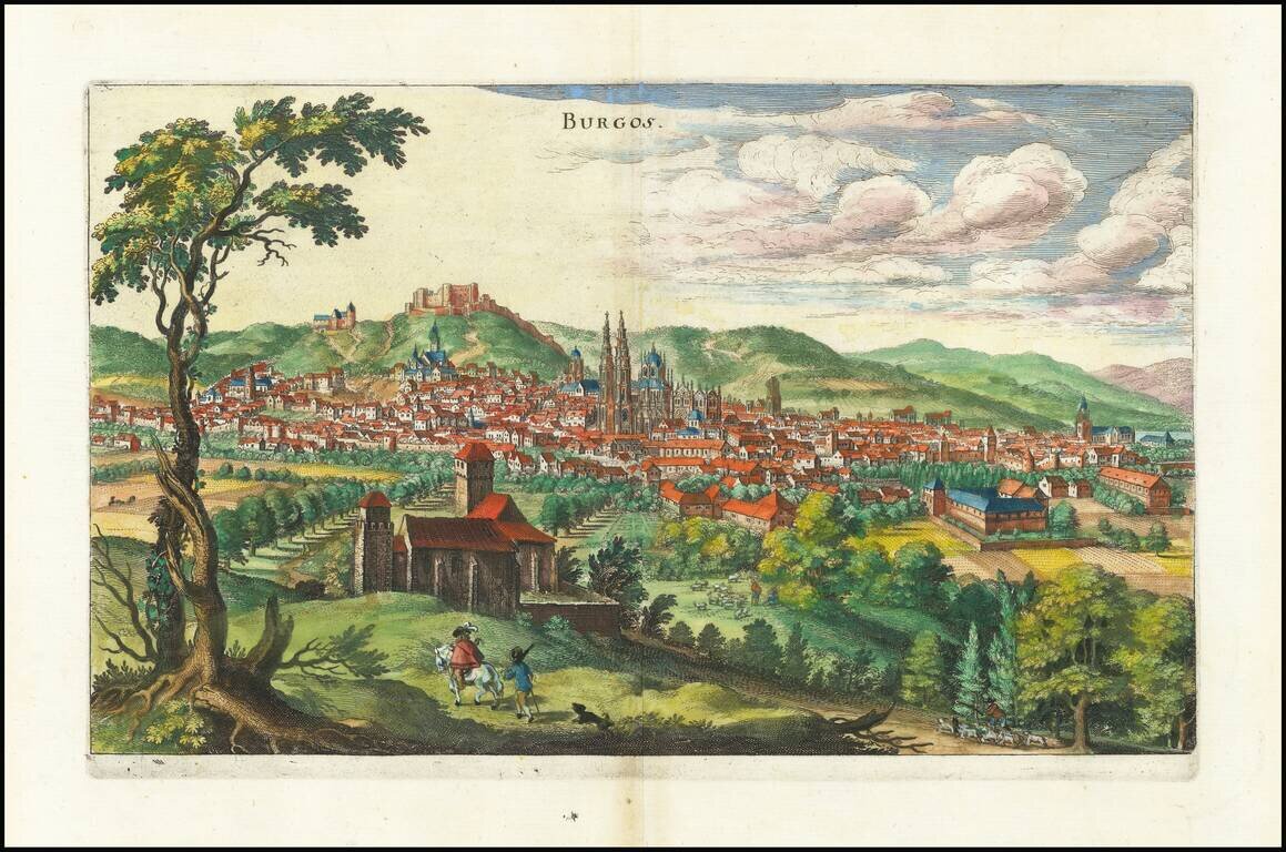
Striking birdseye view of Burgos, from Merian's Neuwe Archontologica Cosmica . . ., published in 1638. Shows town and hillside, buildings, churches, etc.
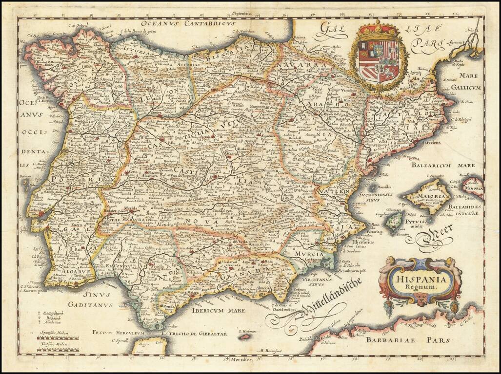
Decorative map of the Iberian Peninsula, including Majorca, Minorca and Ibiza, from Merian's Neuwe Archontologica Cosmica . . ., published in 1638. Includes decorative coat of arms and title cartouche.
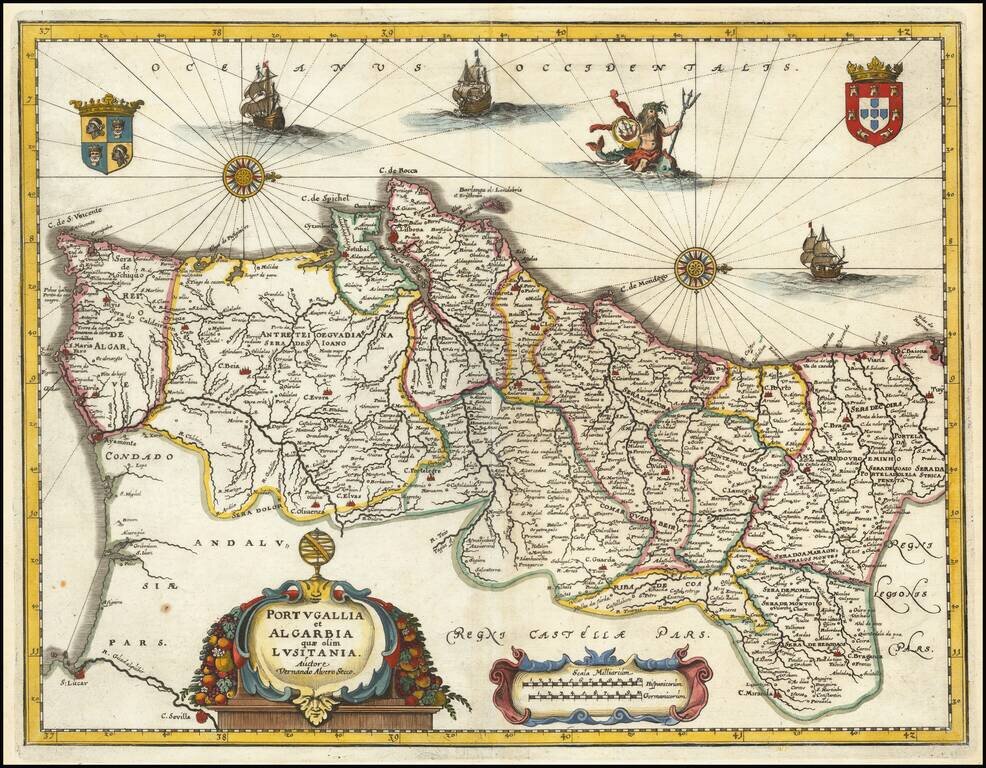
Decorative map of Portugal, based upon an earlier map by Willem Blaeu. Includes a decorative cartouche and scale of miles, 2 coats of arms, 2 sailing ships and a allegorical sea god riding a whale.
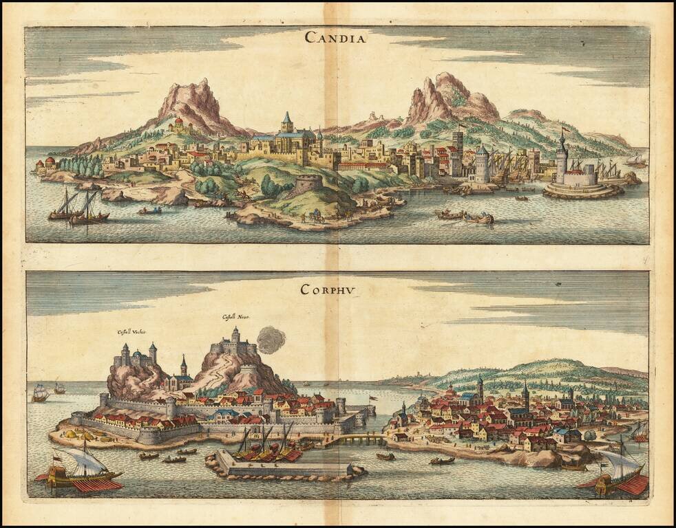
Striking pair of bird's-eye views of Candia and Corphu, from Merian's Neuwe Archontologica Cosmica ..., published in 1638. Shows two fortified harbor towns, castles, topographical details and ships in the harbors.
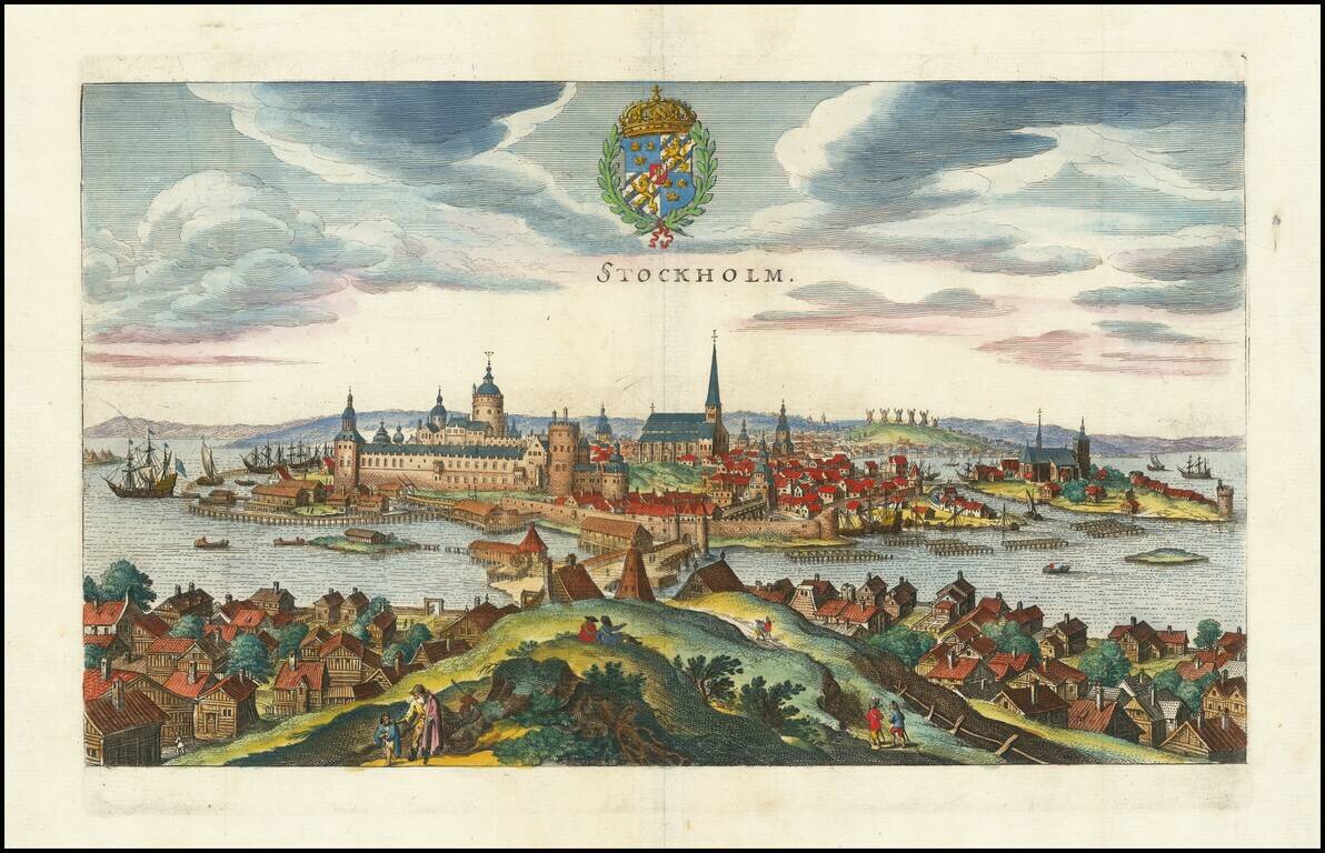
Decorative birdseye view of Stockholm from across the harbor, from Merian's Neuwe Archontologica Cosmica, published in 1638. Shows buildings, churches, bridges, ships, docks, fortified walls of the city, and the surrounding area. The coat of arms of...
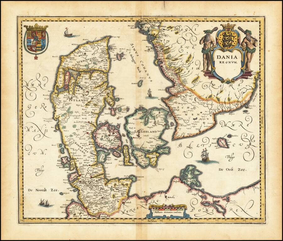
Decorative map of Denmark, from Merian's Neuwe Archontologica Cosmica . . ., published in 1638. Includes 2 decorative coats of arms and title cartouche.
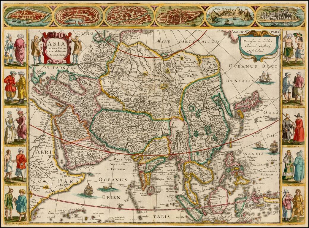
A very fine 'Carte à Figures' map of Asia, by Jan Jansson, after his brother-in-law Jodocus Hondius. This highly attractive map embraces all of Asia. The Middle East is very well formed, although the Caspian Sea has the egg-like form it maintained...
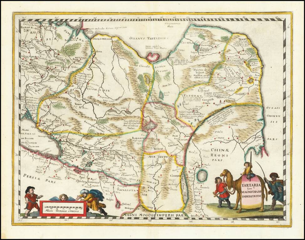
An attractive antique map of China, Tartary, and Central Asia. This map covers a vast area in intriguing detail which reflects European knowledge about the world at the time during which it was made. The detail shown includes many rivers, mountain...
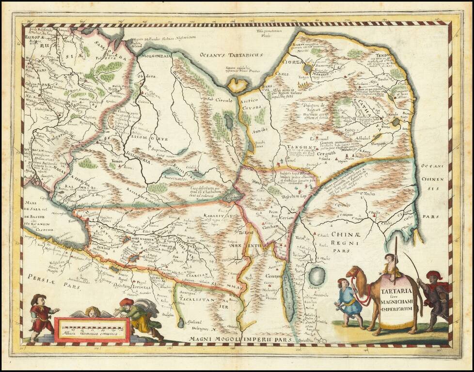
An attractive antique map of China, Tartary, and Central Asia. This map covers a vast area in intriguing detail which reflects European knowledge about the world at the time during which it was made. The detail shown includes many rivers, mountain...
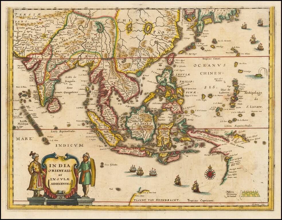
Southeast Asia with an Early Depiction of Northwestern Australia Based on Gerrit Frederikszoon de Witt's Discoveries in 1628 Scarce decorative map of Southeast Asia, China, India, the Philippines and western Oceana, along with the newly discovered...
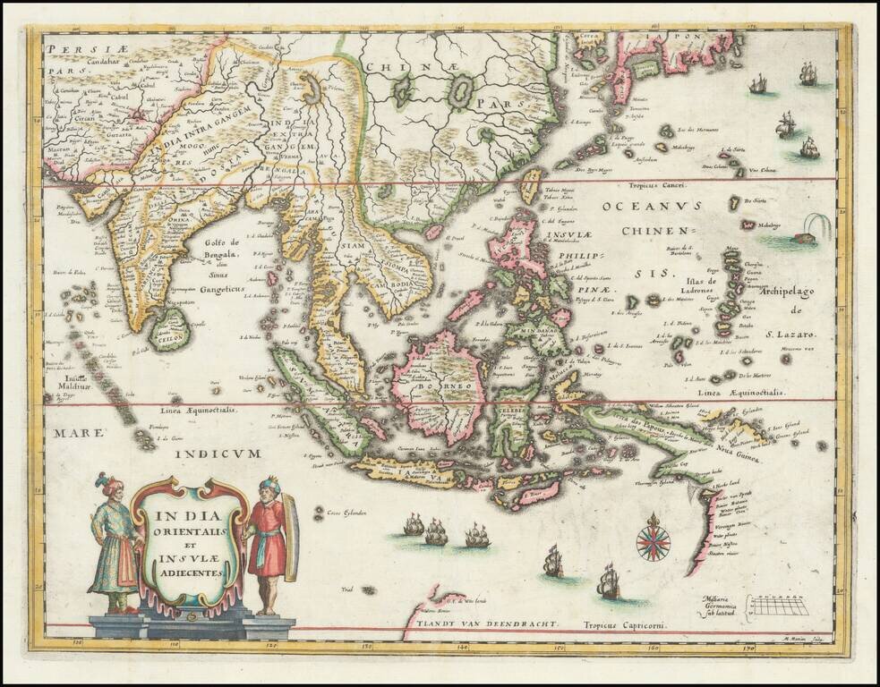
Southeast Asia with an Early Depiction of Northwestern Australia Based on Gerrit Frederikszoon de Witt's Discoveries in 1628 This is a scarce decorative map of Southeast Asia, China, India, the Philippines, and western Oceania. Perhaps the most...
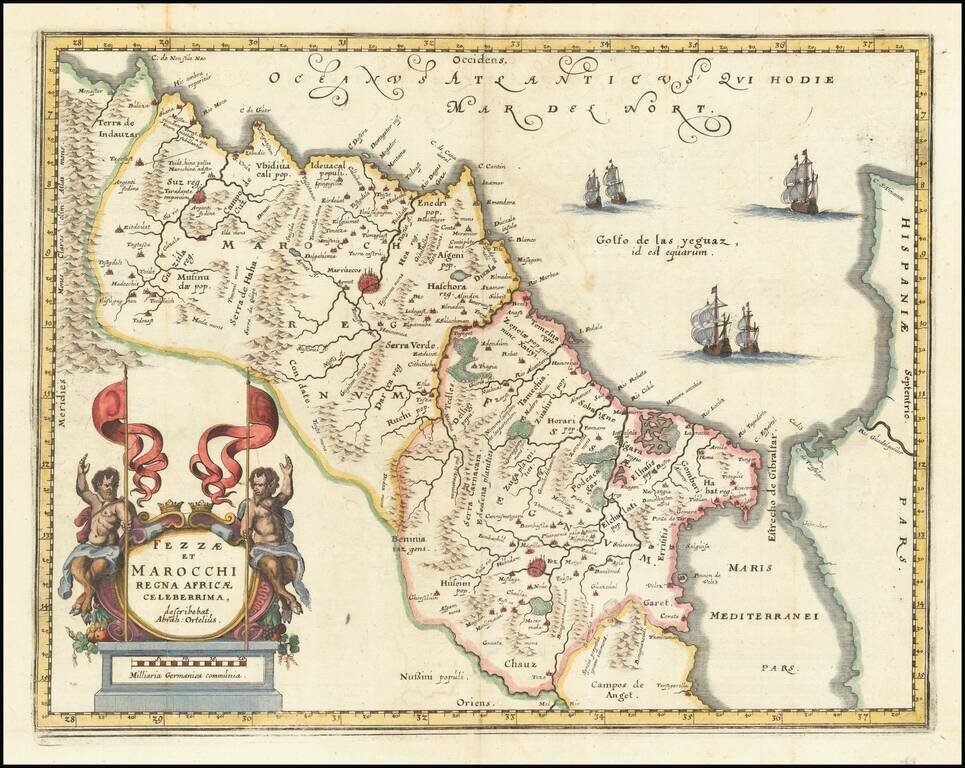
A striking map of Morocco, showing large fortified towns of Marrakesh, Taroudant and Fez, towns, mountains, rivers, lakes, etc. Tangier, Ceuta and Rio Rabata also appear. Large decorative cartouche and sailing ships. Abraham Ortelius is credited in...
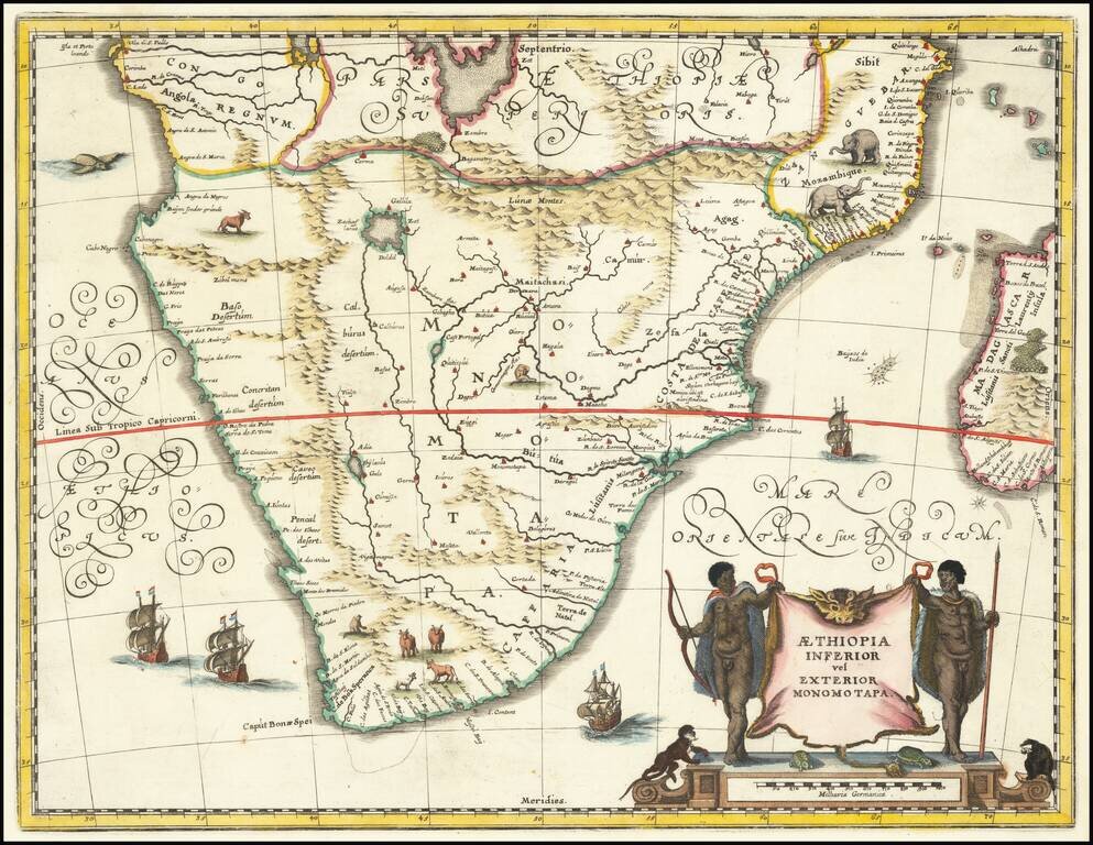
Attractive map of Southern Africa and part of Madagascar, shortly before the first Dutch settlement in the region. The area shown is from the Congo River basin around the Cape of Good Hope and up the east coast as far as northern present-day...