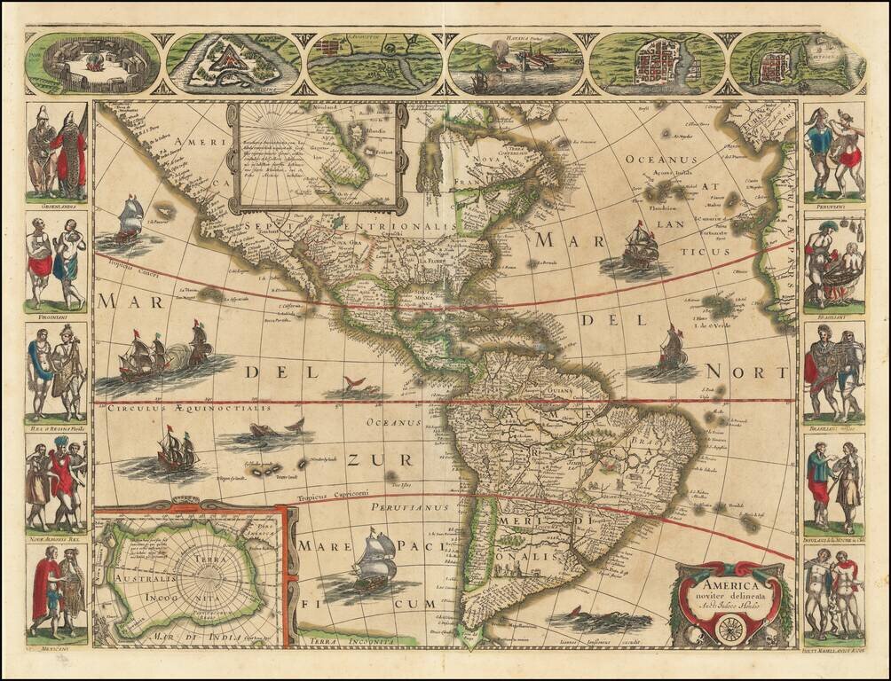
This is the 1632 state of Jansson's rare map of America, first issued in 1623. The map shows the Americas from Tierra del Fuego to Cape Mendocino and the Hudson Strait. Two inset maps depict the poles, with a large Australis Terra Incognita depicted....
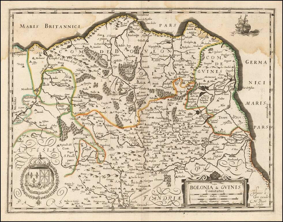
Jean Le Clerc's rare map of the Picardie, including Boulogne-sur-Mer and Calais, and Artois. The map can be found in very rare French composite atlases of the mid-17th century, and in Gabriel Michel de La Rochemaillet's Theatre geographique du...
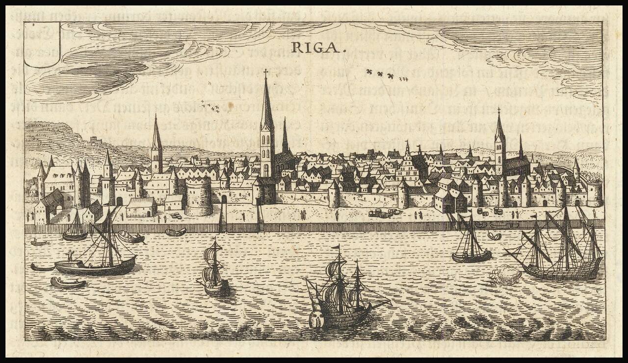
Fine early view of Riga, from an unknown source. We suspect the work is by Jodocus Hondius or Petrus Bertius, but we have been unable to find a definitive source.
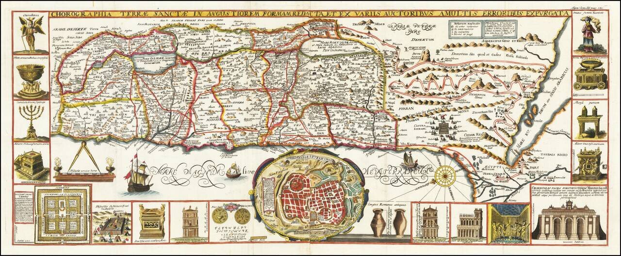
Scarce map of the Holy Land, with inset of Villaplando's Jerusalem. Shows 16 Old Testament vignettes, Moses' exodus and many other biblical events. Colored by tribes. Attractive compass rose and several sailing ships. After Christian Van Adrichom. A...