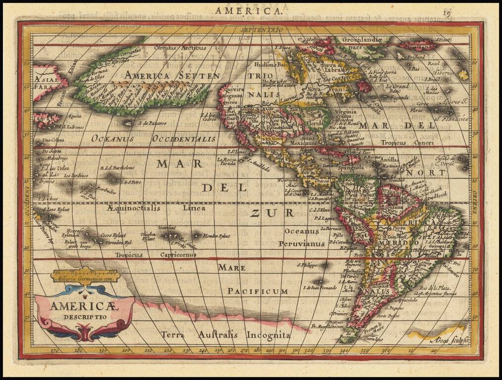
Detailed map of America, which appeared in Jansson's Atlas Minor. The most interesting element of the map is the massive land bridge, running from North America to Asia, with only two small breaks. This configuration was derived from the globe of...
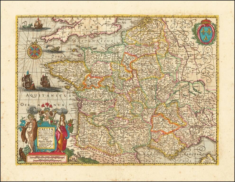
Early Dutch map of France, published in Amsterdam by Henricus Hondius. The map is finely engraved and embellished, including sailing ships, sea monsters, and an elaborate compass rose fill the sea. The royal armorial at upper right is balanced in the...
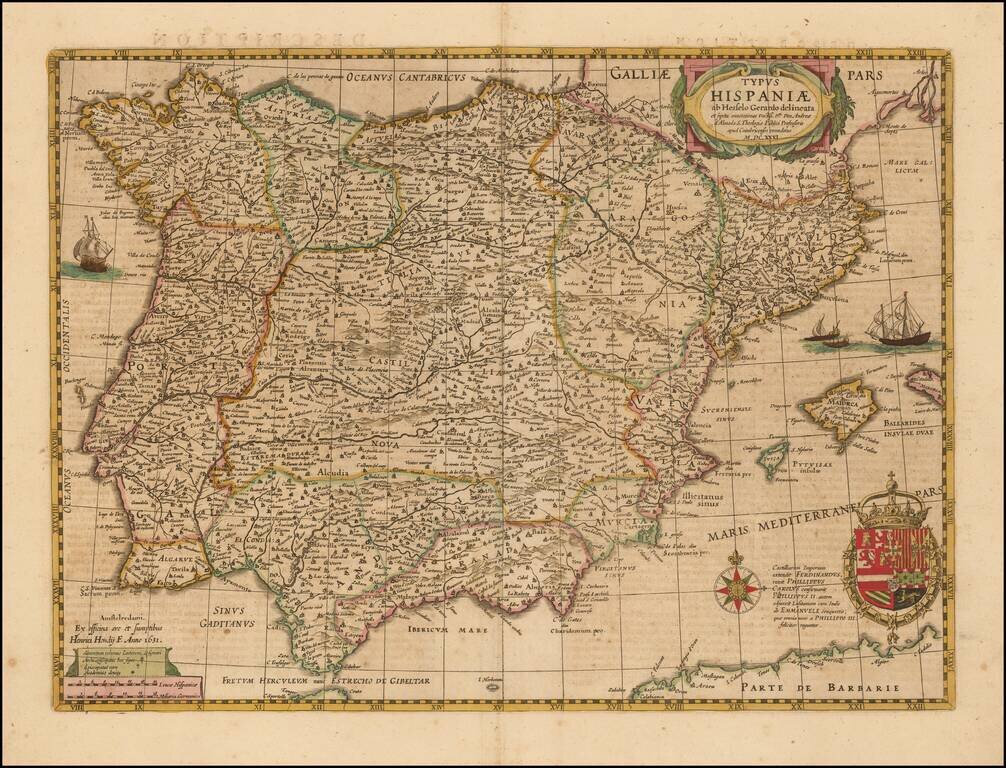
Nice example of Hondius' map of Spain, first issued in 1631. This map replaced the prior Mercator-Hondius map, which was first issued about 1606. The map includes 4 sailing ships, a compass rose, decorative cartouche and ornate coat of arms.
![(V.O.C. Forts) Amboyna [and] I. Nera](/map/small/48714.jpg)
Antique engraving of two Dutch East India Company settlements in the Spice Islands: Ambon and Fort Belgica on Banda Neira. Fort Belgica was an important fort in the area for centuries, originally starting as a Portuguese installation in the 16th...
![[The Spanish fleet in the Ladrone Islands]](/map/small/48713.jpg)
Antique engraving of the Spanish fleet interacting with Polynesian outriggers and sailing vessels in the vicinity of Guam. The engraving was page 475 from Newe Welt und Americanische Historien by Johann Ludwig Gottfried, published by Mattaeus Merian,...