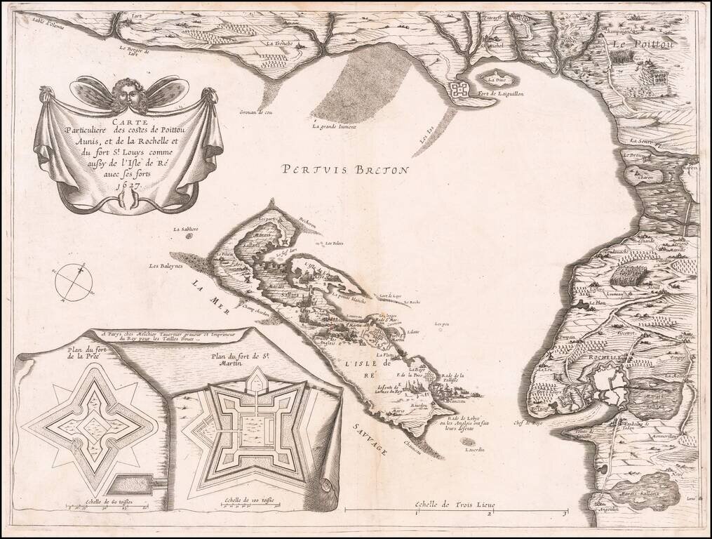
Very rare map of Poitou-Charentes with Île de Ré and the French coast with La Rochelle, oriented to the Northwest, with two inset fortification plans: Fort de la Pree and Fort de St Martin, published in 1627 by Melchior Tavernier. The map shows the...
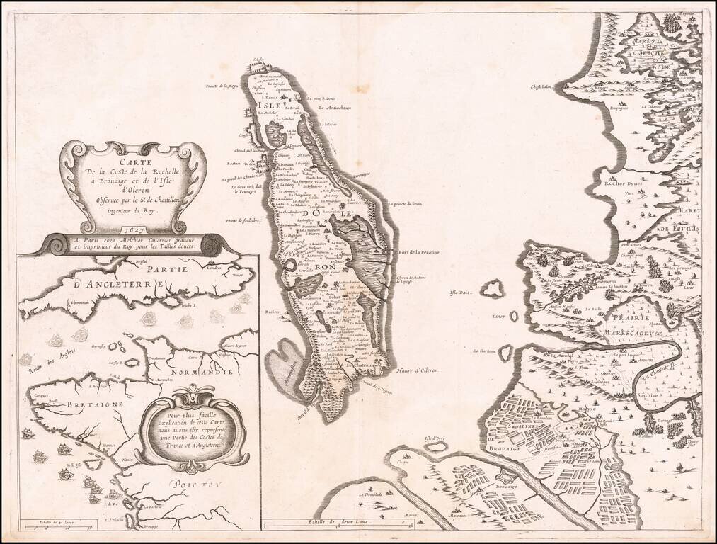
Contemporary Map of the Siege of La Rochelle Detailed map of the area around La Rochelle and the Isle of Olearon, published in Paris in 1627, illustrating both the Hugenot stronghold of La Rochelle and the Catholic stronghold of Brouage, which was...
![[Untitled Map of Central Westphalia]](/map/small/51478.jpg)
Nice example of the Mercator-Hondius regional map of Westphalia, in modern-day Germany.
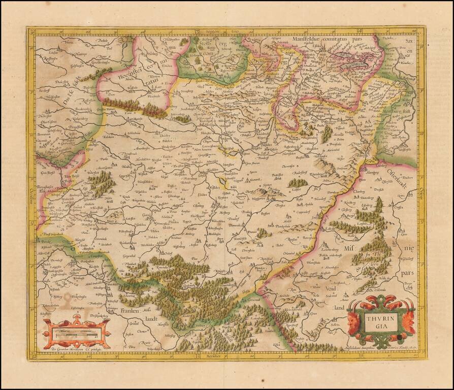
Old color example of Hondius' regional map of Germany, from the Atlas Sive Cosmograhia. The map is centered on Erfurt, Weimar and Gotha.
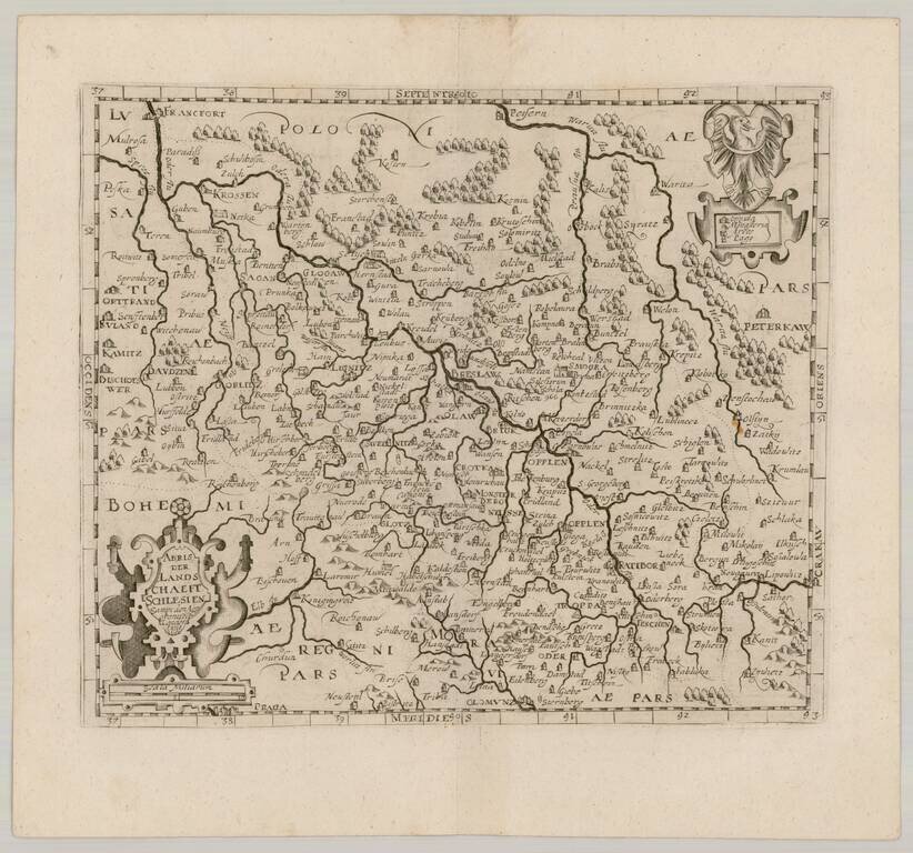
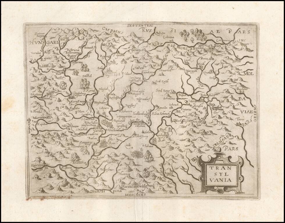
Scarce map of Southern Poland and a bit of Northern Moravia, published in Frankfurt by David Custodis (Custos).
![[ Gdansk Environs ] Schweetsche Schans Auff Den Weyselstrom ongefehr neun Meilen von Dantzig gelegen Ao. 1626.](/map/small/68842.jpg)
Swedish fort constructed on the Vistula River near Danzig, dated 1626. At the bottom a cartouche with a map held up by two soldiers appears, with a key locating 11 places.
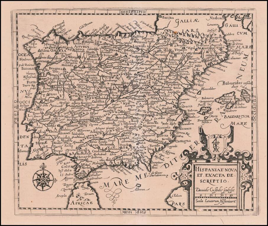
Scarce map of Spain & Portugal, published in Frankfurt by David Custodis (Custos). The map is scarce on the market. This is the first example we have offered in more than 20 years.