![[The Second Map of California as an Island!] Zwoelffter Theil der Newen Welt...](/map/small/68875.jpg)
The Beginning of the Myth -- The Second Map To Show the Island of California Beautiful engraved title page for the 1623 German-language edition of Herrera, published as the twelfth part of Theodore de Bry's Grand Voyages. This title page follows the...
![[Four Untitled Globe Gores of North America]](/map/small/69801.jpg)
John Smith's Lost First Map of Virginia. An exceptional set of four globe gores depicting North America, prepared by Jodocus Hondius II and Johannes Janssonius, and engraved by Abraham Goos, for their 17.5-inch (44-cm.) terrestrial globe published in...
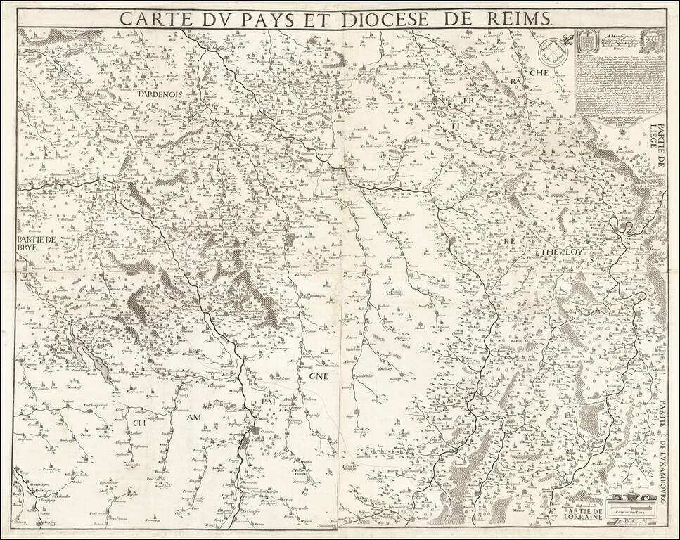
Very Rare French Wall Map of Reims. An attractive map of the region around Reims, one of the earliest to show the area in detail. The map is oriented to the northeast, meaning that most of the rivers of the region run vertically. Many cities, towns,...
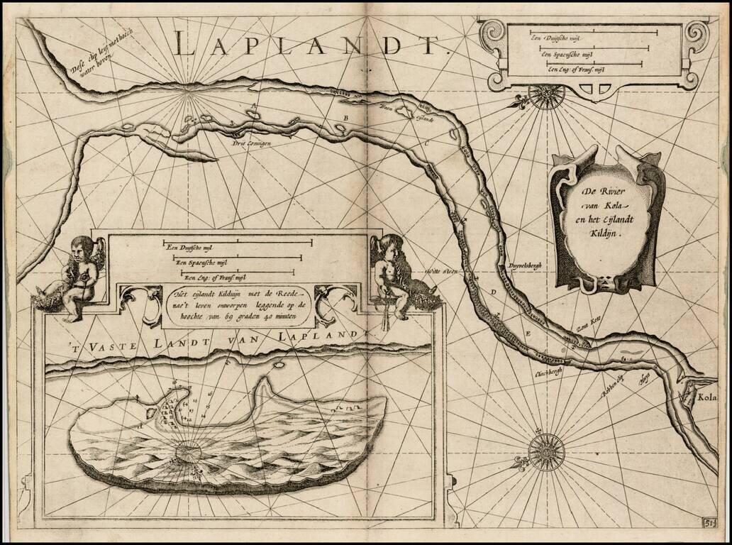
First edition of Blaeu's chart of part of Lapland, near Murmansk, from Blaeu's Zeespiegel, Inhoudende Een Karte Onderwijsinghe in de Konst de Zeevaert, en Eene beschrijvinghe der Seekusten van de Oostersche, Noordsche, en Westersche Schipvaert. The...
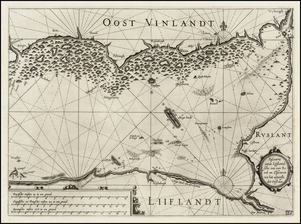
First edition of Blaeu's chart the Narva Bay and the area around St. Petersberg in Russia, from Blaeu's Zeespiegel, Inhoudende Een Karte Onderwijsinghe in de Konst de Zeevaert, en Eene beschrijvinghe der Seekusten van de Oostersche, Noordsche, en...
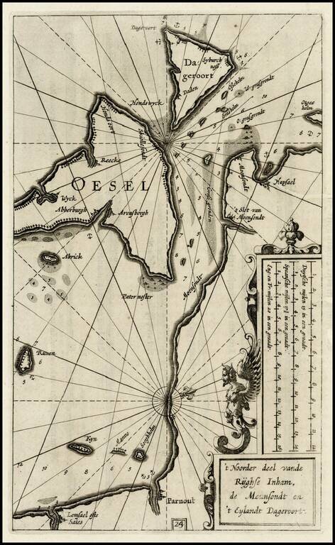
Rare map of the Island of Oesel (Saaremaa) and contiguous coastline of the Gulf of Riga, from the first edition of Blaeu's rare Zeespiegel, Inhoudende Een Karte Onderwijsinghe in de Konst de Zeevaert, en Eene beschrijvinghe der Seekusten van de...
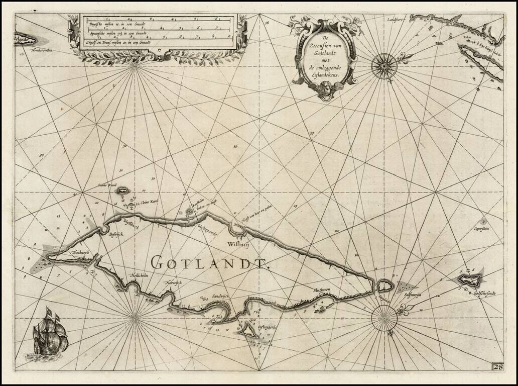
First edition of Blaeu's chart of part of Gotland, from Blaeu's Zeespiegel, Inhoudende Een Karte Onderwijsinghe in de Konst de Zeevaert, en Eene beschrijvinghe der Seekusten van de Oostersche, Noordsche, en Westersche Schipvaert. The map includes...
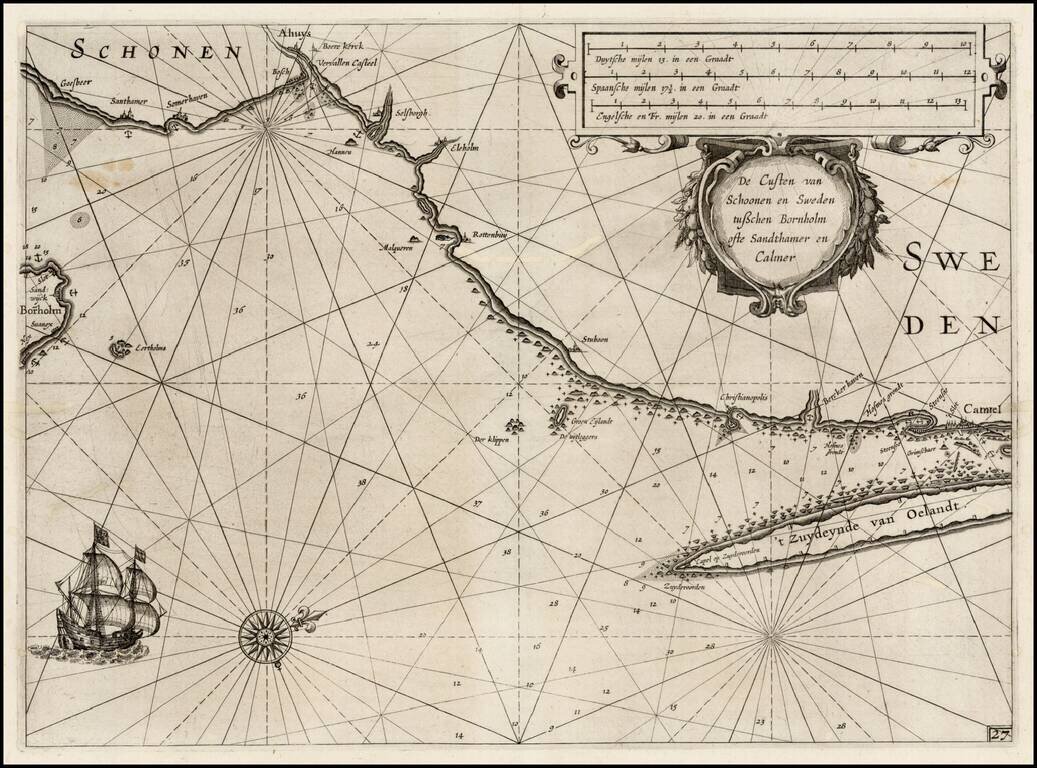
First edition of Blaeu's chart of the southeastern coast of Sweden and part of the Danish Island of Bornholm, from Blaeu's Zeespiegel, Inhoudende Een Karte Onderwijsinghe in de Konst de Zeevaert, en Eene beschrijvinghe der Seekusten van de Oostersche,...
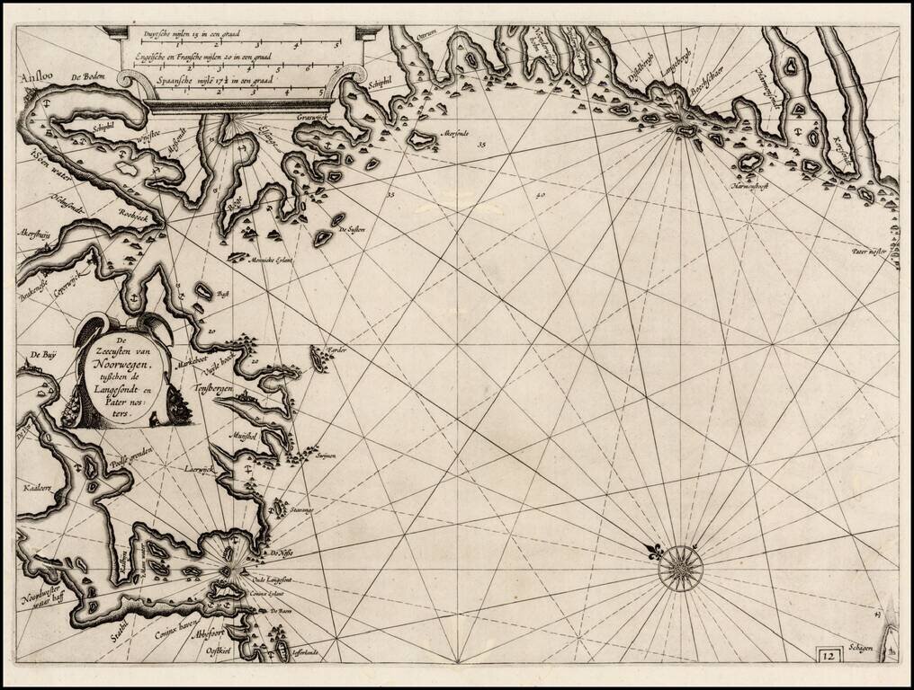
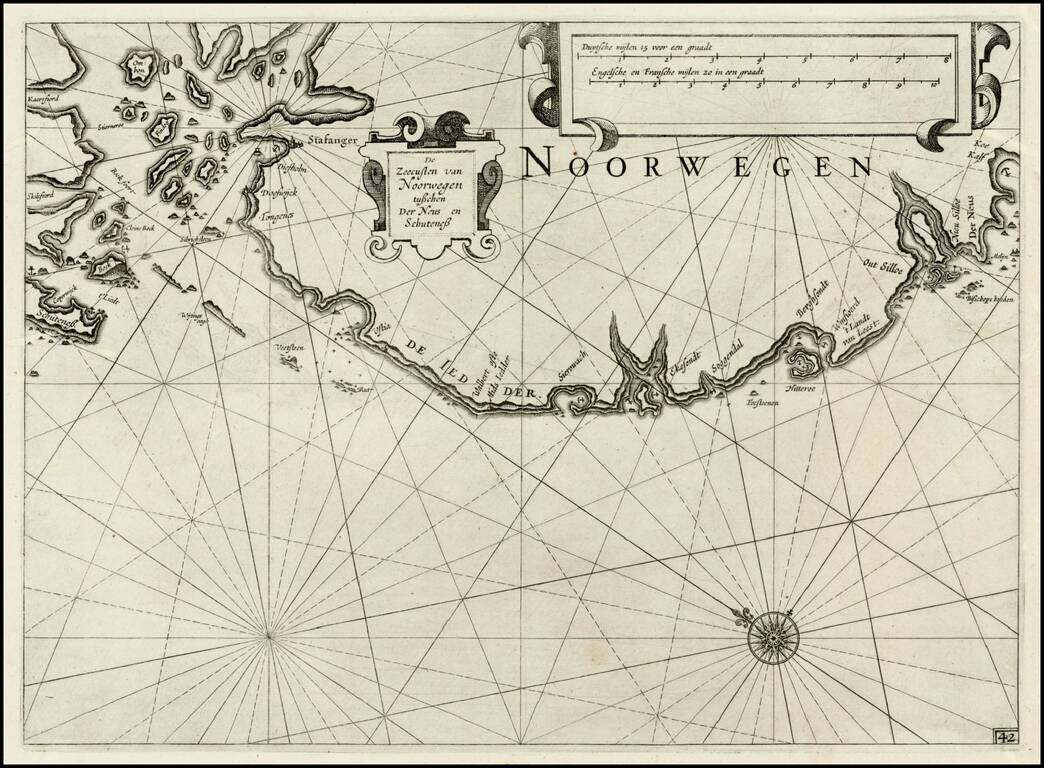
First edition of Blaeu's chart of part of southwestern Norway, from Blaeu's Zeespiegel, Inhoudende Een Karte Onderwijsinghe in de Konst de Zeevaert, en Eene beschrijvinghe der Seekusten van de Oostersche, Noordsche, en Westersche Schipvaert. The map...
First edition of Blaeu's chart of part of Denmark and Norway, from Blaeu's Zeespiegel, Inhoudende Een Karte Onderwijsinghe in de Konst de Zeevaert, en Eene beschrijvinghe der Seekusten van de Oostersche, Noordsche, en Westersche Schipvaert. The map is...
First edition of Blaeu's chart of part of southwestern Norway, from Blaeu's Zeespiegel, Inhoudende Een Karte Onderwijsinghe in de Konst de Zeevaert, en Eene beschrijvinghe der Seekusten van de Oostersche, Noordsche, en Westersche Schipvaert. The map...
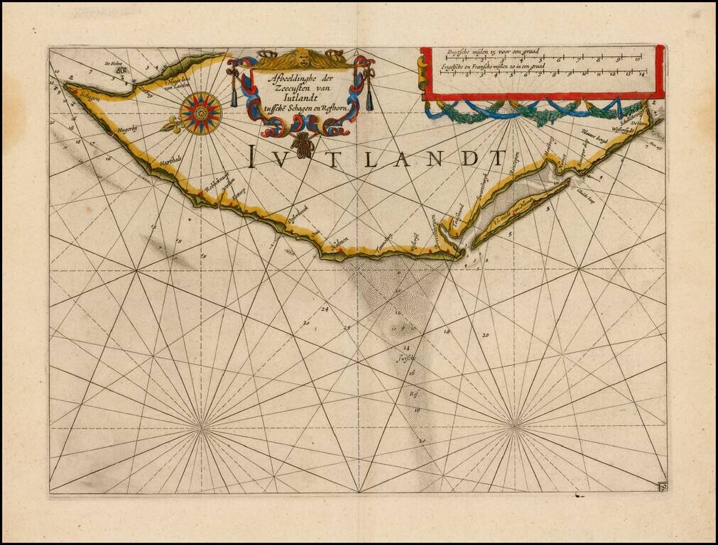
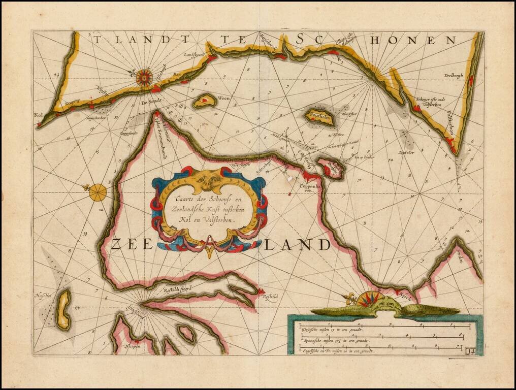
Fine example of this rare sea chart of part of Denmark, published by Blaeu in his Zeespiegel, first published in 1623. The Zeespiegel was the second of Blaeu's sea atlas, following after his Het Licht der Zee-Vaert, which was first issued in 1607. The...