
One of the Earliest Maps to Show and Name the Philippines Rich, dark impression of Matthias Quad's map of Asia. The map shows the entire continent, from the east coast of Africa to the subcontinent to Japan. The land is covered with toponyms; small...
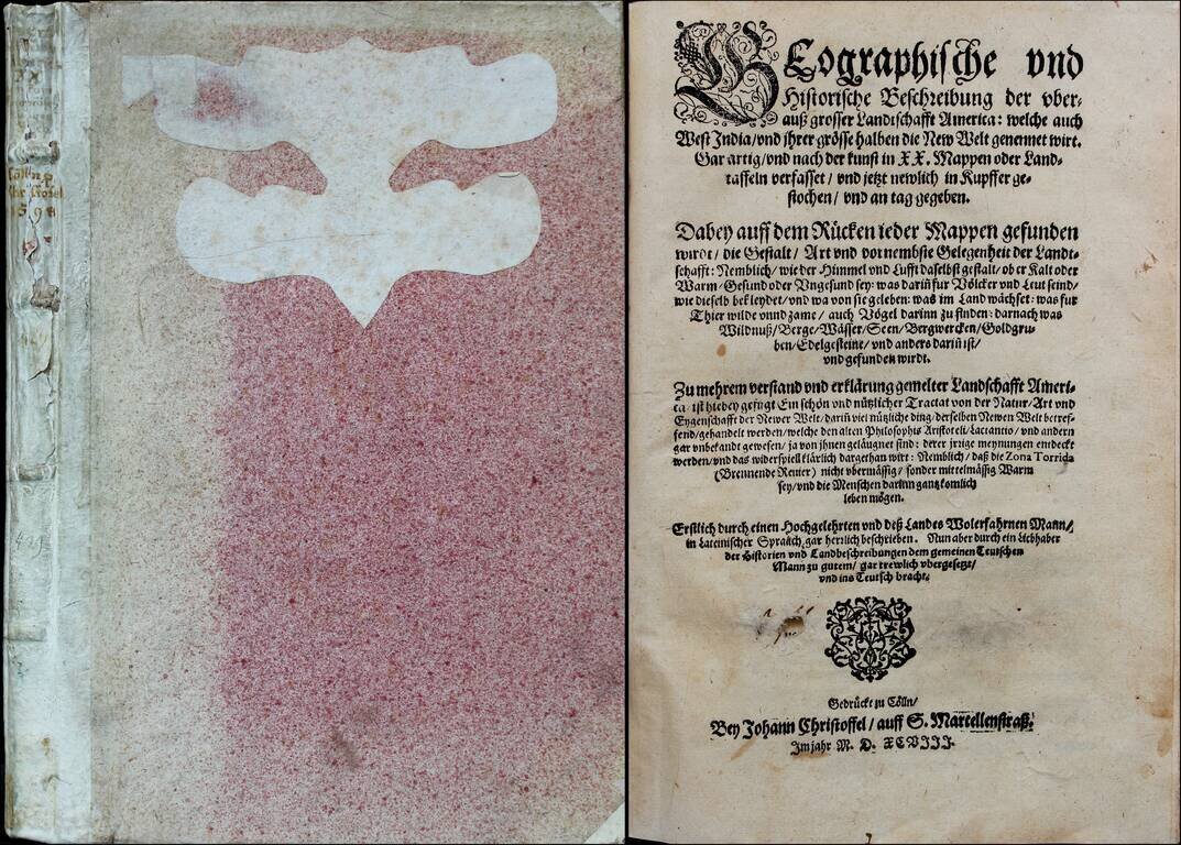
A Rare American Atlas, Bound With A Rare Suite of Maps of 13 Europe Geographische und historische Beschreibung der uberauss grosser Landtschafft America, welche auch West India und ihrer grösse halben die New Welt genennet wirt. Gar artig und nach...
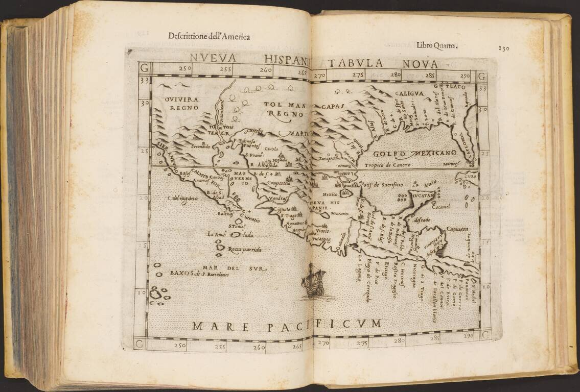
1598 Edition of Ptolemy's Geography An excellent example of Rosaccio's improvement on Ruscelli's Ptolemy, adding contemporaneous knowledge and interpretations and extensively reworking the copperplate-engraved maps with decorative sea monsters and...
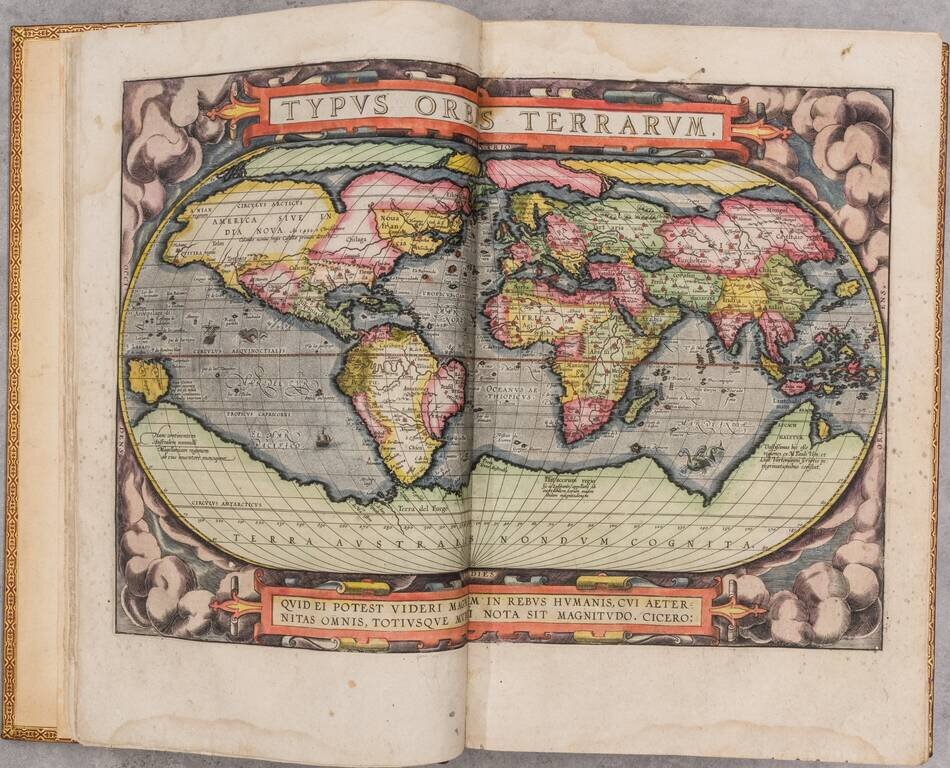
Exceptionally Rare Dutch Edition of the Theatrum Published in Amsterdam by Cornelis Claesz. A superb, full original hand-color, Dutch-language Ortelius atlas published by Cornelis Claesz, Amsterdam's "great motive force behind publications in the...

Willem Barentsz's Map of the Polar Regions, drawn from his observations during his third voyage of 1596-97 and engraved by Baptiste Van Deutecum. The Barentsz map of the polar regions is a major landmark in Arctic cartography, depicting the details...

Willem Barentsz's Map of the Polar Regions, drawn from his observations during his third voyage of 1596-97 and engraved by Baptiste Van Deutecum. The Barentsz map of the polar regions is a major landmark in Arctic cartography, depicting the details...
![[Ascension Island] The True Description of the Island of Ascention lyeing under 8 degrees on ye South syde of ye Equinoctiall lyne.](/map/small/69468.jpg)
Antique engraved view of the Island of Ascension (St. Helena), which appeared in the rare English edition of Linschoten's Itinerario, Iohn Huighen van Linschoten. His discours of voyages . . . , published in London in 1598, and engraved by Englishman...
![[Rare English Edition!] Deliniantur in hac tabula, Orae maritimae Abexiae, freti Mecani: al. Maris Rubri: Arabiae Freti Mecani: al Maris Rubri: Arabiae, Ormi, Persiae, Supra Sindam usque . . . / The description of the coast of Abex, The Straights of Mec](/map/small/69450.jpg)
Rare 16th-century English map of the region centered on the Indian Ocean, which appeared in the rare English edition of Linschoten's Itinerario, Iohn Huighen van Linschoten. His discours of voyages . . . , published in London in 1598. Linschoten's...
![[Rare English Edition!] Delineatio Orarum Maritimarum, Terrae vulgo Indigetatae Terra do Natal, item Sofalae, Mozambicae, & Melindae . . . / The description or Caerd of the Coastes of the Countreys following called ~ Terra do Natal, all the Coast of S](/map/small/69464.jpg)
Rare English Edition -- Stunning Map of Eastern Africa Striking example of the rare English Edition of Linschoten's map of Eastern Africa, which appeared in the rare English edition of Linschoten's Itinerario, Iohn Huighen van Linschoten. His discours...
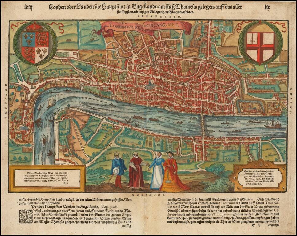
Nice full color example of Munster's map of London, which appeared only in the later editions of Munster's Cosmography. Striking double page city view of the city of London showing the area between Clerkenwell, Wapping, Southwark and Westminster...
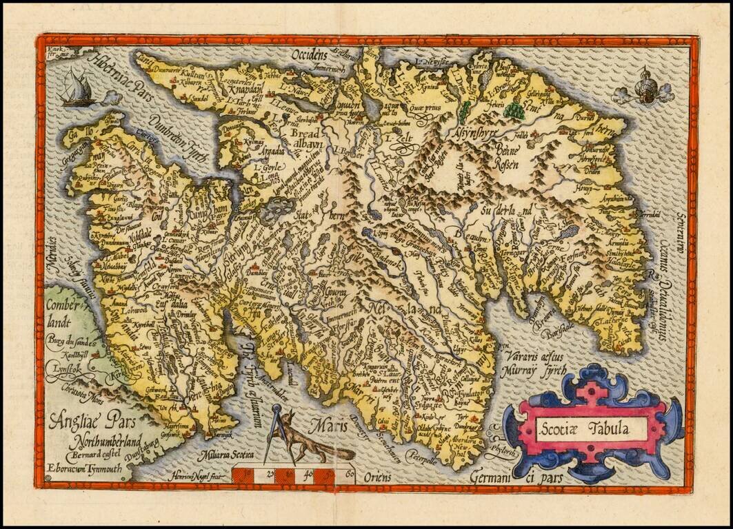
Scarce 16th Century map of Scotland, pubilshed by Bussemacher in Cologne, and oriented with west at the top. Engraved by Henricus Nagel. Published in Cologne.
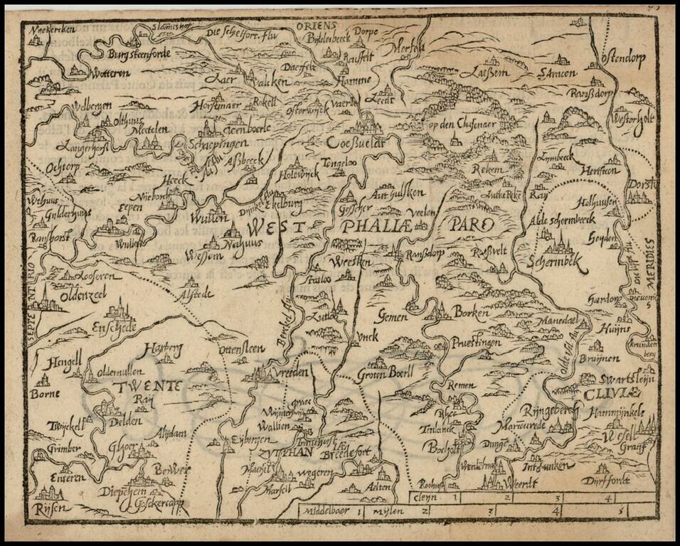
Rare 16th Century map of the region centered on Wesphalia, published by Zacharias Heyns in his rare Le Miroir du Monde, ou, Epitome du Theatre d'Abraham Ortelius, published in Amsterdam in 1598. Zacharias Heyns was the son of Peter Heyns, who wrote...
![Gallia Narbonens [on sheet with] Savaudiae Ducat. [on sheet with] Venuxini Comitatus Descr.](/map/small/61542.jpg)
Fine old color example. The regions include a detailed area map of the Avignon region on the upper Rhodanus River (and coastline from Narbone to Marseille) and the area around Lake Geneva, extending west to Lyon, and showing Grenoble, Geneva, San...
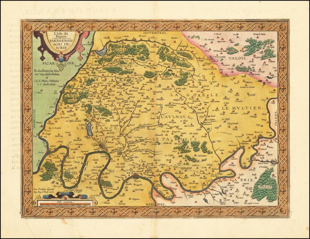
Fine old color example of this important early map of the region around Paris and the Isle de France, published by Abraham Ortelius in Antwerp. The map appeared in Ortelius' Theatrum Orbis Terrarum, the first modern atlas of the world. The map is...
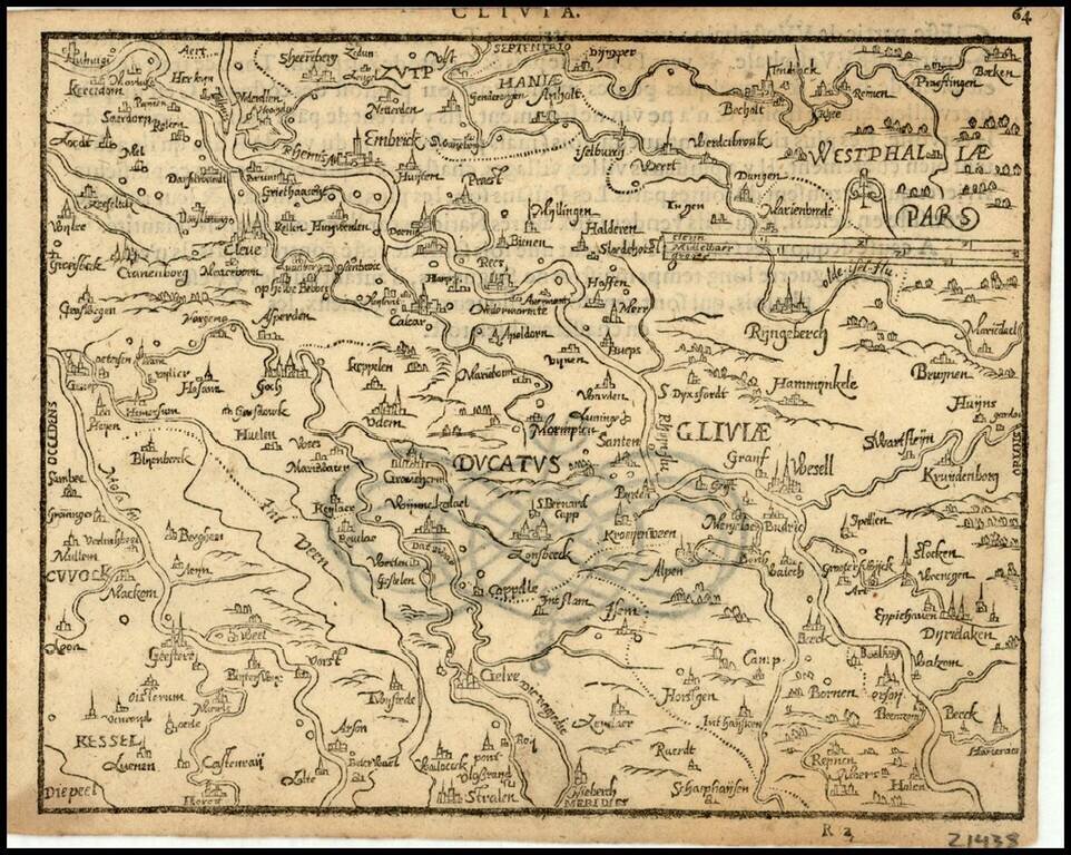
Rare 16th Century map of the Duchy of Cleve in Northwestern Germany, published by Zacharias Heyns in his rare Le Miroir du Monde, ou, Epitome du Theatre d'Abraham Ortelius, published in Amsterdam in 1598. Zacharias Heyns was the son of Peter Heyns,...
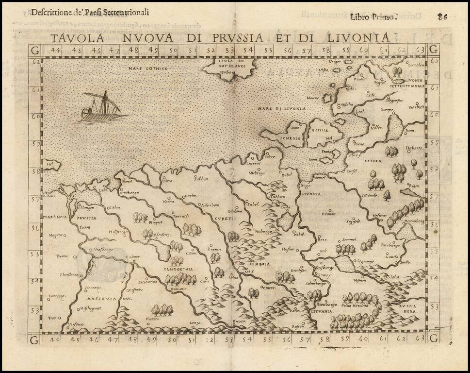
Nice example of the scarce third state Ruscelli's map of Poland, Lithuania and the Baltic Region. The map is bounded by the Vistula River and Prussia in the west, Livonia in the east, and Lithuania in the southeast. Centered on Riga and Vilna....