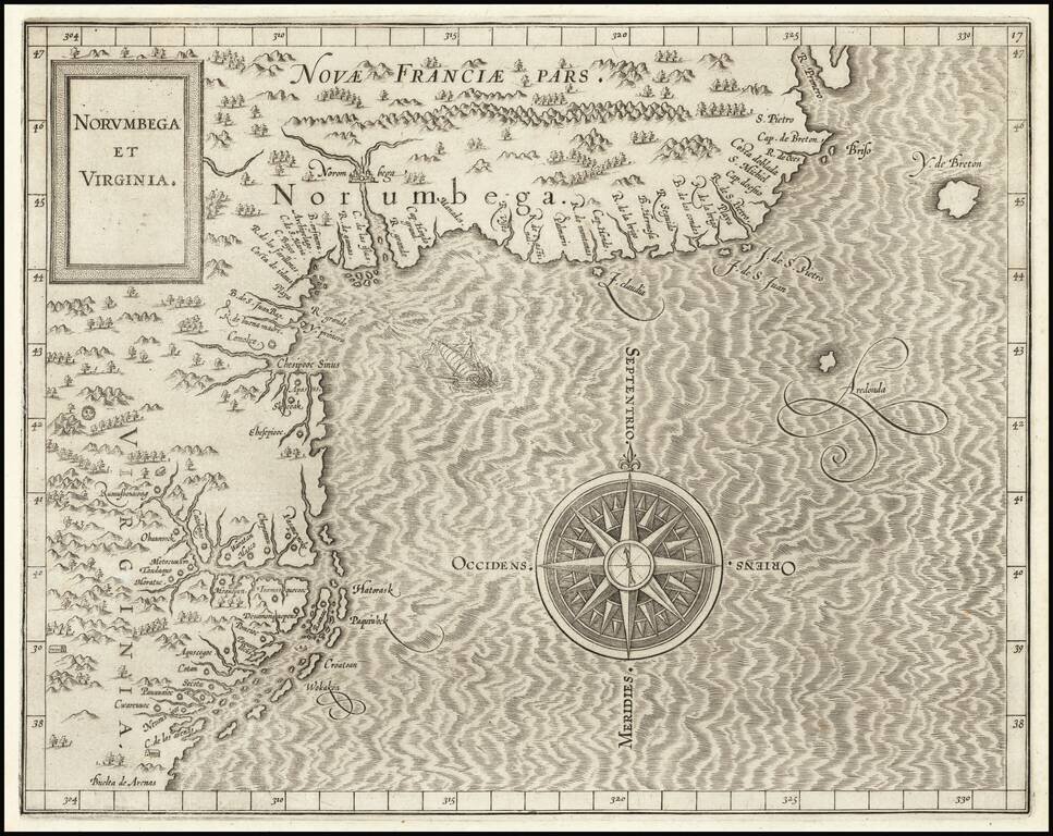
One of the Earliest Printed Maps of the East Coast of the United States. First state (left latitude written "30" instead of "39") of Cornelis van Wytfliet's Norumbega et Virginia, the highly important map of the Atlantic Seaboard of North America from...
![Limes Occidentis Quivira et Anian. 1597 [Pacific Northwest & Northwest Passage]](/map/small/71207.jpg)
The Second Printed Map of the Northwest of North America, including the Northwest Passage. This is a fine example of Wytfliet's map of the Northwest Coast of North America, the second printed map to focus on the region which would become Alaska and...
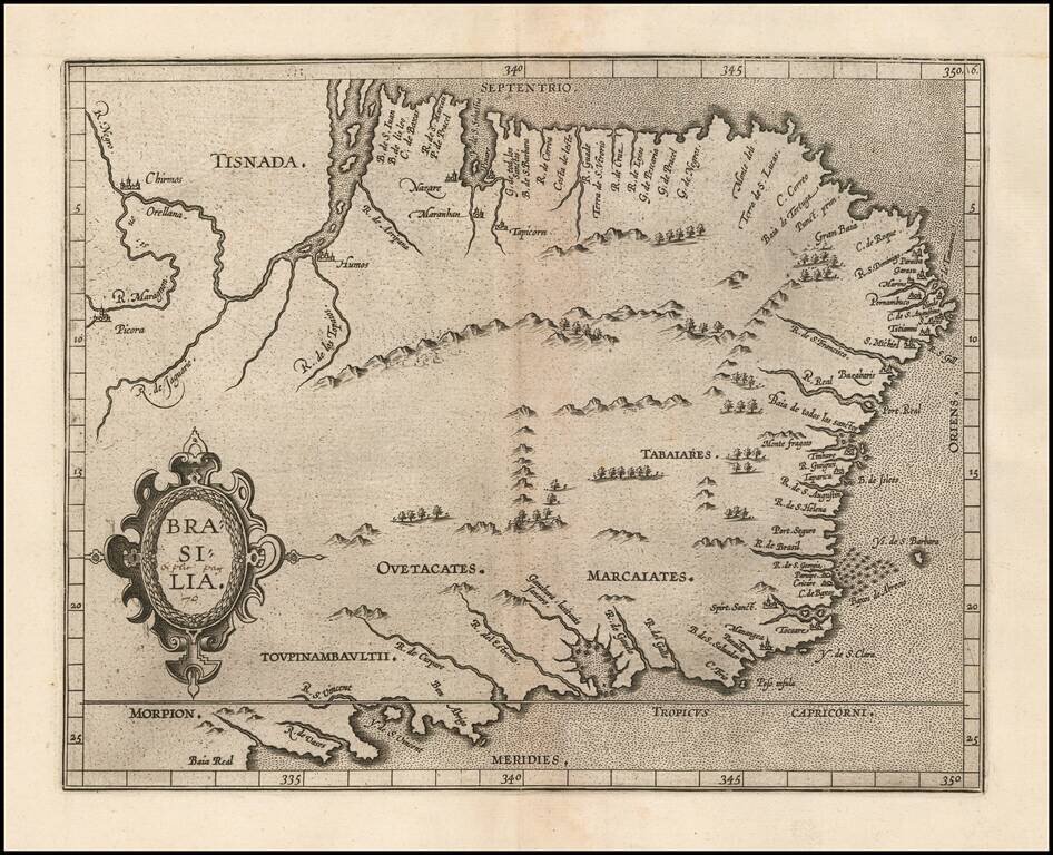
Wytfliet's map of Brazil is one of the earliest obtainable maps of the region. The map appeared in Wytfliet's Descriptionis Ptolemaicae Augmentum, the first atlas to focus on the mapping of the New World. In 1597 Cornelis van Wytfliet published his...
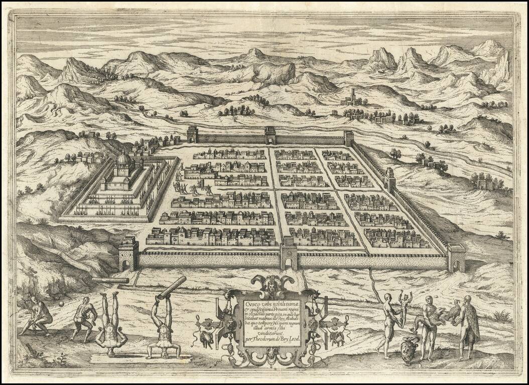
Detailed view of the town of Cusco in Peru, then one of the largest cities in the Americas. The view shows the indigenous Inca king being carried in his elevated chair near the town center. In the foreground Inca people playing a ball game and showing...
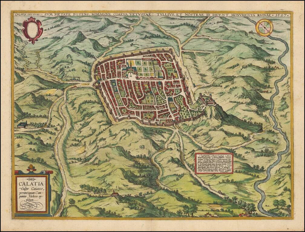
Striking town plan of Caiazzo from Braun & Hogenberg's Civitas Orbis Terrarum, first issued in 1597. Caiazzo is a city in the province of Caserta (Campania) in Italy. It is located on the right bank of the Volturnus, northeast of Capua. The...
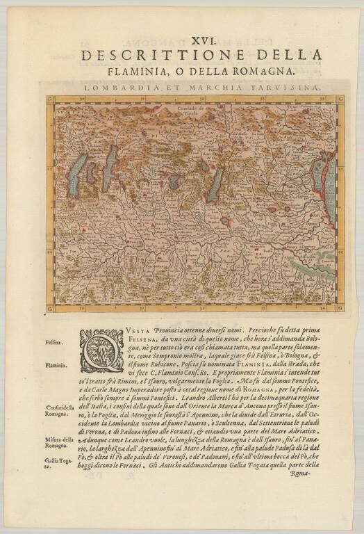
Detailed map of the region between Venice and the Lake Regions, including Lago Maggiore, Lago Como and Lago De Garda. Also shows Bologna, Milan, Bergamo, etc. From the 1597 edition of Magini's Geog rafia, based upon the work of Claudius Ptolemy.
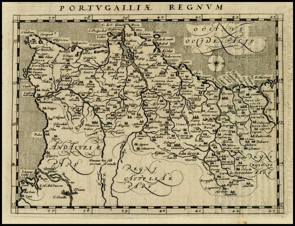
Fine example of this early modern map of Portugal. From a 1597 edition of Magini's Geographia Universae tum Veteris tum Novae Absolutissiumum.
![Tabula Aphricae II [shows Sicily and Sardinia]](/map/small/47363.jpg)
16th Century Italian cartography of Sicily, Sardinia, and North Africa based on Ptolemy. Striking example of Magini's map of North Africa, based upon Ptolemy. Shows part of the Mediterranean, including Sicily and Sardinia. Three sea monsters and an...
![[Arabian Peninsula] Tabula Asiae VI](/map/small/68189.jpg)
Ptolemy's Arabia Felix Detailed map of the Arabian Peninsula and environs, based upon the work of Ptolemy. From an early edition of Magini's Geographia.
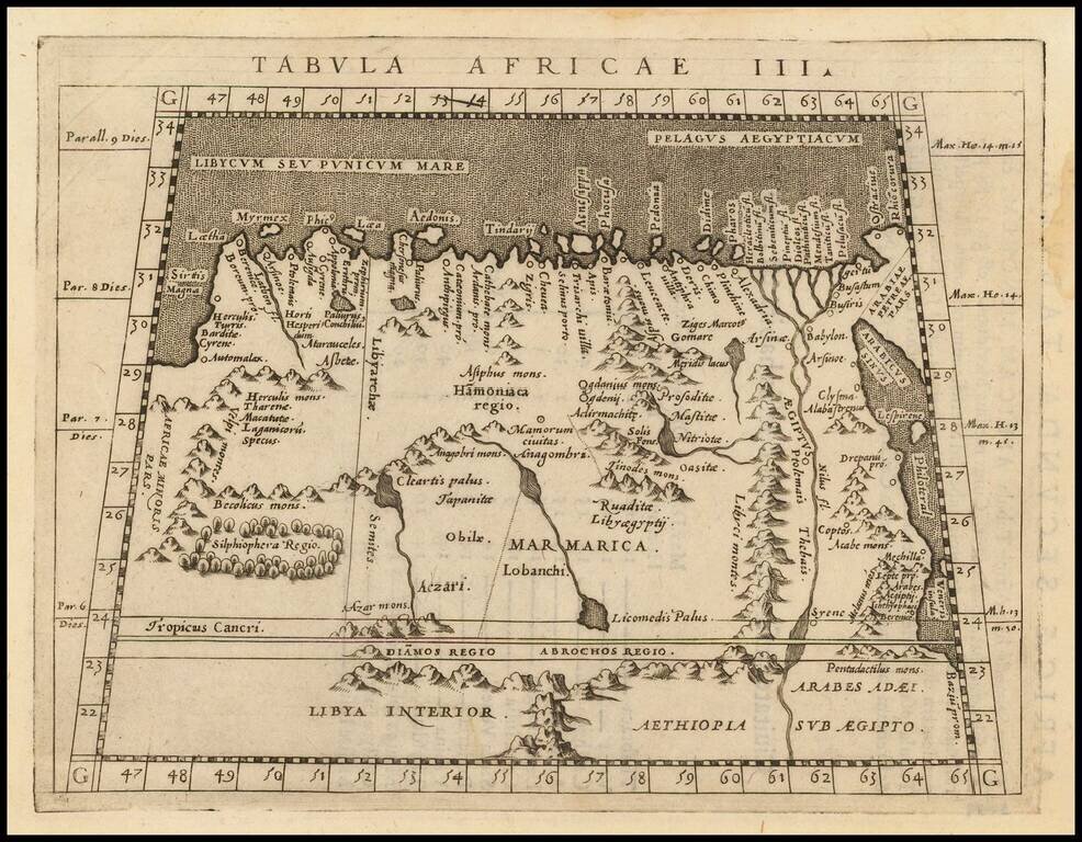
A nice example of Magini's map of the Northeastern portion of Africa, based on Ptolemy. Extends east to Egypt and the Red Sea and south to Libya Interior.
![Tabula Aphricae I [Morocco & Tunisia]](/map/small/47490.jpg)
Striking example of Magini's map of North Africa, based upon Ptolemy.