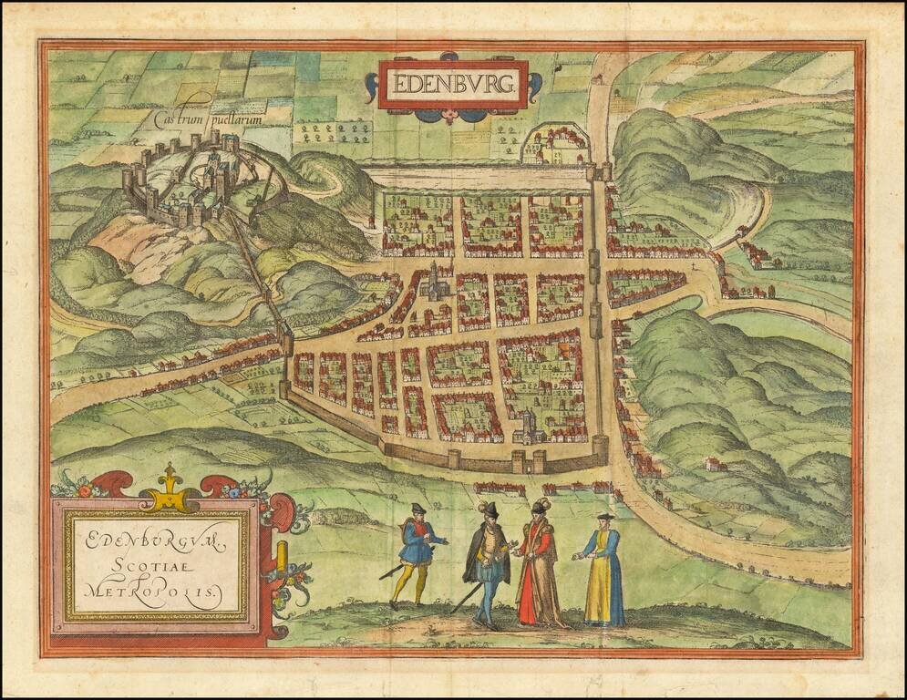
Finely colored example of the earliest obtainable views of Edinburgh, published by Braun & Hogenberg. Includes Edinburgh's major 16th Century buildings shown in profile, with no consideration for perspective. Published for the Civitates Orbis...

Old hand-color example of this early plan of Luxembourg, from Braun & Hogenberg's Civitates Orbis Terrarum, the first major atlas of City Plans and Views, based upon the work of Jacob Van Deventer. The cartouche translates as follows: Luxembourg,...
![[Venaissin]](/map/small/60728.jpg)
Manuscript Map of the Comte de Venaissin Fine early manuscript map of the Comte / County of Venaissin, oriented with west at the top, in an early French hand. The region shown is just above Avignon and tracks the Rhone River from Caderousse and...
![[Marseille] Marsilia](/map/small/61341sb.jpg)
An Important 16th Century View of Marseille Extremely rare bird's-eye anonymously published view / plan of Marseille from above "Le Fort de Notre Dame de la Garde". The view includes a coat of arms of the city of Marseille. Text description of...
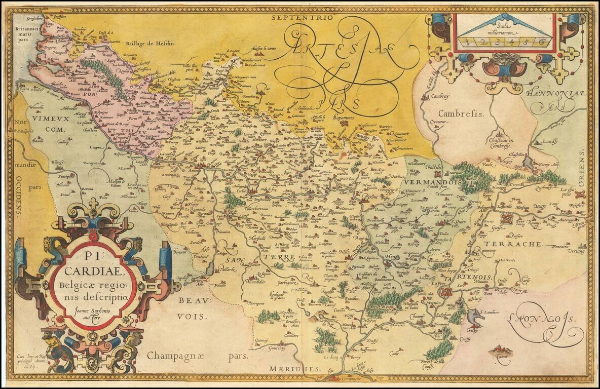
Fine old color example of this regional map of Picardie, from Ortelius' Theatrum Orbis Terrarum, the first modern atlas of the world, first published in 1570. Ornate cartouche and scale of miles.
![[Weimar, Erfurt, Jena, Fuld, Gotha ] Weimaria / Iena . . . / Erdfordia . . . / Gotha . . . / Fuldensis . . .](/map/small/58637mp2.jpg)
Important early views of the German Cities of Weimar, Erfurt, Jena, Fuld and Gotha, which appeared in Braun & Hogenberg's Civitatis Orbis Terrarum, the most important collection of city views and plans published in the 16th Century.