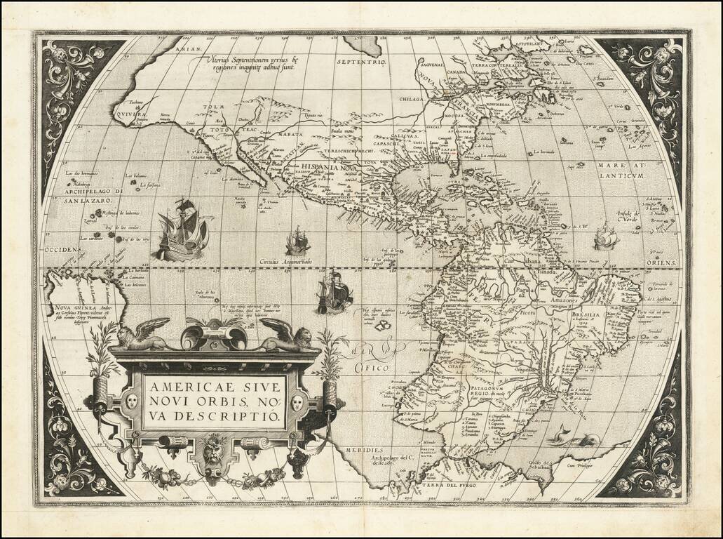
Scarce Second State of Abraham Ortelius' Map of the Americas, One of the Most Iconic Maps of the Western Hemisphere Orteliu's map of America is without doubt one of the most recognized and influential maps of the Americas from the sixteenth century...
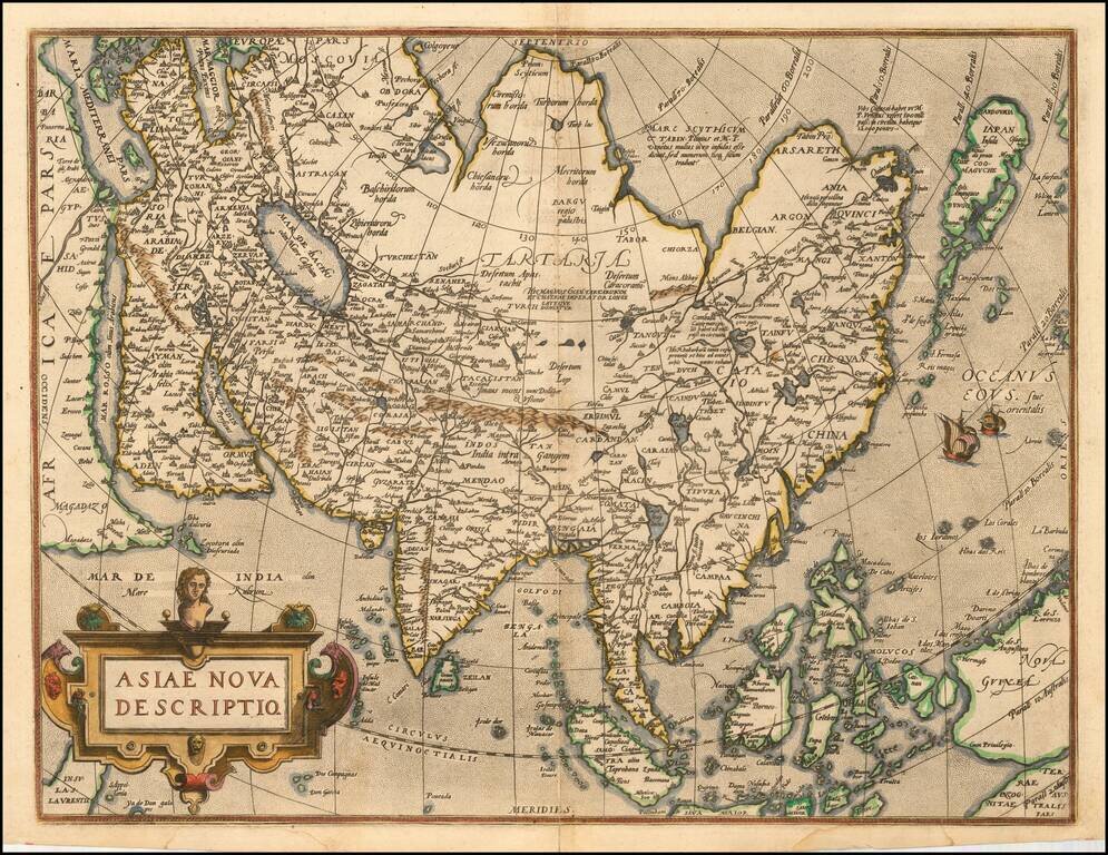
Nice old color example of Ortelius' map of Asia, from Ortelius' Theatrum Orbis Terrarum, the first modern world atlas. A marvelous misprojection of Japan and Southeast Asia. Very distinct Northeast Passage. Includes sailing ships and other...
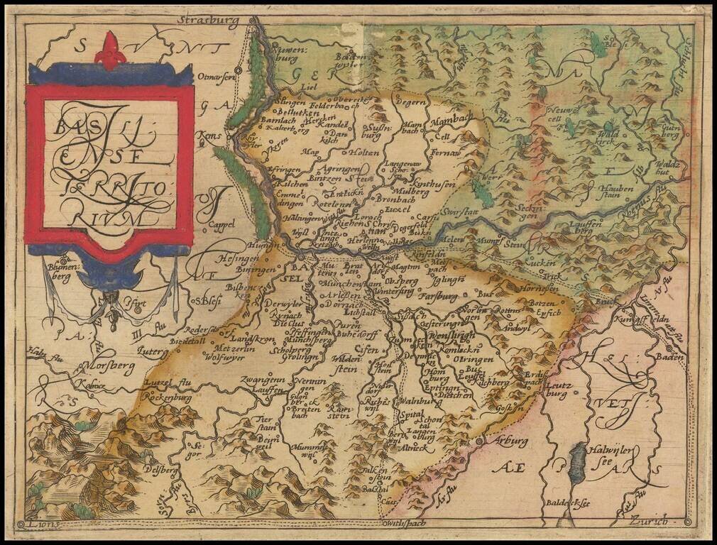
Rare modern map of Switzerland, published in Cologne by Johannes Metellus in 1579 in fine original color. The map is one of the earliest obtainable modern maps published by the so-called Cologne School of mapmakers, which consisted primarily of Flemish...
![Regionis Biturigum Exactiss: Descriptio Per D. Ioannem Calamaeum [with] Limaniae Topographia Gabriele Symeoneo Auct.](/map/small/61579.jpg)
Nice old color pair of regional maps of France. The larger map covers the Loire region from Gian to Le Blang and Argenton, centered on Chateau Neuf and Bourges. The smaller map shows the area around Beauregard and Cleremont.
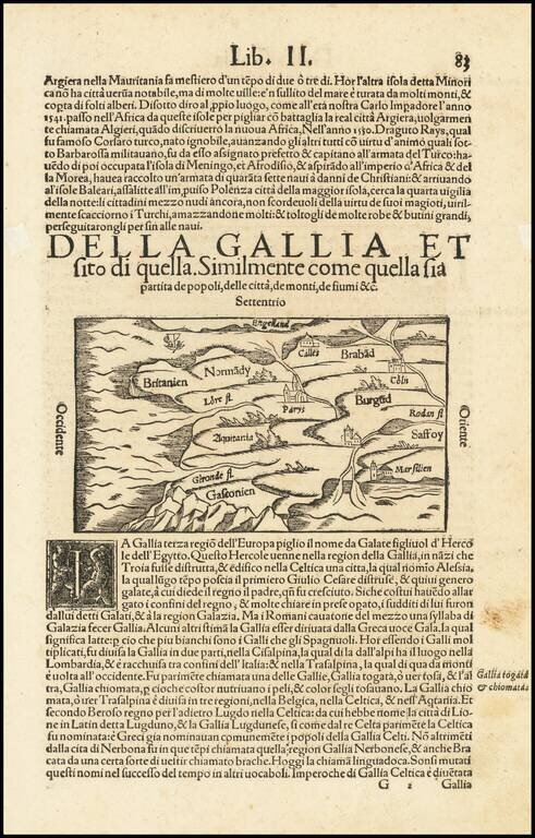
Interesting early map of France, using a stylized hill format which was popularized in maps of the 15th Century. Munster's Cosmography was one of the most influential georgraphical works of the 16th Century. It was published in a number of editions...

Early double page birdseye view of Meissen, with Heraldic images and coats of arms in the sky. Munster's Cosmography was one of the most influential georgraphical works of the 16th Century. It was published in a number of editions over a half century...

Rare modern map of Bavaria, published in Cologne by Johannes Metellus in 1579 in fine original color. The map is one of the earliest obtainable modern maps published by the so-called Cologne School of mapmakers, which consisted primarily of Flemish and...

Rare modern map of the Mansfeld region, published in Cologne by Johannes Metellus in 1579 in fine original color. The map is one of the earliest obtainable modern maps published by the so-called Cologne School of mapmakers, which consisted primarily of...

Nice old color example of Ortelius' regional map of Germany, showing the Fuld region, with decorative cartouche, compass rose, etc. From Ortelius' Theatrum Orbis Terrarum, the first modern atlas of the World. Half of two sheet map.
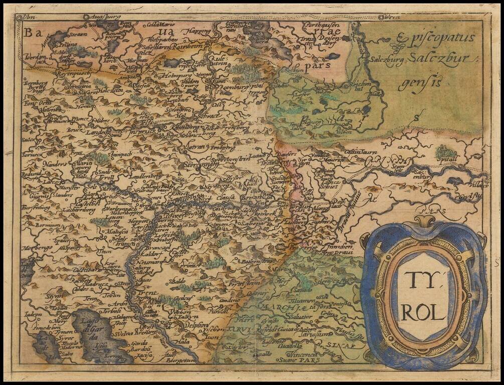
Rare modern map of the Tyrol region, extending from Lago di Garda and Vincenzo in the south to Innsburck, Kitzbuel and Villach in the north, published in Cologne by Johannes Metellus in 1579 in fine original color. The map is one of the earliest...
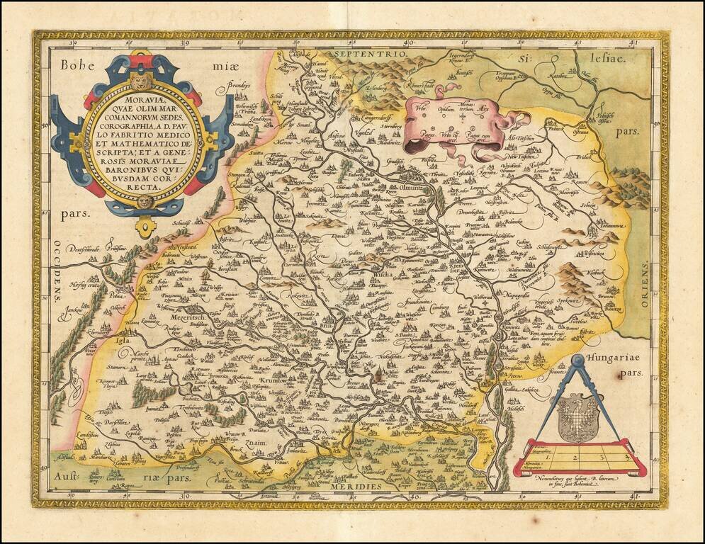
Fine old color example of the Ortelius map of Moravia, showing fortified cities, towns, rivers, etc. Large strapwork cartouche, title banner and smaller cartouche. From Ortelius' Theatrum Orbis Terrarum, the first modern atlas of the World.
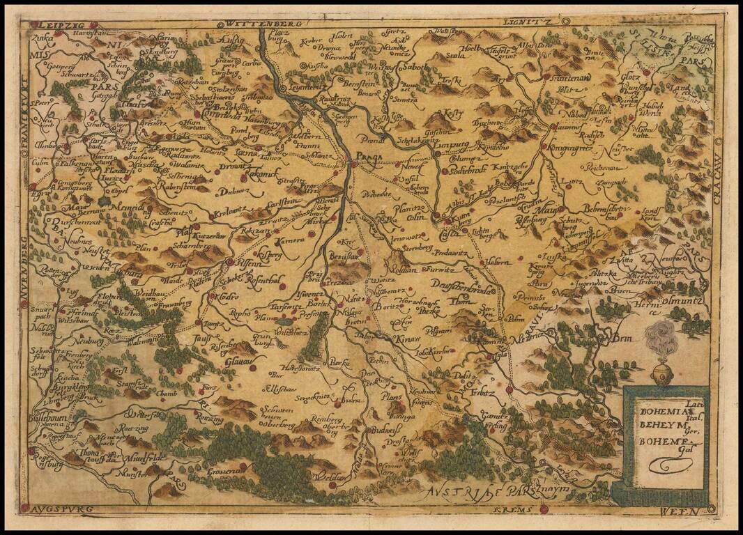
Rare modern map of Bohemia, published in Cologne by Johannes Metellus in 1579 in fine original color. The map is one of the earliest obtainable modern maps published by the so-called Cologne School of mapmakers, which consisted primarily of Flemish and...
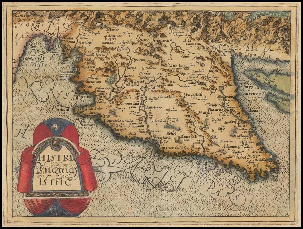
Rare modern map of Istria, published in Cologne by Johannes Metellus in 1579 in fine original color. The map is one of the earliest obtainable modern maps published by the so-called Cologne School of mapmakers, which consisted primarily of Flemish and...
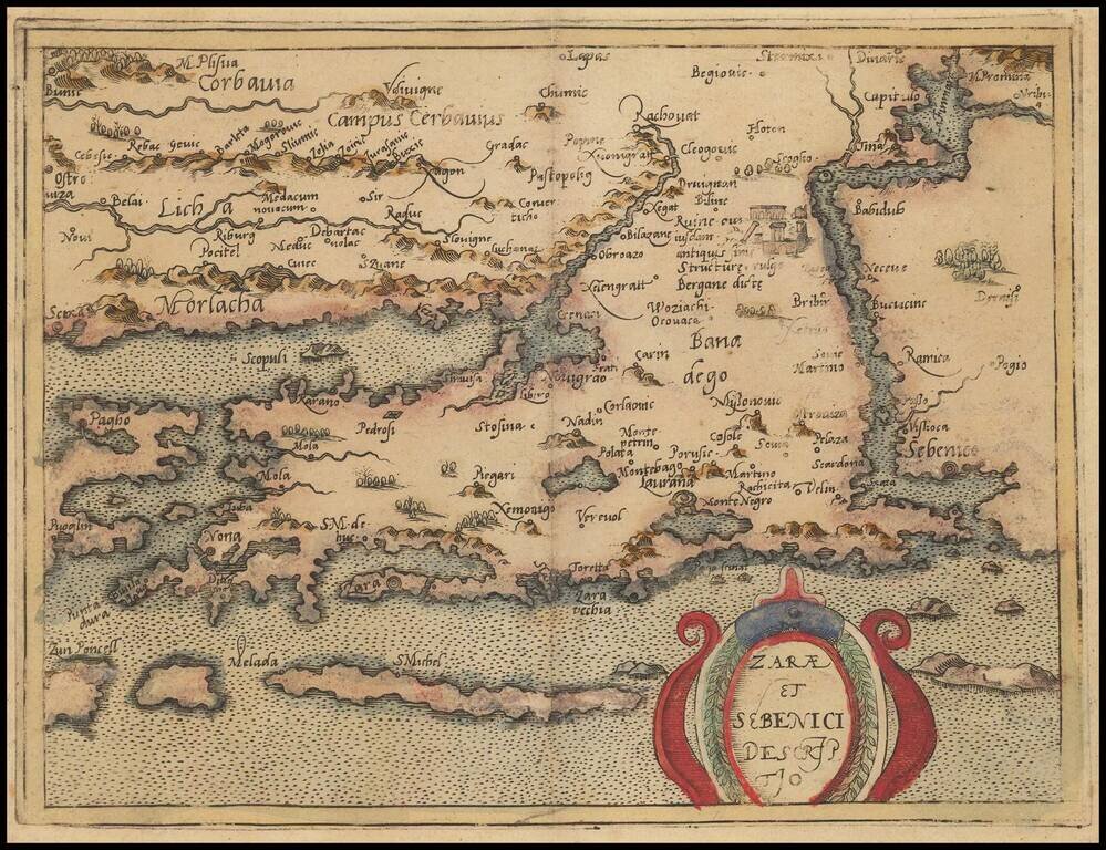
Rare modern map of a portion of the Croatian Coastline, centered on Zadar, published in Cologne by Johannes Metellus in 1579 in fine original color. The map is one of the earliest obtainable modern maps published by the so-called Cologne School of...

Rare modern map of the northern Balkan region of Illyricum, published in Cologne by Johannes Metellus in 1579 in fine original color. The map is one of the earliest obtainable modern maps published by the so-called Cologne School of mapmakers, which...
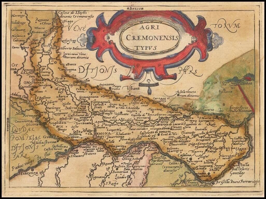
Rare modern map of the Cremona region, published in Cologne by Johannes Metellus in 1579 in fine original color. The map is one of the earliest obtainable modern maps published by the so-called Cologne School of mapmakers, which consisted primarily of...