![[First Map of the American Continent] Tavola dell' isole nuove, le quali son nominate occidentali, & indiane per diversi rispetti.](/map/small/67312.jpg)
First Printed Map of the American Continent Early state of Sebastian Münster’s map of America, the earliest to show all of North and South America in a true continental form with a continuous coastline. It is also the first to use Mare Pacificum as...
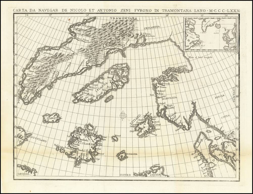
The Zeno Brothers Discoveries in the North Atlantic in the 14th Century Fine dark impression of this fine large format example of Nicolo Zeno's map of the North Atlantic, based upon the legend of a 14th Century Venetian family and their reported...
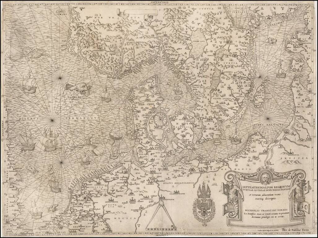
"Beyond all comparison the best map of the Southern Baltic and the North Sea." (A.E. Nordenskold) Extraordinary old color example of this rare Lafreri School Map of Scandinavia, the Baltic and contiguous parts of Poland, Germany, the Low Countries...
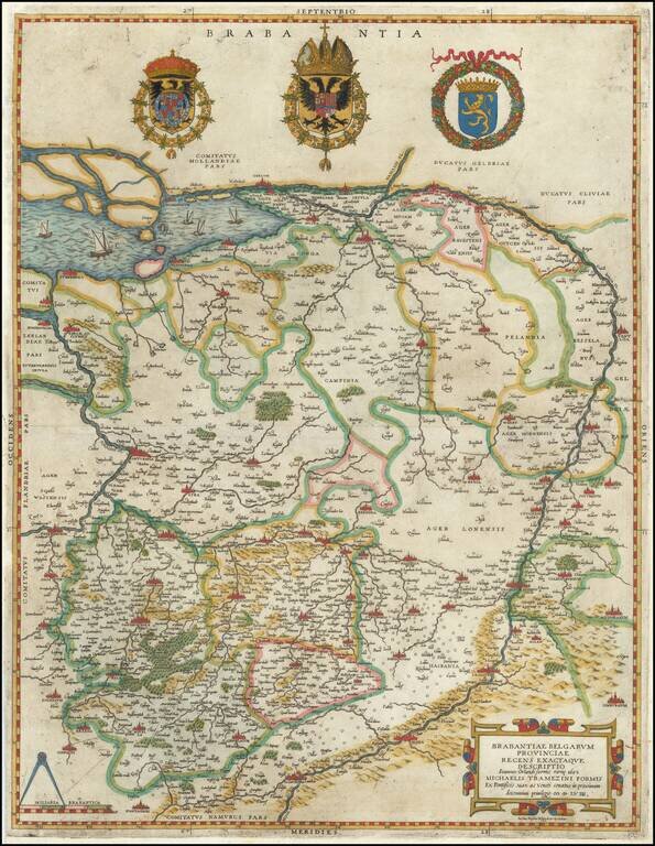
Extremely rare example of the first Lafreri School edition of Jacob van Deventer's groundbreaking survey of Brabant, the earliest surviving example of a map based upon a modern trigonometric survey. The present map represents the synergy of fine art...
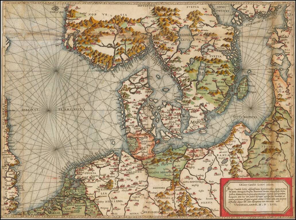
The most important modern map of Scandinavia and the Baltic Regions published in the mid-16th century. Rare and highly important early map of Scandinavia, the Baltic Sea and the North Sea by Michael Tramezini, based upon Cornelis Anthoniszoon's lost...
![[Plan of the Siege of Guînes, France] Ritratto Della Fortezza di Ghines, presa perforza dallo essecito del Re Christianissimo . . .](/map/small/41817sb.jpg)
State 3 of rare plan of the Siege of Guînes, France, by Pietro de Nobili. Rare third state of this finely engraved battle plan depicts the Siege of Guînes (near Calais, France), in January 1558, following which a French army seized the fortress...
![[Calais] Chales](/map/small/61280sb.jpg)
Extremely Rare Plan of The Siege of Calais in 1558 Rare early map / view of Calais, showing its capture by the French in 1558. The map is very similar to the map of Bertelli, but no engraver or publisher is given. Siege of Calais The Siege of...
![[Calais] Chales](/map/small/61301sb.jpg)
Extremely Rare Plan of The Siege of Calais in 1558 Rare early map / view of Calais, showing its capture by the French in 1558, which is believed to be by Antonio Lafreri. First state of Lafreri's map of Calais, but without mounted legend and note at...
![[Calais] Il vero ritratto de Cales preso a Inglesi del Re Cristianissimo l'Anno M.D.L V III](/map/small/61403.jpg)
"When I am dead and cut open, they will find Philip and Calais inscribed on my heart" -- The Siege of Calais in 1558 Rare early map / view of Calais, showing its capture by the French in 1558. Fourth and final state of this are map of the Siege of...
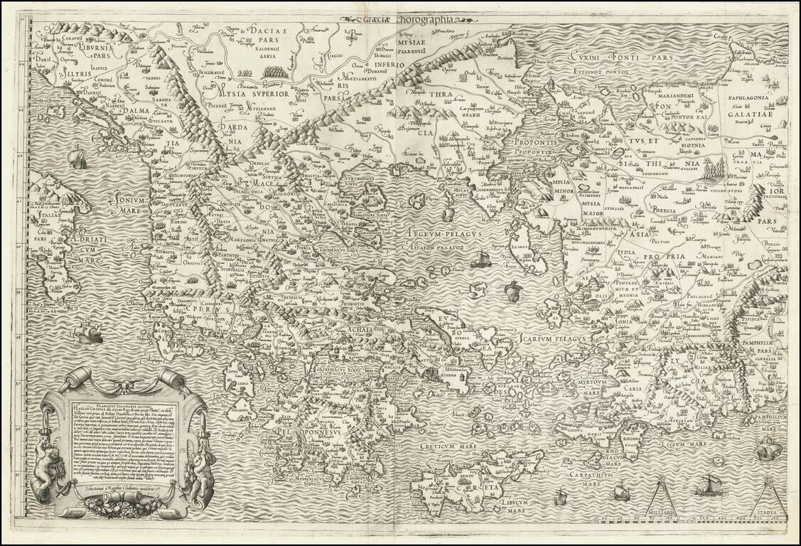
Nice example of Antonio Salamanca's 1558 map of Greece, based upon Nikolaos Sophianos's landmark 8-sheet map of Greece, from classical and modern authorities. Antonio Salamanca's map of Greece is the earliest obtainable map based upon Nikolaos...