Map size in jpg-format: 54.3084MiB
Click to open in high resolution (open in new tab).
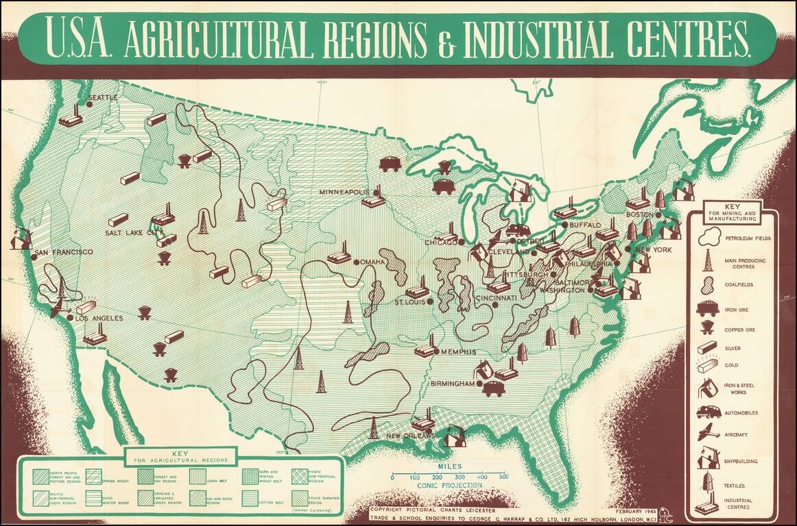
Fascinating pictorial map of US Agriculture and Industry, "Prepared and Published By Pictorial Charts Leicester . . . February 1945."
This informative pictorial map was prepared to illustrate the strength of America's industry and agriculture, as a means of boosting British morale during the final months the War in Europe during World War II.
Rarity
The map is apparently unrecorded.
If you are a student, write to us in telegram: @antiquemaps and indicate what material you need and for what work you need a map in high detail. We are ready to provide material on special terms. For students only!

![[Signed Political Satire Artwork] Vietnam ... Vietnam ... Vietnam ...](/map/small/68726.jpg)
