Map size in jpg-format: 38.601MiB
Click to open in high resolution (open in new tab).

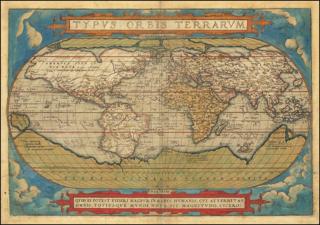
Old color example of the first edition of Ortelius' famous world map.
Ortelius' world map is one of the most important and widely disseminated maps of the second half of the 16th Century, forming the base model for a number of other contemporary maps. The present example is from the earliest state of the map, which can be identified by the signature of the engraver, Fransciscus Hogenbergus (Franz Hogenberg), below the Cicero quote (center right) and the lack of any evidence of cracking in the lower left part of the plate.
The map is drawn from Gerard Mercator's 1569 wall map of the World, Gastaldi's 1561 world map, and Diego Gutierrez' portolan map of the Atlantic. On the verso, Ortelius mentions in his Catalogus Auctorum that he also apparently had access to and drew upon the world maps by Peter ab Aggere from Mechelen, Sebastian Cabotus from Venice, Laurentius Fries from Antwerp, Jacobus Gastaldi, Gemma Frisius from Antwerp, Guicciardinus from Antwerp, Doco ab Hemminga Frisius and Orontius Finæus from Paris.
The coastline of South America includes the extra bulge, which would be removed in state 2 (1585). Both the Northwest and Northeast Passages are shown quite boldly, although based completely upon myth and conjecture. A massive Terra Australis Nondum Cognita is shown with equally bold conjecture in the Southern Hemisphere. South America is shown in its potato configuration, as is the case in the first edition of this map. An elongated northwest coast of America is shown, along with Anian. Civola is shown, along with Quivira. Includes several sea monsters, a sailing ship and other decorative embellishments.
A fine full color example. The present example shows early signs of the crack which required the replacement of the map several years later.
If you are a student, write to us in telegram: @antiquemaps and indicate what material you need and for what work you need a map in high detail. We are ready to provide material on special terms. For students only!


