Map size in jpg-format: 1.90014MiB
Click to open in high resolution (open in new tab).
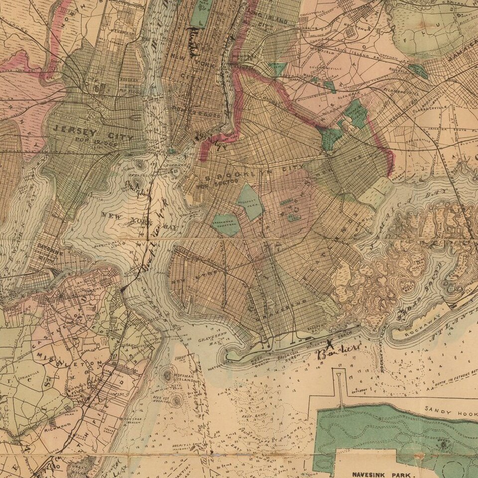
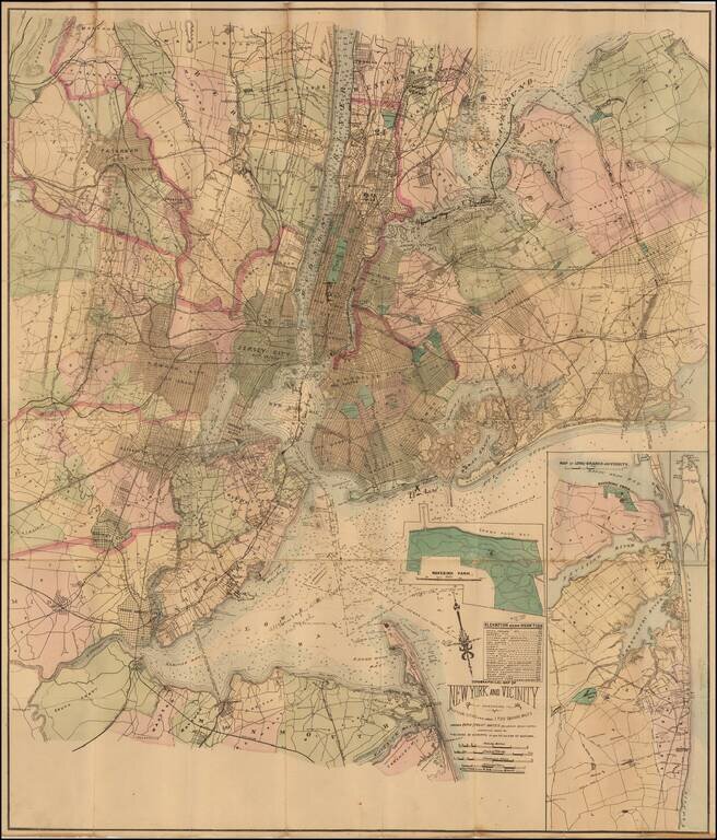
Detailed hand-colored lithographed map of the New York Metropolitan area, published in New York by Matthew Dripps.
The map shows metropolitan New York and its environs, extending as far east on Long Island as Oyster Bay. Shows rapid transit system, canals, and railroads.
An inset in the lower right corner shows Long-Branch and vicinity.
Pen manuscript additions show a route from Long Island Sound through the East River and New York Harbor to Staten Island. Another note mentions "breakers" off Manhattan Beach.
If you are a student, write to us in telegram: @antiquemaps and indicate what material you need and for what work you need a map in high detail. We are ready to provide material on special terms. For students only!

![[Charles Lindbergh] Spirit of St. Louis](/map/small/69234.jpg)
![[Charles Lindbergh / New York to Paris View] Spirit of St. Louis](/map/small/69235.jpg)