logo

1800. The World, according to the Latest Discoveries. By I. Sharman

  • The World, according to the Latest Discoveries.  By I. Sharman

The World, according to the Latest Discoveries. By I. Sharman information:

Year of creation: 
Resolution size (pixels): 
 8964x4593 px
Disk Size: 
 11.5527MiB
Number of pages: 
 1
Place: 
 Dublin
Author: 

Print information. Print size (Width x height in inches):
Printing at 72 dpi 
  124.5 х 63.79
Printing at 150 dpi 
 59.76 х 30.62
Printing at 300 dpi 
 29.88 х 15.31

An example of detailing the file of this map of in a printable high-resolution:

Click to open in high resolution (open in new tab).
Attention! this is just the central piece (central area 960x960 px) of the map file!
This is an example, so that you can see and study the level of detail of a given map. The entire Map will be fully available after payment!

The World, according to the Latest Discoveries.  By I. Sharman

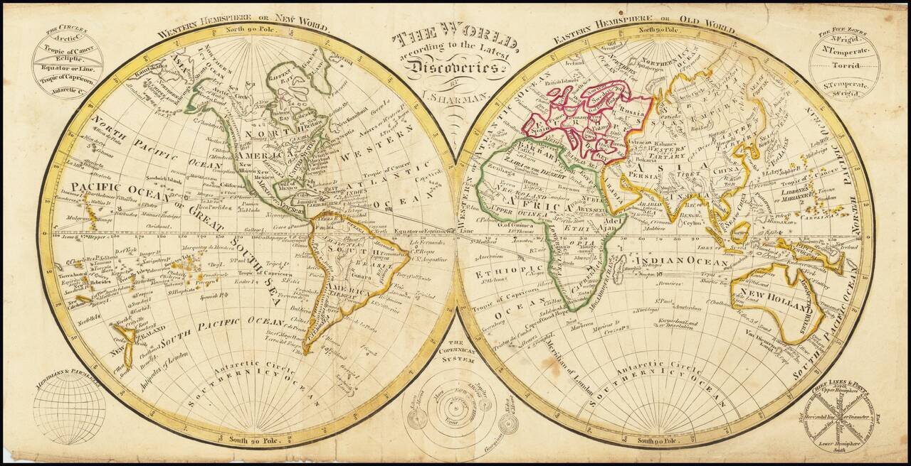
A Rare Dublin School Atlas Map

Rare double hemisphere map of the world, published by Sharman in Dublin.

The map shows the results of James Cook's three voyages. Of note, "Basses Straits" is shown, discovered by George Bass in 1798-99.


Special conditions for students!

If you are a student, write to us in telegram: @antiquemaps and indicate what material you need and for what work you need a map in high detail. We are ready to provide material on special terms. For students only!

Item information:

Year of creation:
Size:
8964x4593 px
Disk:
11.5527MiB
Number of pages:
1
Place:
Dublin
Author:
John Sharman.
$14.99

Related item