Map size in jpg-format: 36.9939MiB
Click to open in high resolution (open in new tab).
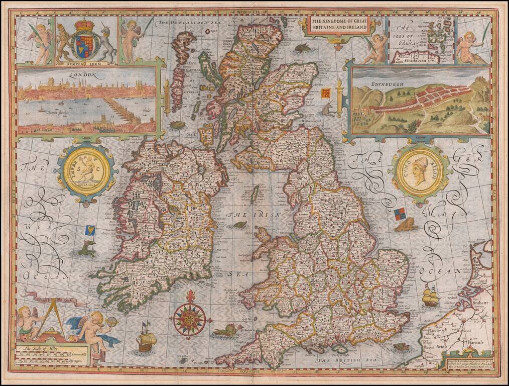
Highly decorative map of the British Isles, first published by John Speed in 1611.
Speed based his map upon Saxton's map of England and Wales, Hondius' map of Ireland and Mercator's map of Scotland.
Speed's map is considered the most decorative map of the British Isles to appear in a commercial atlas in the 17th Century. Engraved by Jodocus Hondius, the map is a true work of art, combining great detail with artistic flourishes, including a compass rose, cherubs, ships, sea monsters, the Royal coats of arms, ancient coins showing Britannia and Cunobelin - the latter known to Shakespeare as Cymbeline. Two views show London c.1600, with St Paul's and the Tower on the north bank and the Globe and the Bear-baiting ring in the south; and Edinburgh, showing the city under siege c.1544.
The sea is engraved in the style made famous by Hondius and is best appreciated in the early states, before the effect is lost, as delicate engraving of this type soon wore smooth. No river bridges are shown except those crossing the Thames.
The map was re-issued many times in Speed's atlases and as a separate publication. English text on verso.
If you are a student, write to us in telegram: @antiquemaps and indicate what material you need and for what work you need a map in high detail. We are ready to provide material on special terms. For students only!


