logo

1740. Sphaera Mundi Per circulos tam primarios quam secundarios cum punctis lineis at angulis notabilioribus, in triplici sexpectu Horizontis situ pro mot stellarum primo aliisque haruni Phaenomenis in genere tradendis exhibita . . .

  • Sphaera Mundi Per circulos tam primarios quam secundarios cum punctis lineis at angulis notabilioribus, in triplici sexpectu Horizontis situ pro mot stellarum primo aliisque haruni Phaenomenis in genere tradendis exhibita . . .

Sphaera Mundi Per circulos tam primarios quam secundarios cum punctis lineis at angulis notabilioribus, in triplici sexpectu Horizontis situ pro mot stellarum primo aliisque haruni Phaenomenis in genere tradendis exhibita . . . information:

Year of creation: 
Resolution size (pixels): 
 14360x12275 px
Disk Size: 
 49.426MiB
Number of pages: 
 1
Place: 
 Nuremberg

Print information. Print size (Width x height in inches):
Printing at 72 dpi 
  199.44 х 170.49
Printing at 150 dpi 
 95.73 х 81.83
Printing at 300 dpi 
 47.87 х 40.92

An example of detailing the file of this map of in a printable high-resolution:

Click to open in high resolution (open in new tab).
Attention! this is just the central piece (central area 960x960 px) of the map file!
This is an example, so that you can see and study the level of detail of a given map. The entire Map will be fully available after payment!

Sphaera Mundi Per circulos tam primarios quam secundarios cum punctis lineis at angulis notabilioribus, in triplici sexpectu Horizontis situ pro mot stellarum primo aliisque haruni Phaenomenis in genere tradendis exhibita . . .

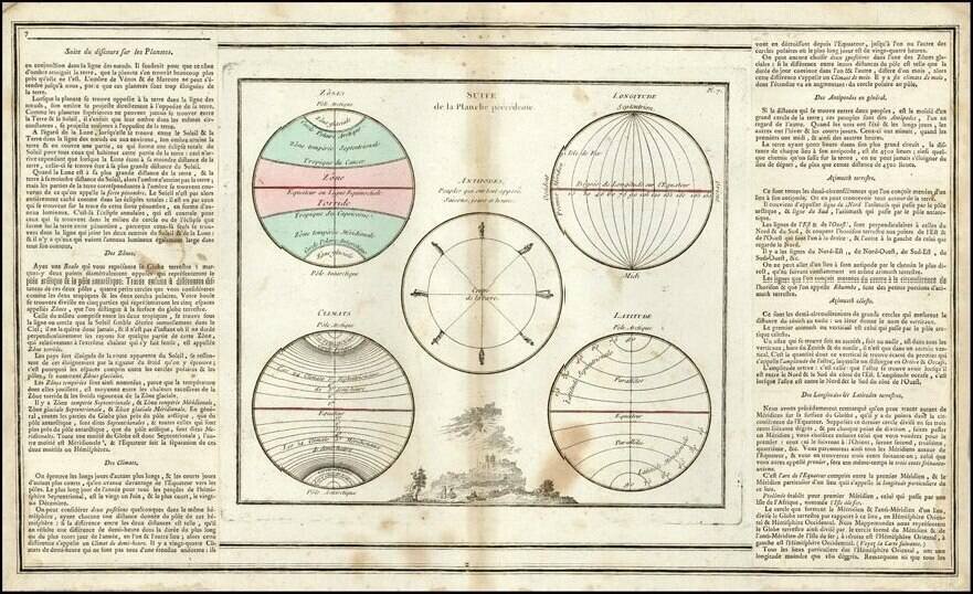
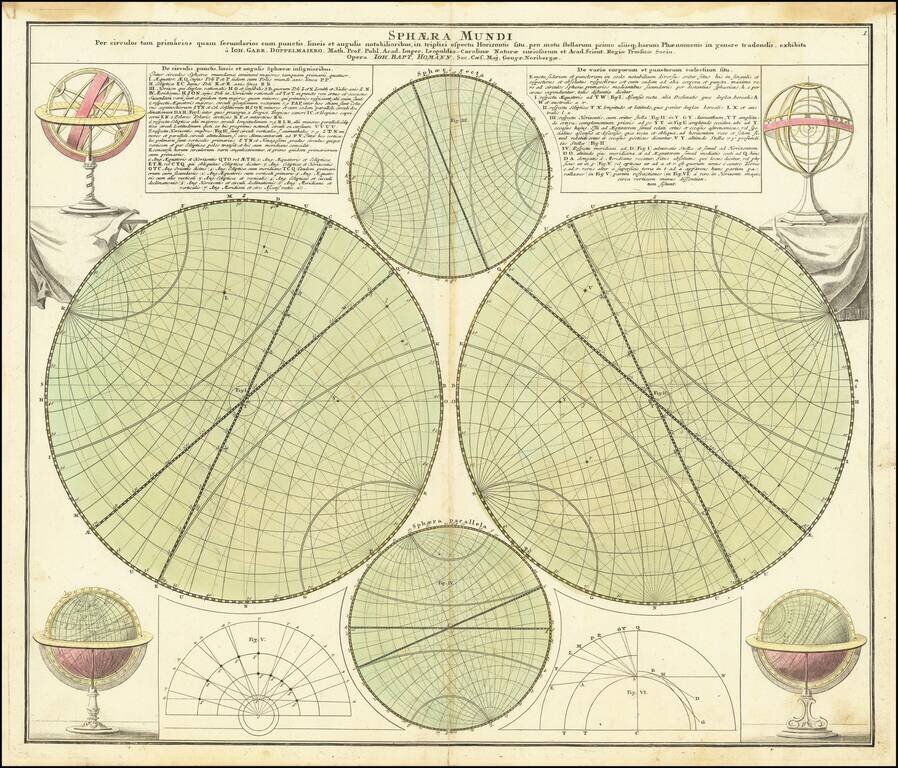
An interesting set of diagrams describing the basic ways in which the globe and the solar system are described. The image illustrates the basic methods of modeling the equator, the two Tropics, the Poles, the horizon and other features of a sphere. Includes decorative armillary spheres and globes in the corners.

The work acts as an instructive image to cartographers and artists as to the ways in which a globe can be properly portrayed. The text on the left-hand side describes the various symbols that may be made use of in imaging a globe. The text on the right side describes the various celestial bodies and points of interest in drawing these maps. All text on this image is in Latin. Overall, this is an intriguing and instructive work from the 18th century.


Special conditions for students!

If you are a student, write to us in telegram: @antiquemaps and indicate what material you need and for what work you need a map in high detail. We are ready to provide material on special terms. For students only!

Item information:

Year of creation:
Size:
14360x12275 px
Disk:
49.426MiB
Number of pages:
1
Place:
Nuremberg
Author:
Johann Gabriele Doppelmayr.
$14.99

Related item