Map size in jpg-format: 63.8805MiB
Click to open in high resolution (open in new tab).
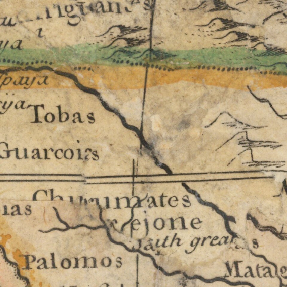
Animals of the Middle Species -- Half Bird, Half Fish!
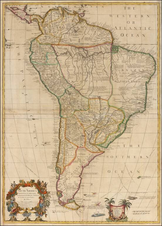
Rare 2-sheet wall map of South America, dedicated by Charles Price to Edmund Halley LLD Savilian Professor of Geometry in Oxford, and Fellow of the Royal Society, Corrected from his own Discoveries . . .
The map was first published by the partnership of Charles Price, John Senex and John Maxwell in 1708. After the partnership dissolved in 1711, Price retained this plate, but by 1713, it was being published by George Willdey & Timothy Brandreth. By the end of the year that partnership was also in tatters, accounting for the scarcity of this map.
The map is a remarkable compendium of geographical detail and contemporary explorations, noting a number of sea voyages in the southern waters of South America, including Sharp's return route in 1681, Sr. la Roche's Course in 1675, Magellan's course in 1520, Americus Vespuccio's course in 1502, and Halley's course in 1700. The region where Halley noted floating ice is identified.
To the left of the dedication cartouche, Price makes an observation concerning the sighting of a strange breed of animal:
The sea in these parts abounds with two sorts of Animalls, of a Middle Species between a Bird & a Fish, having necks like swans and swimming with their whole Bodyes always underwater only putting up their long necks for Air.
Within the map itself, there are a number of other interesting observations and annotations in English.
Charles Price (1679?-1733) was an engraver, instrument maker, and mapseller.
Price had been apprenticed to John Seller, famous mapmaker and father to Charles’ business partner, Jeremiah. In fact, Jeremiah and Charles were made free of the Merchant Taylors Guild on the same day, September 1, 1703. The two were already working together by then.
After breaking off with Seller, Price worked with John Senex (1705-10) and George Wildey (1710-13). He was still working in the 1720s, but was in Fleet Prison in 1731 for debt and died two years later.
He is known to have published in 1732 his Atlas Maritimus or, a new Sea Atlas . . . This work contains maps dated 1728 and 1731. We locate at single example (Bancroft Library - 30 maps) and we acquired an example in 2018 (25 maps). It is quite likely that the work was an unfinished composite, as a number of the maps have blank spaces in the titles, in anticipation of dedicatees that were apparently never obtained. The atlas was known to have been started, but not completed, as noted by Tony Campbell in the British Library Journal, recording the acquisition by the British Library of an untitled collection of charts by Price:
Price, Charles. [A set of English charts of the coasts of the British Isles and Europe, together with Hispaniola, engraved by Charles Price.] London: Charles Price , IV.1730].
Twenty-one charts, 50 cm.
An unrecorded collection without title-page, with a note on one chart announcing the author's intention of publishing 'a Compleat Sea Atlas', to remedy 'the Great want of a good sett of Sea Charts now extant in Great Britain (excepting for our own Coasts)'. The project proceeded no further.
By 1731 Price had to sell off his charts cheaply, and he ended the year in the Fleet Prison. Many of the charts are based on those of Greenville Collins and most are dated 1729 or 1730.
The named collaborators were teachers of mathematics, or, like Price, mathematical instrument makers.
Maps C.8.b.i
If you are a student, write to us in telegram: @antiquemaps and indicate what material you need and for what work you need a map in high detail. We are ready to provide material on special terms. For students only!


![[Signed Political Satire Artwork] Vietnam ... Vietnam ... Vietnam ...](/map/small/68726.jpg)