Map size in jpg-format: 14.8006MiB
Click to open in high resolution (open in new tab).
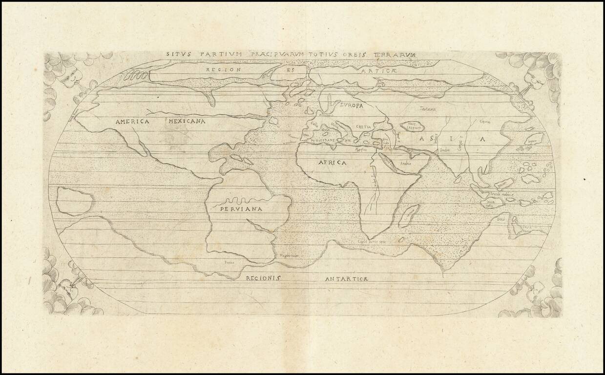
Scarce early world map from Augustino Torniello's Anales Sacri et Profani, published in Frankfurt.
Torniello presents a simplified version of Abraham Ortelius' world map on an oval projection with spandrel windhead decorations.
The map prominently shows both a Northeast and Northwest Passage.
North America bears the name of America Mexicana with an unnamed St. Lawrence River stretching far across the continent and no Great Lakes. South America is named Perviana and is shown in the bulbous, potato shape that Ortelius used for his earliest versions of the continent. An unnamed Amazon reaches far across South America, nearly reaching the opposite coast. Magellan's Strait (Fretum Magelanicum) is shown.
In Asia, the Philippines islands are shown, but not named.
A massive Regionis Antarctica extends across the southern portion of the world, with only the place name of Beach noted on a portion of what would become Australia, in reference to Marco Polo's writings of his explorations.
In Africa, the Nile originates in the southern tip of the continent, but without the Ptolemaic twin lake source.
If you are a student, write to us in telegram: @antiquemaps and indicate what material you need and for what work you need a map in high detail. We are ready to provide material on special terms. For students only!


