logo

1795. Schets van de DonkereBaai in Nieuw Zeeland 1773.

  • Schets van de DonkereBaai in Nieuw Zeeland 1773.

Schets van de DonkereBaai in Nieuw Zeeland 1773. information:

Year of creation: 
Resolution size (pixels): 
 9383x5239 px
Disk Size: 
 7.10054MiB
Number of pages: 
 1
Place: 
 Leiden
Author: 

Print information. Print size (Width x height in inches):
Printing at 72 dpi 
  130.32 х 72.76
Printing at 150 dpi 
 62.55 х 34.93
Printing at 300 dpi 
 31.28 х 17.46

An example of detailing the file of this map of in a printable high-resolution:

Click to open in high resolution (open in new tab).
Attention! this is just the central piece (central area 960x960 px) of the map file!
This is an example, so that you can see and study the level of detail of a given map. The entire Map will be fully available after payment!

Schets van de DonkereBaai in Nieuw Zeeland 1773.

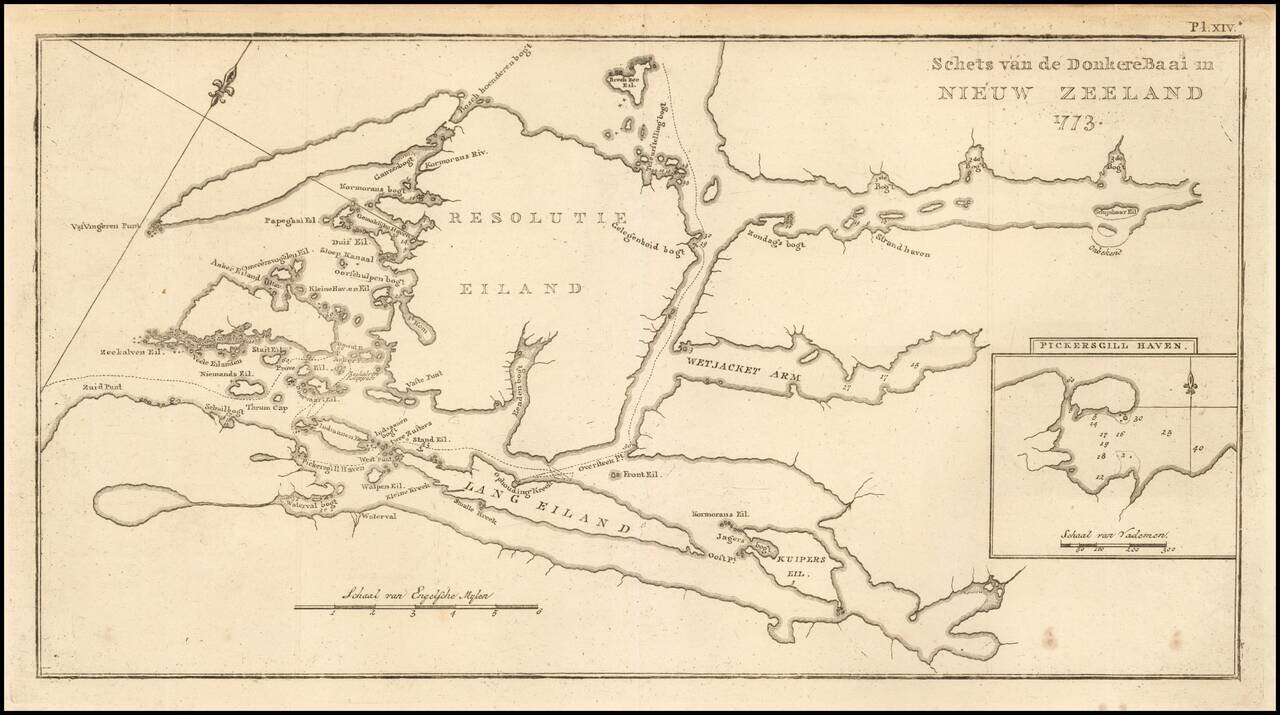
Dutch Edition of Cook's Chart of Donkere Bay, Resolution Island and environs on the southwest coast of the South Island of New Zealand.


Special conditions for students!

If you are a student, write to us in telegram: @antiquemaps and indicate what material you need and for what work you need a map in high detail. We are ready to provide material on special terms. For students only!

Item information:

Year of creation:
Size:
9383x5239 px
Disk:
7.10054MiB
Number of pages:
1
Place:
Leiden
Author:
James Cook.
$14.99

Related item