Map size in jpg-format: 8.79813MiB
Click to open in high resolution (open in new tab).
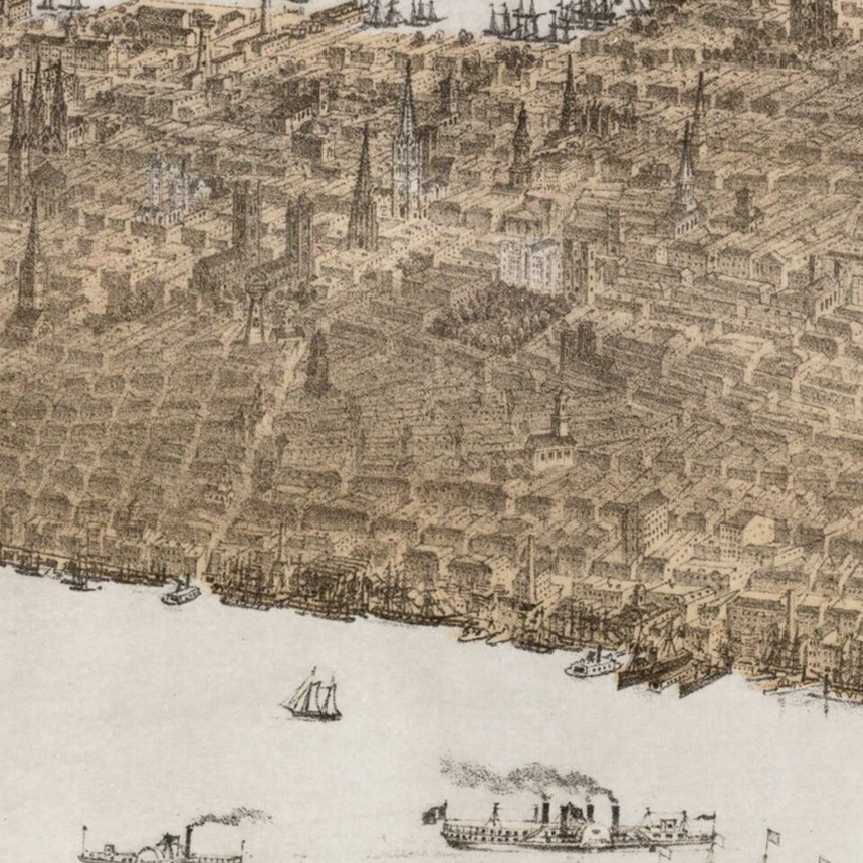
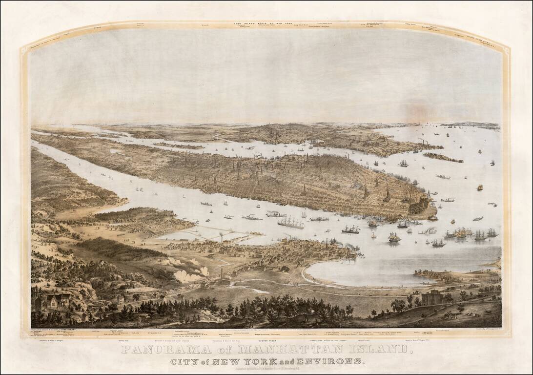
Fine large format panoramic view of New York City, published in New York.
Drawn from nature & on stone by John Bornet. Printed by Nagel & Weingartner, N.Y. Forty-seven locations noted above the title, and twenty-four locations in the top margin are identified.
Bornet's fine view features Manhattan and a sweeping view from the West, with New Jersey in the foreground, Manhattan in the Center and Brooklyn, Westchester County, Long Island and Staten Island in the distance.
If you are a student, write to us in telegram: @antiquemaps and indicate what material you need and for what work you need a map in high detail. We are ready to provide material on special terms. For students only!

![[Charles Lindbergh] Spirit of St. Louis](/map/small/69234.jpg)
![[Charles Lindbergh / New York to Paris View] Spirit of St. Louis](/map/small/69235.jpg)