logo

1900. North America Transportation and Trading Company's Map of Alaska and Yukon Territory, and Sectional Maps of the Klondike, Koyukuk, Golfin Bay and Cape Nome, Manook Creek, Birch Creek, and American and Mission Creeks Mining Districts of Alaska / Nome an

  • North America Transportation and Trading Company's Map of Alaska and Yukon Territory, and Sectional Maps of the Klondike, Koyukuk, Golfin Bay and Cape Nome, Manook Creek, Birch Creek, and American and Mission Creeks Mining Districts of Alaska  /   Nome an
  • North America Transportation and Trading Company's Map of Alaska and Yukon Territory, and Sectional Maps of the Klondike, Koyukuk, Golfin Bay and Cape Nome, Manook Creek, Birch Creek, and American and Mission Creeks Mining Districts of Alaska  /   Nome an

North America Transportation and Trading Company's Map of Alaska and Yukon Territory, and Sectional Maps of the Klondike, Koyukuk, Golfin Bay and Cape Nome, Manook Creek, Birch Creek, and American and Mission Creeks Mining Districts of Alaska / Nome an information:

Year of creation: 
Resolution size (pixels): 
 16067x11844 px
Disk Size: 
 58.6547MiB
Number of pages: 
 2
Place: 
 Chicago

Print information. Print size (Width x height in inches):
Printing at 72 dpi 
  223.15 х 164.5
Printing at 150 dpi 
 107.11 х 78.96
Printing at 300 dpi 
 53.56 х 39.48

An example of detailing the file of this map of in a printable high-resolution:

Click to open in high resolution (open in new tab).
Attention! this is just the central piece (central area 960x960 px) of the map file!
This is an example, so that you can see and study the level of detail of a given map. The entire Map will be fully available after payment!

North America Transportation and Trading Company's Map of Alaska and Yukon Territory, and Sectional Maps of the Klondike, Koyukuk, Golfin Bay and Cape Nome, Manook Creek, Birch Creek, and American and Mission Creeks Mining Districts of Alaska  /   Nome an

Promoting Nome and Other Alaskan Mining Regions

Rare promotional map and brochure, printed for the North American Transportation and Trading Company to Nome and St. Michael.

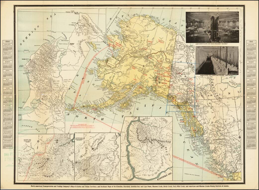
The map provides a large depiction of Alaska and the Klondike Region, with gold regions noted in red, along with the route of the North American Transportation and Trading Company.

In addition to the main map, two photographs show interior images of the Dining Saloons on the Ocean Steamship "Roanoke" and the Yukon River Steamer "John Cudahy," along with inset maps focusing on the mining regions of:

  • Forty Mile Creek
  • Birch Creek District
  • Klondike Section
  • Nome and Coastal Gold Regions

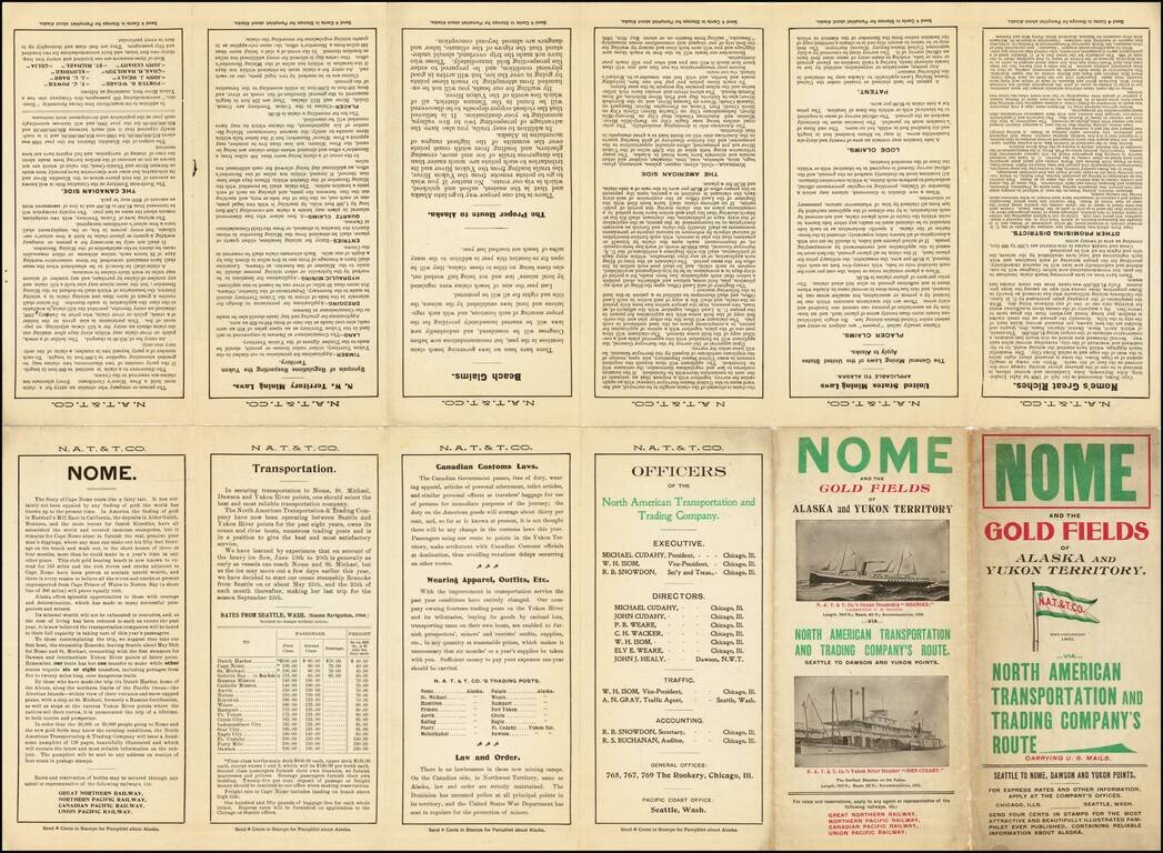
The verso includes promotional information encouraging the trip to Alaska.

Rarity

The map is very rare. OCLC notes copies at the University of Washington, Yale and Dartmouth.

We find no prior auction or dealer catalog records.


Special conditions for students!

If you are a student, write to us in telegram: @antiquemaps and indicate what material you need and for what work you need a map in high detail. We are ready to provide material on special terms. For students only!

Item information:

Year of creation:
Size:
16067x11844 px
Disk:
58.6547MiB
Number of pages:
2
Place:
Chicago
Author:
Charles O. Richardson.
$14.99

Related item