Map size in jpg-format: 995936B
Click to open in high resolution (open in new tab).
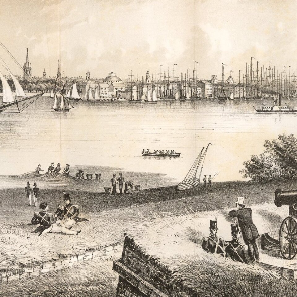
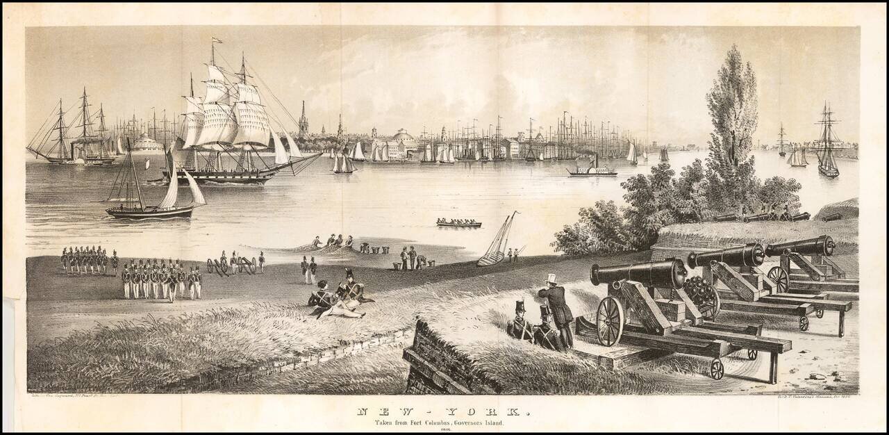
Striking view of New York City from Governors Island, as it appeared in 1816.
The view shows a harbor teaming with ships and commerce, with the fortifications at Fort Columbus illustrated, as it appeared at the close of the War of 1812, with soliders and fisherman in the foreground.
An early steam paddle wheel ship can be seen at the left, one of the earliest examples of such a vessel, which had only been introduced on the Mississippi River in 1812.
If you are a student, write to us in telegram: @antiquemaps and indicate what material you need and for what work you need a map in high detail. We are ready to provide material on special terms. For students only!

![[Charles Lindbergh] Spirit of St. Louis](/map/small/69234.jpg)
![[Charles Lindbergh / New York to Paris View] Spirit of St. Louis](/map/small/69235.jpg)