Map size in jpg-format: 9.2191MiB
Click to open in high resolution (open in new tab).
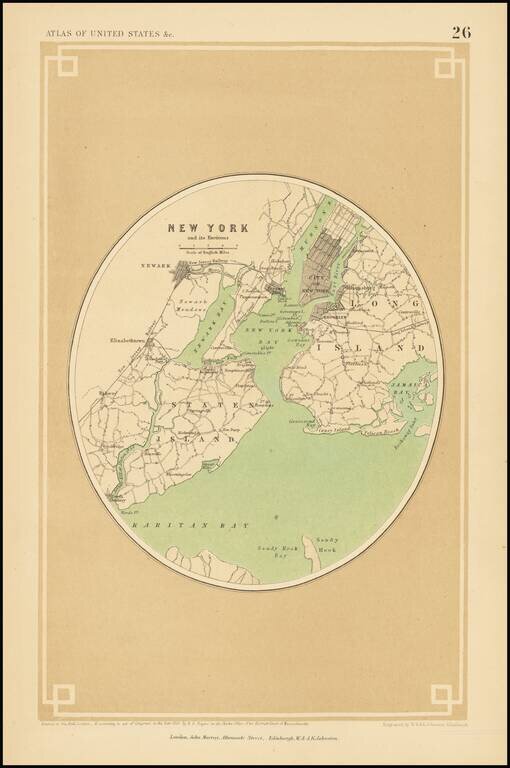
A rare map of New York and its surroundings, from Rogers & Johnston's Atlas of the United States. This map is on a much larger scale than most other maps in this atlas, with the field of view occupying approximately 25 miles. The map shows the layout of the area including streets, neighborhoods, cities, railroads, and other major features. The areas most densely populated are shaded; in Manhattan, this extends to Midtown. Parts of Long Island, Staten Island, and New Jersey are all shown. The New Jersey Railway acts as a western boundary for detail on the map. Newark, Coney Island, Jamaica Bay, Hoboken, and many more neighborhoods and cities are all named.
If you are a student, write to us in telegram: @antiquemaps and indicate what material you need and for what work you need a map in high detail. We are ready to provide material on special terms. For students only!

![[Charles Lindbergh] Spirit of St. Louis](/map/small/69234.jpg)
![[Charles Lindbergh / New York to Paris View] Spirit of St. Louis](/map/small/69235.jpg)