Map size in jpg-format: 10.09MiB
Click to open in high resolution (open in new tab).
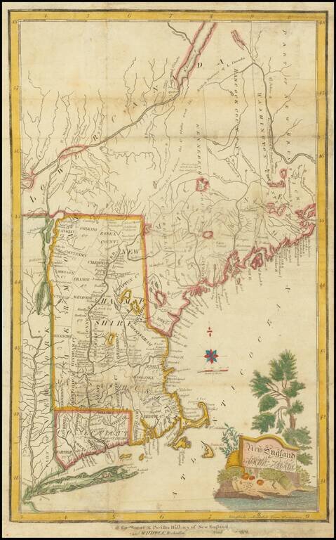
Scarce antique engraved map of New England, published by Thomas and Whipple, for Morse and Parish's History of New England.
That map extends from New York City to Maine. The name "ATHUR ADAMS" in the cartouche is a spelling error that persists in all states of the map.
This is the 3rd state (of 3) with the additional imprint of Thomas and Whipple, dated 1809, added outside the lower border.
If you are a student, write to us in telegram: @antiquemaps and indicate what material you need and for what work you need a map in high detail. We are ready to provide material on special terms. For students only!
![[The First Maps in a la poupée Printed Color] Cartes en Couleur des Lieux Sujets aux tremblements de Terre Dans toutes les parties du Monde Selon le Sisteme de l’impulsion Solaire](/map/small/52293op.jpg)

