Map size in jpg-format: 49.7106MiB
Click to open in high resolution (open in new tab).
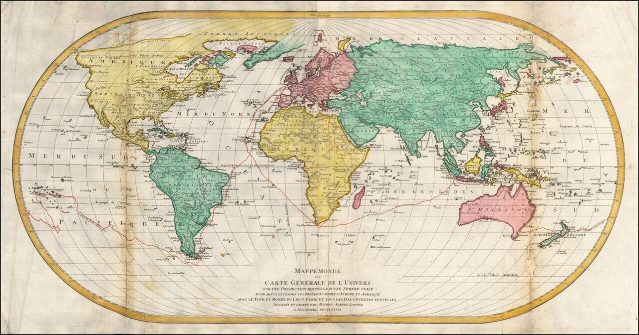
Tracking Captain James Cook's First Voyage -- 1768-1771
Rare first edition of this unusual large world map on an ovoid projection, published in Augsburg in 1778.
The attractive and somewhat unusual ovoid projection is based on J.B.B. D'Anville's wall map of 1761.
The map was published by Matthäus Albrecht Lotter (1741-1810), the heir to one of Europe's most prolific and long lasting cartographic dynasties. He was the son of important Augsburg mapmaker Tobias Conrad Lotter (1717-77) who was, in turn the son-in-law and heir of Matthäus Seutter (1678-1757), who had trained under the eminent cartographer Johann Baptist Homann (1664-1724).
The map was engraved by eminent Matthäus Albrecht's brother, Georg Frederick Lotter.
If you are a student, write to us in telegram: @antiquemaps and indicate what material you need and for what work you need a map in high detail. We are ready to provide material on special terms. For students only!


