Map size in jpg-format: 60.7322MiB
Click to open in high resolution (open in new tab).
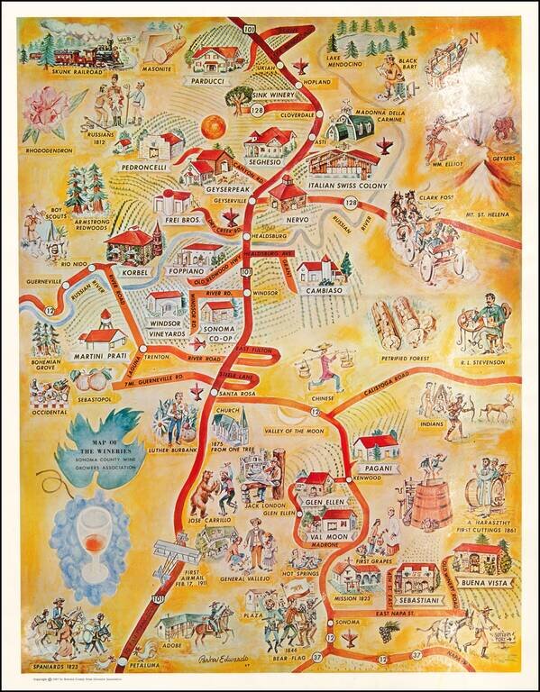
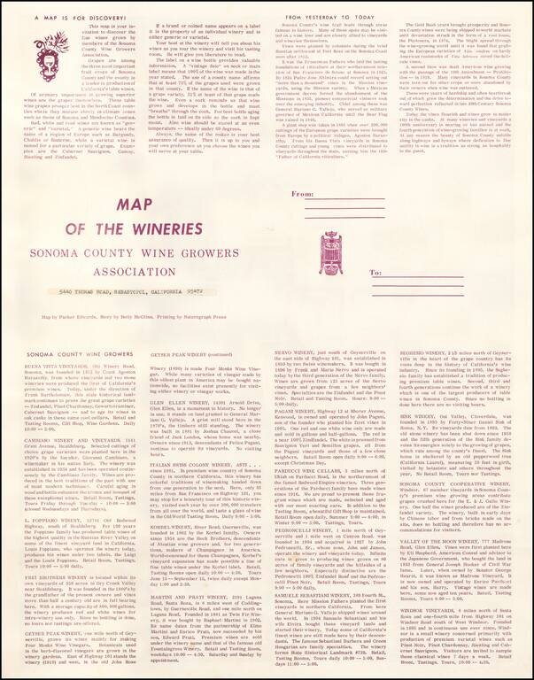
Fine pictorial map, focusing on the history of Sonoma Count and the location of its major wind producers in the 1960s.
The artist, Parker Edwards, is probably best known in Pictorial map circles as the artist who created the iconic Dole Pineapple map in 1937.
The map is apparently quite rare. We were not able to locate other examples.
As noted by David Rumsey:
Parker Edwards was a Hawaii based painter and illustrator. Edwards worked primarily in the medium of watercolors and was known for his "tiki" inspired imagery. Edwards was the third husband of the well-known writer, Peggy Bracken. In cartographic circles he is known for this iconic pictorial map of the Hawaiian Islands issued for the Dole Pineapple Company.
If you are a student, write to us in telegram: @antiquemaps and indicate what material you need and for what work you need a map in high detail. We are ready to provide material on special terms. For students only!


