logo

1853. Map of the City of New-York 1854

  • Map of the City of New-York 1854

Map of the City of New-York 1854 information:

Year of creation: 
Resolution size (pixels): 
 2387x1814 px
Disk Size: 
 1.18199MiB
Number of pages: 
 1
Place: 
 New York
Author: 

Print information. Print size (Width x height in inches):
Printing at 72 dpi 
  33.15 х 25.19
Printing at 150 dpi 
 15.91 х 12.09
Printing at 300 dpi 
 7.96 х 6.05

An example of detailing the file of this map of in a printable high-resolution:

Click to open in high resolution (open in new tab).
Attention! this is just the central piece (central area 960x960 px) of the map file!
This is an example, so that you can see and study the level of detail of a given map. The entire Map will be fully available after payment!

Map of the City of New-York 1854

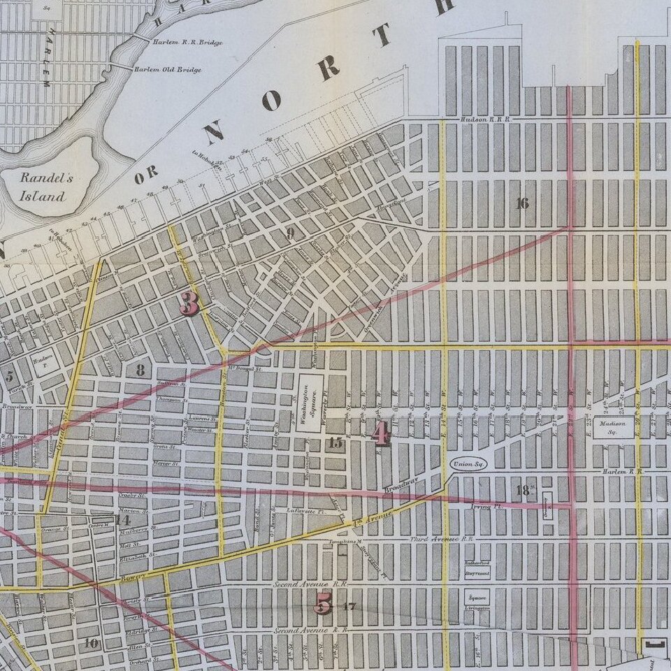
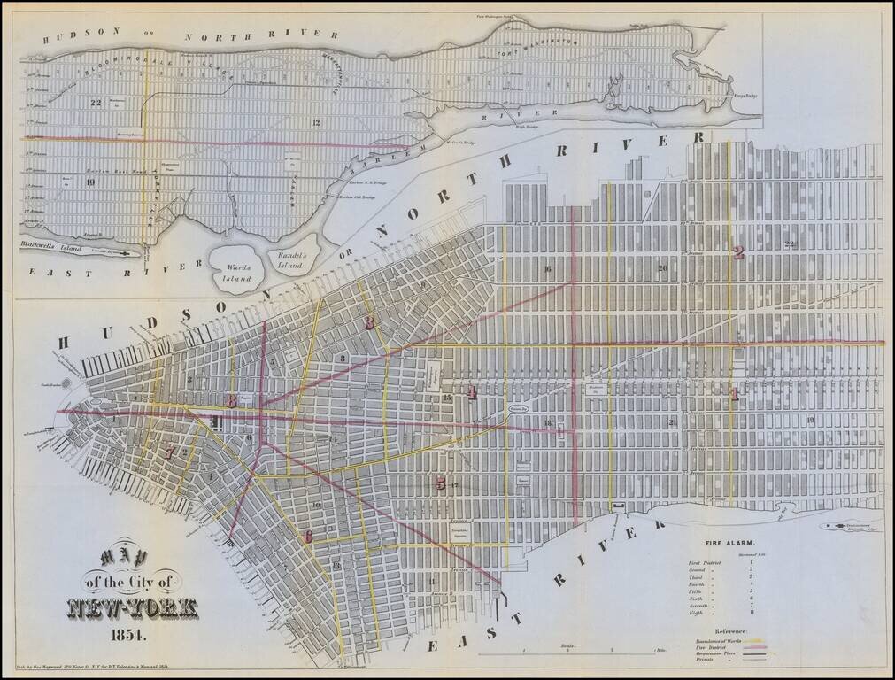
Detailed map of the City, colored by Wards and Fire Districts.

Shows public and private piers, streets, parks, and other details, with a larger plan of the Island of Manhattan at the top.


Special conditions for students!

If you are a student, write to us in telegram: @antiquemaps and indicate what material you need and for what work you need a map in high detail. We are ready to provide material on special terms. For students only!

Item information:

Year of creation:
Size:
2387x1814 px
Disk:
1.18199MiB
Number of pages:
1
Place:
New York
Author:
Valentine's Manual.
$9.99

Related item