logo

1574. Mansfeldiae Comitatus Descriptio auctore Tilemanno Stella Sig.

  • Mansfeldiae Comitatus Descriptio auctore Tilemanno Stella Sig.

Mansfeldiae Comitatus Descriptio auctore Tilemanno Stella Sig. information:

Year of creation: 
Resolution size (pixels): 
 11094x9528 px
Disk Size: 
 32.975MiB
Number of pages: 
 1
Place: 
 Antwerp
Author: 

Print information. Print size (Width x height in inches):
Printing at 72 dpi 
  154.08 х 132.33
Printing at 150 dpi 
 73.96 х 63.52
Printing at 300 dpi 
 36.98 х 31.76

An example of detailing the file of this map of in a printable high-resolution:

Click to open in high resolution (open in new tab).
Attention! this is just the central piece (central area 960x960 px) of the map file!
This is an example, so that you can see and study the level of detail of a given map. The entire Map will be fully available after payment!

Mansfeldiae Comitatus Descriptio auctore Tilemanno Stella Sig.

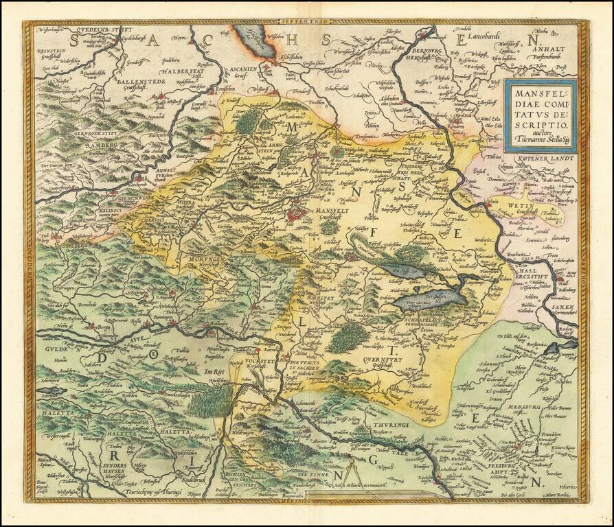
Nice old color example of Ortelius' regional map of Germany, centered on Mansfield and showing the Salsa River from Bernburgh to Rockendorf, and the Helm River, from Berga to Dorndorff.

From Ortelius' Theatrum Orbis Terrarum, the first modern atlas of the World.

Van Den Broecke 94.

Special conditions for students!

If you are a student, write to us in telegram: @antiquemaps and indicate what material you need and for what work you need a map in high detail. We are ready to provide material on special terms. For students only!

Item information:

Year of creation:
Size:
11094x9528 px
Disk:
32.975MiB
Number of pages:
1
Place:
Antwerp
Author:
Abraham Ortelius.
$14.99

Related item