Map size in jpg-format: 40.1813MiB
Click to open in high resolution (open in new tab).
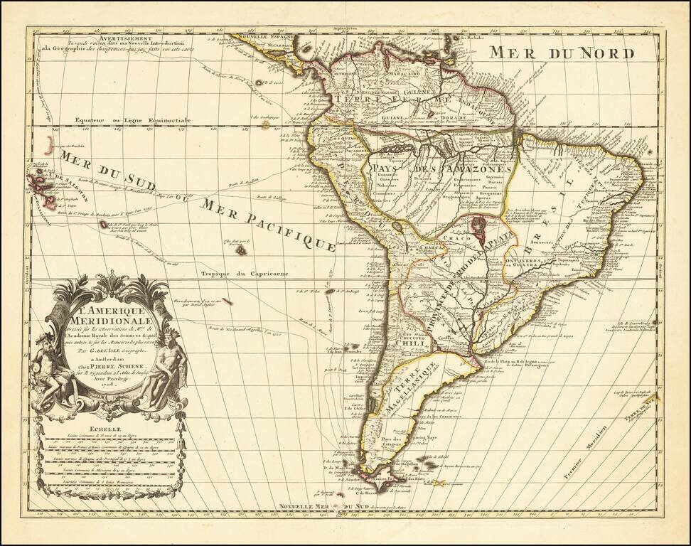
Decorative detailed map of South America, published in Amsterdam by Peter Schenk.
The map is based upon the work of Guillaume De L'Isle, a French mapmaker to the King of France who was the most important and influential mapmaker of the early 18th Century. The credit includes a note referencing De L'Isle's sources as including information transmitted to the French Royal Academy of Sciences.
The map Includes substantial details along the Amazon and the River Plate, many of which are conjecture. While the coastal regions are quite well known, large tracts of the interior in Terre Magellanique, Bresil, Pays Des Amazons and Provinces De Rio De La Plata remain blank.
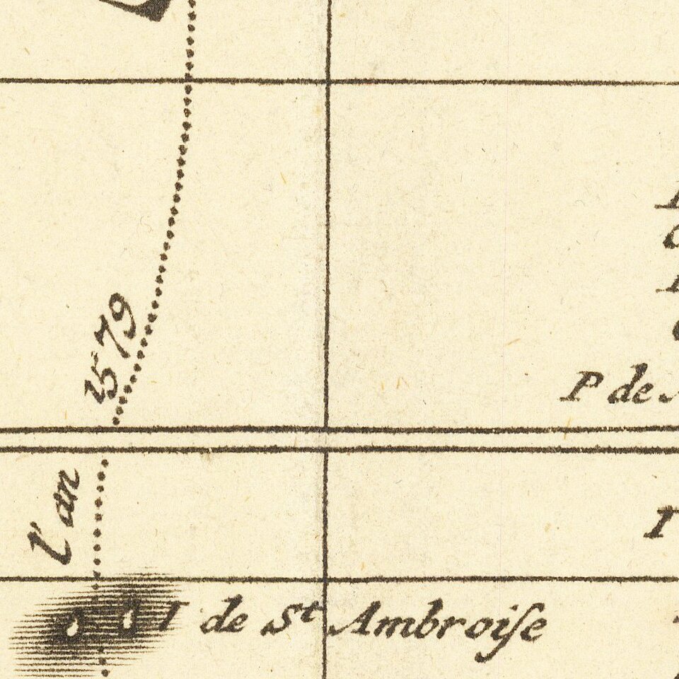
The map includes tracks of 16th & 17th Century explorers including Drake, Schouten, Magellan,Mendana, Olivier, Stirnaento and others to The Salomon Islands and beyond.
Gorgeous decorative cartouche.
Peter Schenk the Elder (1660-1711) moved to Amsterdam in 1675 and began to learn the art of mezzotint. In 1694 he bought some of the copperplate stock of the mapmaker Johannes Janssonius, which allowed him to specialize in the engraving and printing of maps and prints. He split his time between his Amsterdam shop and Leipzig and also sold a considerable volume of materials to London.
Peter Schenk the Elder had three sons. Peter the Younger carried on his father’s business in Leipzig while the other two, Leonard and Jan, worked in Amsterdam. Leonard engraved several maps and also carried on his father’s relationship with engraving plates for the Amsterdam edition of the Histoire de l'Académie Royale des Sciences.
If you are a student, write to us in telegram: @antiquemaps and indicate what material you need and for what work you need a map in high detail. We are ready to provide material on special terms. For students only!


![[Signed Political Satire Artwork] Vietnam ... Vietnam ... Vietnam ...](/map/small/68726.jpg)