Map size in jpg-format: 103.446MiB
Click to open in high resolution (open in new tab).

Including the Frisius-Apian World Map.
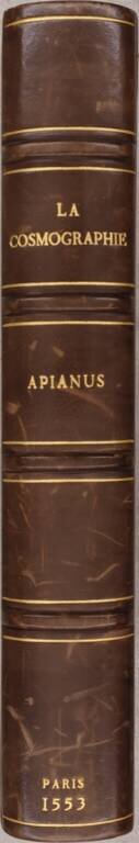
A very good example of the French-language 1553 Paris edition of Peter Apian's Cosmographia, which was first published in 1524.
Apian's 1524 Cosmographia was his greatest work, not least of which for the inclusion of his map of the world. It was a wide-ranging treatise on astronomy, geography, cartography, navigation, and instrument-making. This knowledge was eagerly sought-after and resulted in many subsequent editions after 1544. The present work relates much of the work available in Apian's first edition of 1524, including its fantastic woodblock illustrations of armillary spheres, astronomical phenomena, world maps, etc.
The primary double-page world map included in this work is Shirley 82 (block 1):
PETER APIAN'S Cosmographia, first published in 1524, was republished many times throughout the sixteenth century. From 1544 onwards most of the editions contain a truncated cordiform world map which is reportedly based on the larger map of the world prepared by Gemma Frisius and published from Louvain in 1540, but which has now been lost.
How faithful this smaller woodcut version is to the lost original it is not possible to determine. The continents are broadly presented as in the globe gores for Mercator's globe of 1541 but North America (labelled Baccalearium in reference to the cod fishing nearby) has shrunk to a slender peninsula lying almost east-west. There are relatively few geographic features; instead there are a number of small drawings of animals and ships, and even a mermaid. Frisius' 1540 map is said to have been dedicated to the Emperor Charles V; in this 1544 copy one of the deistic personages at the head of the map has as a design on his breastplate the Holy Roman Emperor's double eagle. The heart-shaped border of the map contains signs of the zodiac, and the outer surround is filled with clouds and winds, including three cadaverous windheads representing the traditional plague-carrying winds of the south.
The map is one of the earliest obtainable world maps not based on the works of Ptolemy. North America is depicted as a narrow stretch of land extending almost eastwards. Cuba and Hispaniola are shown as huge islands and the Mountains of the Moon are considered the source of the River Nile. The map includes a Northwest passage, above which is a fascinating Asian projection. North America is called Baccalearum for its Cod fisheries. The narrow Straits of Magellan represent the only passage between South America and an understated Southern Continent. A 'truncated' cordiform projection is used which prevents the south polar regions from being represented.
If you are a student, write to us in telegram: @antiquemaps and indicate what material you need and for what work you need a map in high detail. We are ready to provide material on special terms. For students only!


