Map size in jpg-format: 730614B
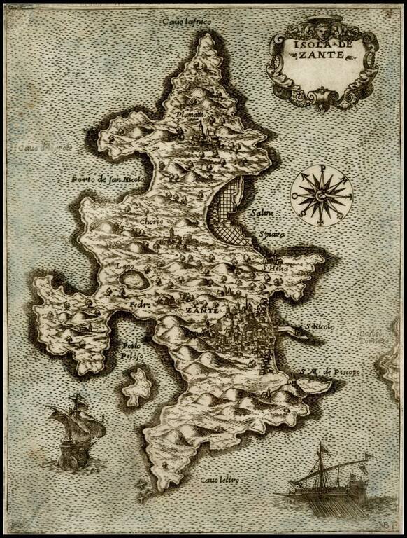
Fine early map of the Island of Zante, engraved by Natale Bonifacio (NB F in lower right corner).
As noted by Peter Meuer in The Stabo Illustratus Atlas:
The . . . best known cartographic works of the engraver Natale Bonifacio is a series of maps showing Greek Islands in the Ionian and Aegean Seas. They are all undated and their chronological sequence is difficult to ascertain. [The maps] . . . were first issued for a loose sheet circulation, and then assembled in booklet form for interested customer. Some of the maps, separately issued, appear in copies of the first edition of Ferrando Bertelli's "Civitatum aliquot insignorum et locorum magis monitorum exacta delineation cum additione aliquot Insularum principalium. Disegni di alcune più illustri città et fortezze del mondo con aggionta di alcune Isole principali", of 1568. Others are known only from the second edition of the Bertelli book, published by Donato in 1574 and from the undated "Isole Famose…" by Giovanni Francesco Camocio.Due to the size of the maps, they were rarely added to composite (Lafreri) atlases. The present map of Zakynthos seems to be based on an original drawing. The depiction of the essential elements is fairly correct, although the bays appear overestimated in size.
If you are a student, write to us in telegram: @antiquemaps and indicate what material you need and for what work you need a map in high detail. We are ready to provide material on special terms. For students only!

![Patriarchatus Antiocheni Geographica Descriptio . . . [shows Cyprus]](/map/small/54177.jpg)
