Map size in jpg-format: 17.7061MiB
Click to open in high resolution (open in new tab).
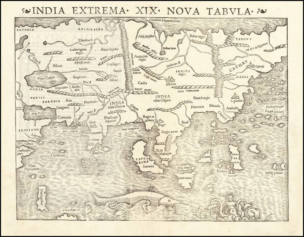
Rare Early State of the First Modern Map of the Asian Continent.
Nice example of the first printed map of Asia, published by Sebastian Munster, from the 1542 edition of Munster's Geographia.
The map shows Asia from the Caspian Sea and Persian Gulf to the Pacific. The Pacific Ocean shows an archipelago of 7448 islands, a forerunner to the better understanding of Southeast Asia, which is largely unrecognizable, although Java Minor and Major, Porne (Borneo), Molucca and several other islands are named. The map does not include Japan, which appears on the map of America. The northeastern coast of Asia is also omitted. The map also includes a large sea monster and mermaid type creature.
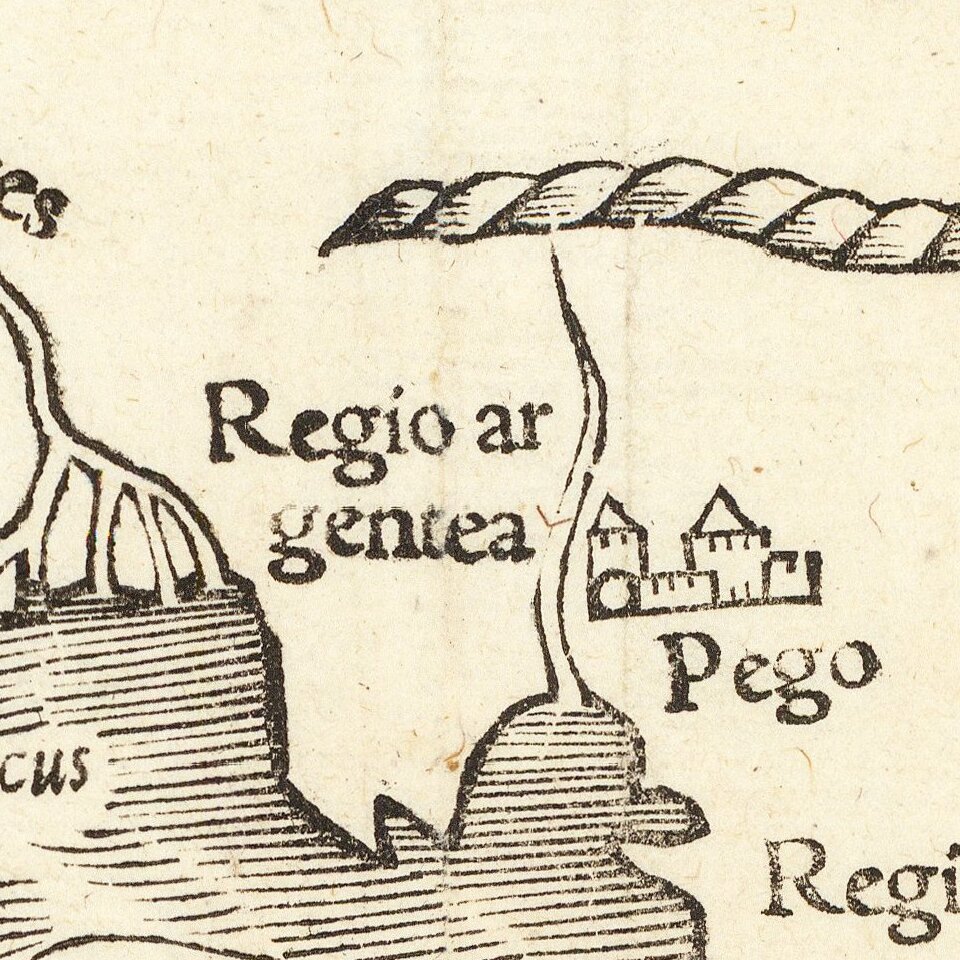
Although largely based on Ptolemy's work, the map incorporates some of the more recent Portuguese discoveries. The outlines of the Indian subcontinent, between the Indus and the Ganges rivers are now in a more recognizable form, with "Zaylon" (Sri Lanka) correctly shown as an island. The Portuguese outpost of Goa and Calicut, the first place where Vasco da Gama landed in 1497, are depicted. Further to the east "Taprobana" is also designated as "Sumatra.". The Portuguese trading port of "Malaqua" is shown. Java is depicted as two separate islands. "Moloca," center of the spice island trade and the object of considerable conflict between Spain and Portugal, is shown. The resolution of the dispute was the official purpose of Magellan's epic circumnavigation. The treatment of "Cathay" (China) is consistent with the writings of Marco Polo and other Venetian travellers.
The first edition can be distinguished by the single decorative printer's device, to the left of the title. The second edition includes the same printer's device on both sides of the title.
Munster's Geographia was a cartographic landmark, including not only Ptolemaic maps, but also a number of landmark modern maps, including the first separate maps of the 4 continents, the first map of England and the earliest obtainable map of Scandinavia. Munster dominated cartographic publication during the mid-16th Century. Munster is generally regarded as one of the most important map makers of the 16th Century.
Sebastian Munster was a linguist and mathematician, who initially taught Hebrew in Heidelberg. He issued his first mapping of Germany in 1529, after which he issued a call for geographical information about Germany, to scholars throughout the country. The response was better than hoped for, and included substantial foreign material, which supplied him with up to date, if not necessarily accurate maps, for the issuance of his Geographia in 1540.
If you are a student, write to us in telegram: @antiquemaps and indicate what material you need and for what work you need a map in high detail. We are ready to provide material on special terms. For students only!

![[Eastern Hemisphere Globe Gores] (Nova et integra universi Orbis descriptio)](/map/small/54480.jpg)