Map size in jpg-format: 9.67353MiB
Click to open in high resolution (open in new tab).
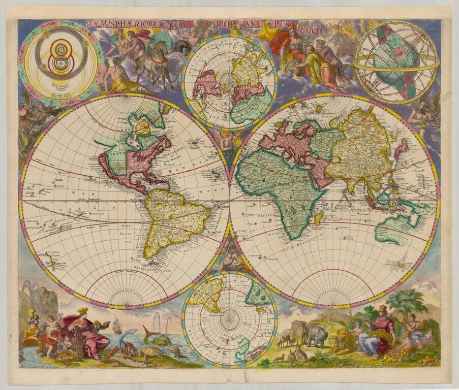
Rare separately published world map by Pieter Schenk II, published in Amsterdam.
The map consists of twin hemispheres, embellished with two small polar hemispheres and two models of the solar system, with an elaborate set of vignettes surrounding the map images.
California is shown as an island, with a narrow strait of Anian and oversized South America. New Zealand is shown with only a single coastline, while Australia reflects the discoveries of Tasman and others.
The map was apparently bound into some examples of the Atlas Contractus, but is extremely rare on the market, this being the first example we have ever seen. We note one example at auction at Zisska & Kistner in May 2003, quite likely this example.
Peter Schenk the Elder (1660-1711) moved to Amsterdam in 1675 and began to learn the art of mezzotint. In 1694 he bought some of the copperplate stock of the mapmaker Johannes Janssonius, which allowed him to specialize in the engraving and printing of maps and prints. He split his time between his Amsterdam shop and Leipzig and also sold a considerable volume of materials to London.
Peter Schenk the Elder had three sons. Peter the Younger carried on his father’s business in Leipzig while the other two, Leonard and Jan, worked in Amsterdam. Leonard engraved several maps and also carried on his father’s relationship with engraving plates for the Amsterdam edition of the Histoire de l'Académie Royale des Sciences.
If you are a student, write to us in telegram: @antiquemaps and indicate what material you need and for what work you need a map in high detail. We are ready to provide material on special terms. For students only!


