Map size in jpg-format: 21.4769MiB
Click to open in high resolution (open in new tab).

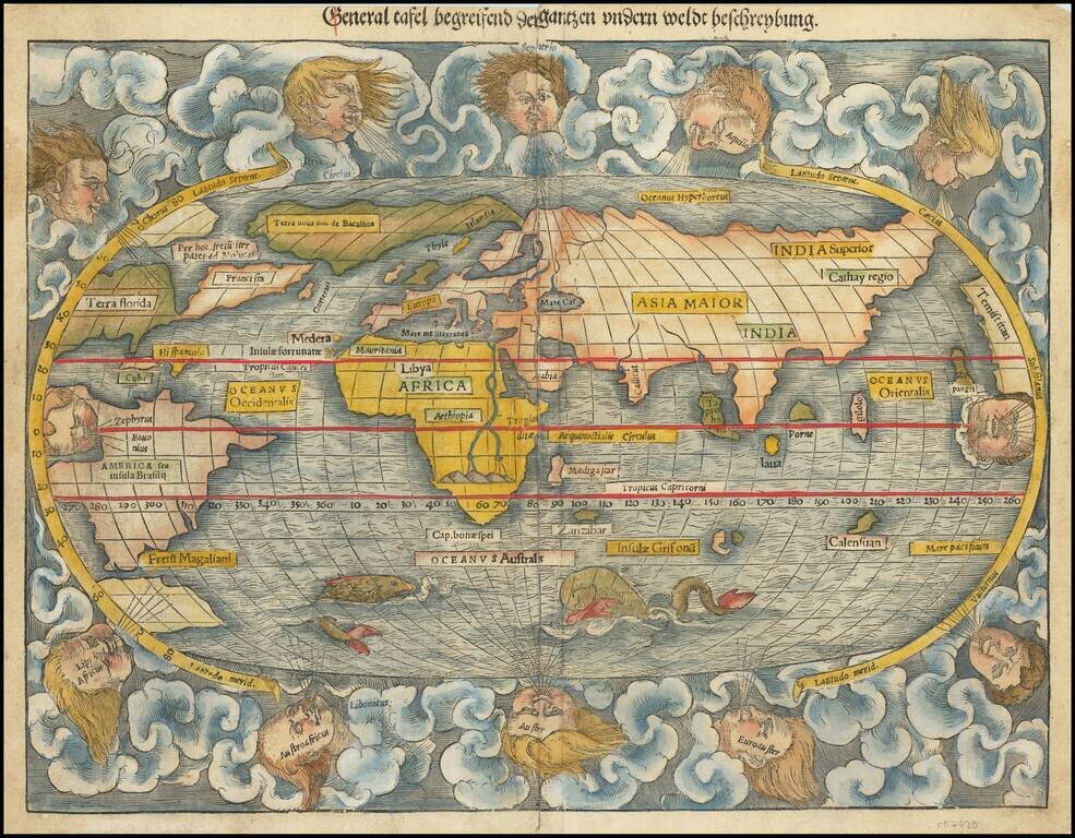
First edition of Munster's map of the World, one of the most recognized world maps of the 16th century.
This example is from the first woodblock (1540-1545), which can be distinguished from the editions of 1550 and after, the later editions being significantly revised and including the initials (DK) of the engraver David Kandel.
The map is based upon a mix of information derived from Verrazano's explorations (1522-24), which mistook the Chesapeake for the Pacific Ocean, and Cartier's voyages (1534-35) up the St. Lawrence in search of the Northwest Passage. The west coast of America appears on the right side of the map. This is also the 1st map to name the Pacific Ocean (Mare Pacificum). Munster is non-committal as to the continuity of North and South America, an unbroken Central America being implied but not clearly shown. Though unnamed, Terra Australis is present but small, only serving to form the Magellan Strait.
All of North America is called Terra Florida. Munster here adds further to the current confusion over Taprobana and Ceylon, depicting a Sumatra-shaped Taprobana on the west side of the Indian subcontinent, and Java in the approximately correct size and position of Sri Lanka.
If you are a student, write to us in telegram: @antiquemaps and indicate what material you need and for what work you need a map in high detail. We are ready to provide material on special terms. For students only!


