logo

1852. F. H. Johnson's New Map of Niagara Falls and River, showing all the Prominent Points Adjacent

  • F. H. Johnson's New Map of Niagara Falls and River, showing all the Prominent Points Adjacent

F. H. Johnson's New Map of Niagara Falls and River, showing all the Prominent Points Adjacent information:

Year of creation: 
Resolution size (pixels): 
 1488x1208 px
Disk Size: 
 449726B
Number of pages: 
 1
Place: 
 Niagara Falls
Author: 

Print information. Print size (Width x height in inches):
Printing at 72 dpi 
  20.67 х 16.78
Printing at 150 dpi 
 9.92 х 8.05
Printing at 300 dpi 
 4.96 х 4.03

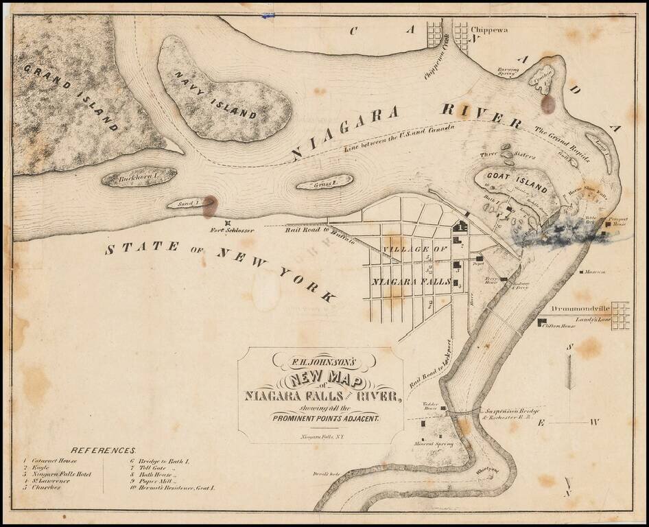
Interesting local map of the area around Niagara Falls.

Includes the Suspension Bridge & Rochester Railroad, Vedder House, Clifton House, Fort Schlosser, Prospect House and many other details.


Special conditions for students!

If you are a student, write to us in telegram: @antiquemaps and indicate what material you need and for what work you need a map in high detail. We are ready to provide material on special terms. For students only!

Item information:

Year of creation:
Size:
1488x1208 px
Disk:
449726B
Number of pages:
1
Place:
Niagara Falls
Author:
F. H. Johnson.
$9.99

Related item