Map size in jpg-format: 7.88116MiB
Click to open in high resolution (open in new tab).

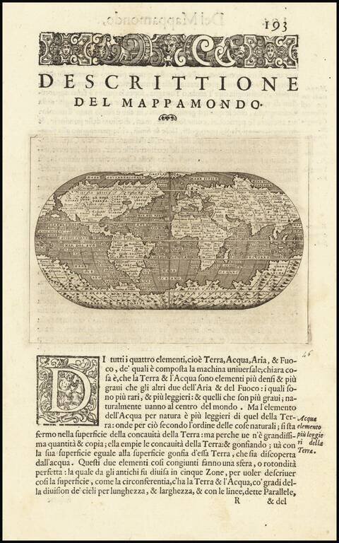
Striking example of Porcacchi's world map, first published in 1572.
Porcacchi's world map is a finely executed reduction of Camocio's Wall Map of 1567, one of the last wall maps to follow Gastaldi's wall map of 1546.
The map shows a narrow strait between America and Asia. California is shown as a peninsula. Limited information on the east coast, although Florida is named. No obvious entry for either the Hudson or St. Lawrence Rivers. The Amazon is depicted, but flowing north-south. Massive southern continent shown, along with a north polar land mass.
A terrific early world map and one of the few opportunities to acquire an example of the Gastaldi World map.
If you are a student, write to us in telegram: @antiquemaps and indicate what material you need and for what work you need a map in high detail. We are ready to provide material on special terms. For students only!


