Map size in jpg-format: 13.241MiB
Click to open in high resolution (open in new tab).
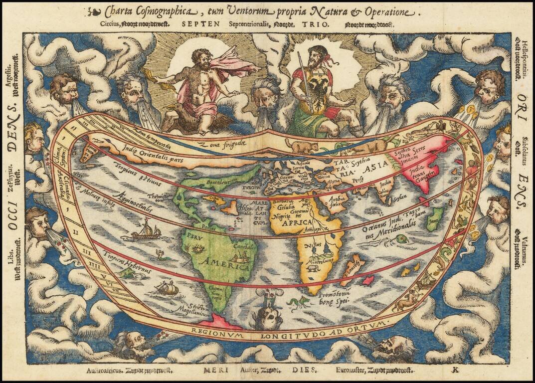
Second Edition of Peter Apian's Cordiform Map of the World
Nice example of the second state of Peter Apian's 1544 cordiform world map, the earliest surviving derivative of Gemma Frisius' larger cordiform map of the world, published in 1540.
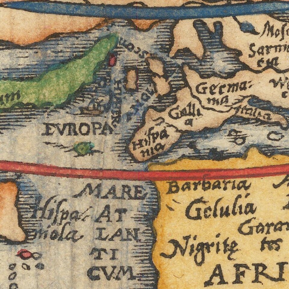
The map is one of the earliest obtainable world maps not based on the works of Ptolemy. North America is depicted as a narrow stretch of land extending almost eastwards. Cuba and Hispaniola are shown as huge islands and the Mountains of the Moon are considered the source of the River Nile. The map includes a Northwest passage, above which is a fascinating Asian projection. North America is called Baccalearum for its Cod fisheries. The narrow Straits of Magellan represent the only passage between South America and an understated Southern Continent. A 'truncated' cordiform projection is used which prevents the south polar regions from being represented.
The map is bordered by signs of the zodiac and the Ptolemaic climatic zones. Zeus and Mars, wearing the coats of arms of Charles V, Holy Roman Emperor, are shown at the top of the map while wind-heads at the south represent the traditional believed plague-bearing nature of those winds. The map is highly decorative but also an important milestone in the history of cartography as it is one of the earliest maps to show a representation of America, or the name itself.
During the 16th Century, the quest for geographical knowledge was primarily spurred on by trade. The great trading nations of Europe became leaders in the printing of maps. Because of its location connecting land routes to the east and southeast, Germany became one of the pre-eminent map centers. Peter Apian, also known by his Latin name Petrus Apainus, was a professor of mathematics and was known as a great astronomer. These skills combined with his interest in geography led to the establishment of his own printing press in Landshut. Apian's textbook Cosmographicus Liber was first published in 1524. The fourth edition (1529) and later editions were edited by his pupil Gemma Frisius, who inserted his own world map in the 1545 publication.
The map was printed over the years with 3 different wood blocks, which can be differentiated as follows:
If you are a student, write to us in telegram: @antiquemaps and indicate what material you need and for what work you need a map in high detail. We are ready to provide material on special terms. For students only!


