Map size in jpg-format: 1.14428MiB
Click to open in high resolution (open in new tab).
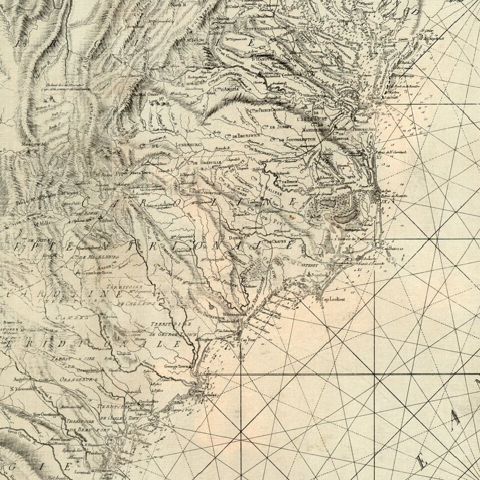
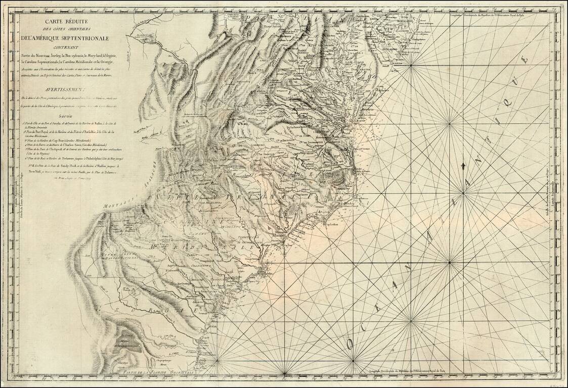
Rare Italian edition of Sartine's map of the Atlantic Coast, from the Chesapeake and Delaware Bays to the mouth of the St. John River. This edition has been completely re-engraved, with some modest changes, although the precision of the copy is quite remarkable for such a large chart.
While at first blush, the map appears to be a coast chart, in fact, its charm lies as much for what it shows in the interior parts of Maryland, Virginia, the Carolinas and Georgia. The map includes dozens of early roads, forts and towns, as well as excellent detail in locating the various Indian Lands east of the Appalachians.
While published in Rome, it retains its French nomenclature. The map also locates dozens of churches and identifies denominations. Annotations include an Assembly of Non-conformists in western North Carolina (Franklinites?), and many other interesting notes. Along the coast, the islands, capes, soundings and other coastal details are provided in tremendous detail. Because this map was issued after Cummings cut-off date in mapping of the Southeast and after Sellers & Van Ee's cutoff of 1789, it does not appear to have garnered nearly the attention it deserves, despite being on a scale which is similar to the seminal maps by Popple and Mitchell. Only the second example we have ever seen.
If you are a student, write to us in telegram: @antiquemaps and indicate what material you need and for what work you need a map in high detail. We are ready to provide material on special terms. For students only!
![[Wall Map] West-Indische Paskaert waer in de graden der breedde over weder zyden vande middelyn wassende so vergrooten dat die geproportioneert syn tegen hunne nevenstaende graden de lengde.](/map/small/60169.jpg)

![[The First Maps in a la poupée Printed Color] Cartes en Couleur des Lieux Sujets aux tremblements de Terre Dans toutes les parties du Monde Selon le Sisteme de l’impulsion Solaire](/map/small/52293op.jpg)