Map size in jpg-format: 25.7242MiB
Click to open in high resolution (open in new tab).
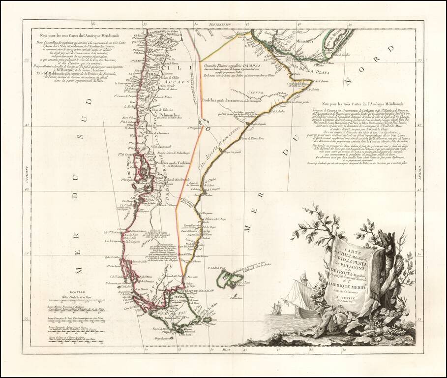
Finely engraved map of southern South America, focusing on Chile, Patagonia, Tierra del Fuego and the Strait of Magellan, from Santini's Venetian edition of d'Anville's map from "Atlas Universel" printed in 1776-84.
Includes an elaborate cartouche and extensive annotations, referencing Condamme, Mouguer, Maldonado and others, with further annotations in the interior of the map.
Paolo Santini (1729-1793) was an Venetian engraver known especially for his religious prints and fine cartographic engravings. He published in Venice and may have a been a member of the clergy. In his maps, he largely adopted and adapted the work of his French counterparts, especially the brothers de Vaugondy.
If you are a student, write to us in telegram: @antiquemaps and indicate what material you need and for what work you need a map in high detail. We are ready to provide material on special terms. For students only!


![[Signed Political Satire Artwork] Vietnam ... Vietnam ... Vietnam ...](/map/small/68726.jpg)