Map size in jpg-format: 79.5834MiB
Click to open in high resolution (open in new tab).
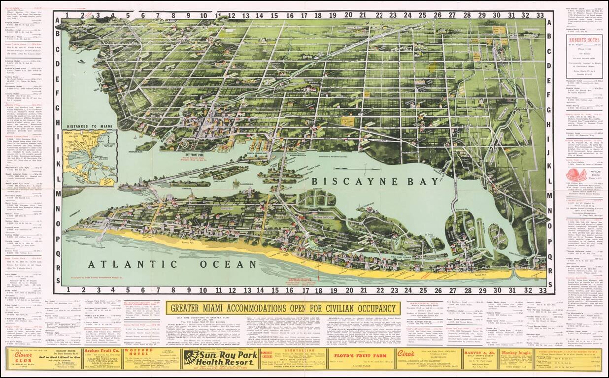
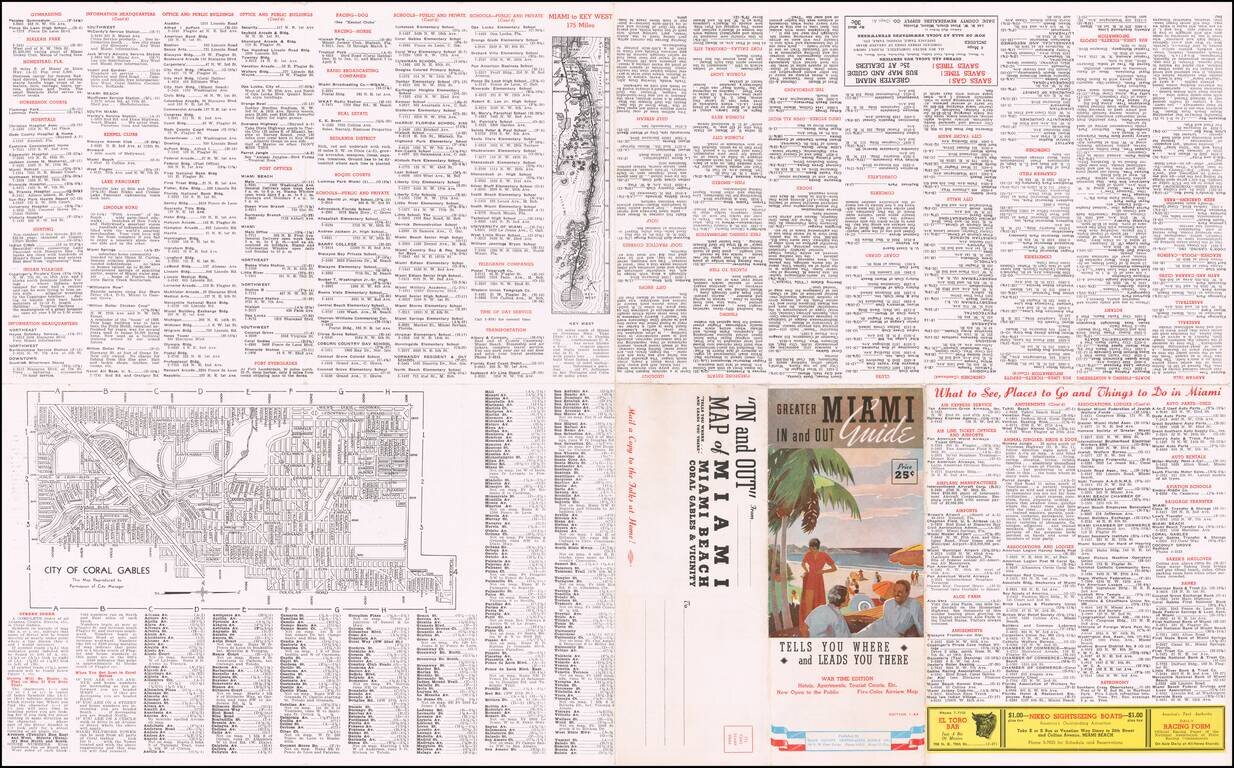
Fantastic early birdseye view map of Miami and Biscayne Bay, Miami Beach and Coral Gables, illustrating this early edition of "Greater Miami In and Out Guide.
Issued during World War II, it includes section noting the war-time accommodations in Greater Miami.
A fantastic early map--only the second example we have ever seen.
If you are a student, write to us in telegram: @antiquemaps and indicate what material you need and for what work you need a map in high detail. We are ready to provide material on special terms. For students only!

![[Wall Map] West-Indische Paskaert waer in de graden der breedde over weder zyden vande middelyn wassende so vergrooten dat die geproportioneert syn tegen hunne nevenstaende graden de lengde.](/map/small/60169.jpg)
