Map size in jpg-format: 3.3539MiB
Click to open in high resolution (open in new tab).

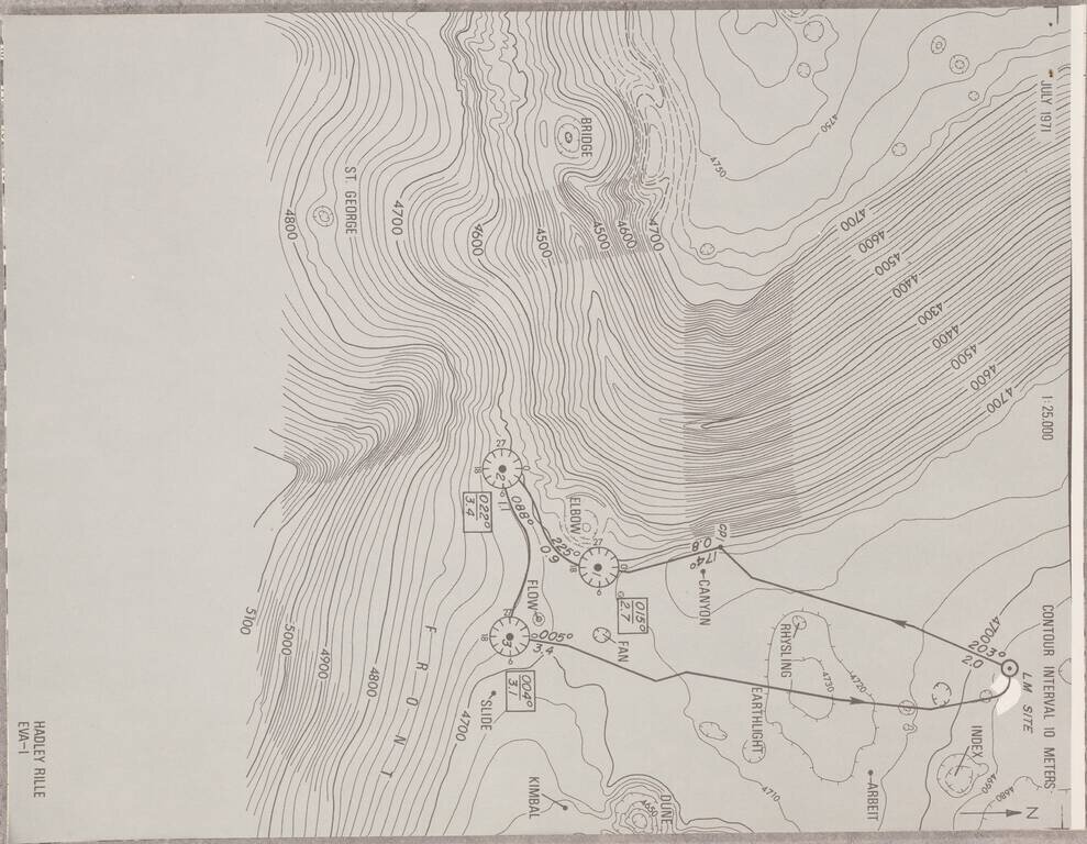
An Atlas for a Walk on the Moon.
An extremely rare Apollo 15 extravehicular activity (EVA) atlas, detailing the projected routes of Apollo 15's three EVAs.
The atlas consists of a key sheet and 24 maps. The ephemeral nature of the atlas (loose sheets secured with a single staple) probably contributes to the atlas's extreme rarity; we find no copies list in OCLC nor any other copies ever having been offered for sale.
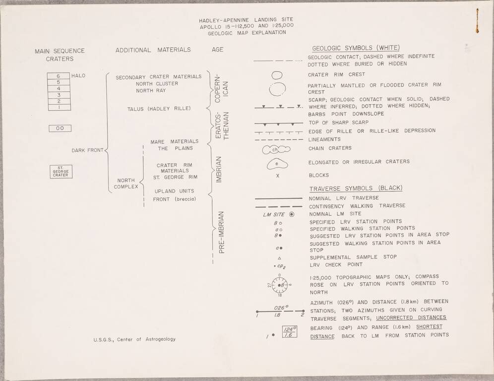
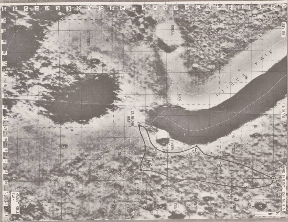
A major theme in these images is the geological observations made during the mission. The planned and contingency routes are shown alongside the features that the astronauts described back to the USGS scientists on earth. Not only are geomorphological features described, but also the presence of fans, flows, and a pluton. These maps are made in a stellar geological mapping style despite the limitations of selenological mapping. Observations and routes are shown on both topographic maps and areal images.
Collation
The following is an enumeration of the contents of the atlas:
If you are a student, write to us in telegram: @antiquemaps and indicate what material you need and for what work you need a map in high detail. We are ready to provide material on special terms. For students only!
![[Blaeu Atlas of America] America, Quae Est Geographiae Blavianae Pars Quinta Liber Unus Volumen Undecimum](/map/small/66852.jpg)