Map size in jpg-format: 1.35767MiB
Click to open in high resolution (open in new tab).
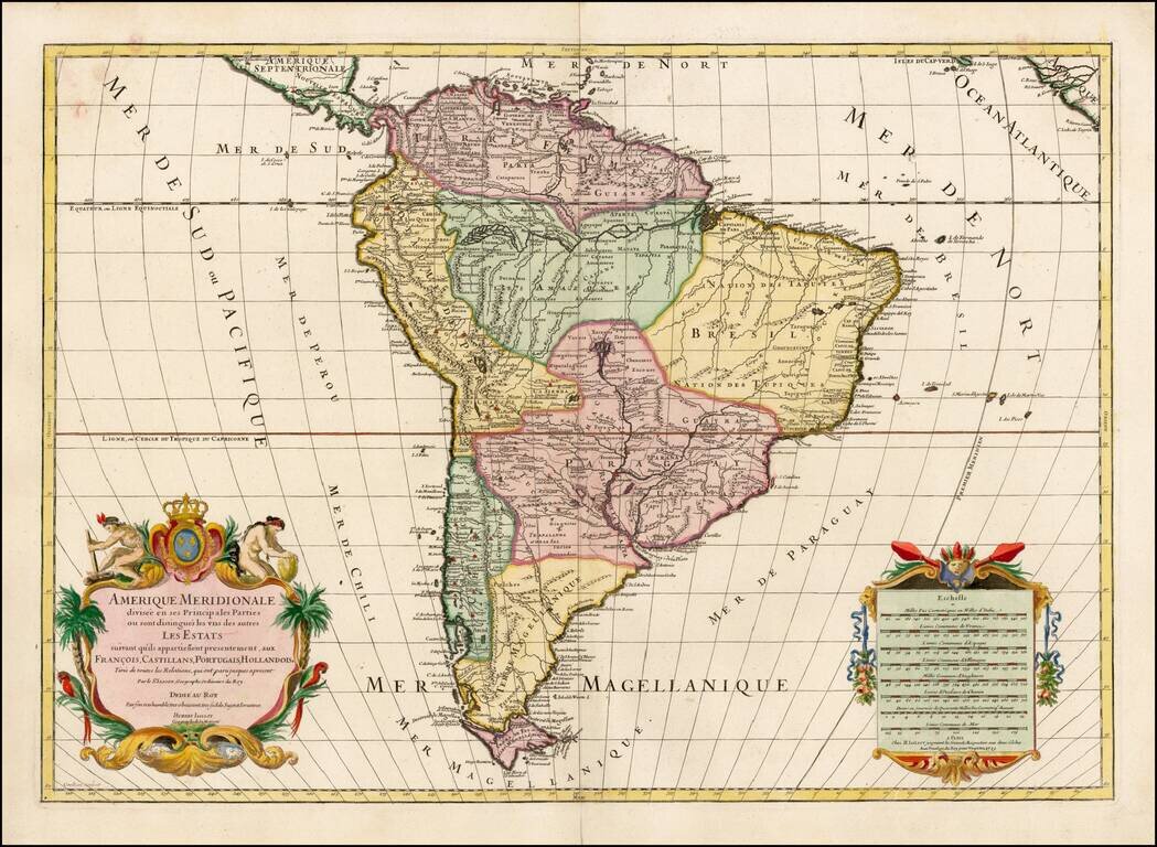
Fine Map of South America by Jaillot
Handsome large-format map of South America. This is a revised state of Jaillot’s map of the continent, which was originally based on the earlier maps of Nicholas Sanson.
Jaillot’s map is well-framed, showing South America with portions of Central America, Africa, and the Cape Verde Islands.
The continent’s defining physical features are notable here. The Rio de la Plata curls northwards, studded with islands, and ends in the mythical Lake of Xarayes. The Amazon winds towards the heart of the landmass, splitting into a feather-like pattern and then weaving its way from smaller rivers in Peru. On the previous state of the map, there was a large, rectangular lake, Lake Parime, in the north. Here, the lake is gone, but the mystical city of Manoa El Dorado, supposedly on its banks, is still included.
In the far south, the Straits of Magellan separate Tierra del Fuego from the mainland. The latter is shown as a single island with several rivers, a common depiction of the area at the time. The Straits are surrounded by toponyms of Spanish, Dutch, and English origins. This reflects the dense history of navigation in the area, with Magellan—a Portuguese sailor in the employ of the Spanish—naming Cape of 11,000 Virgins, Jacob Le Maire naming Staten Land and the Straits of Le Maire, and John Narbrough naming Cape Froward, as some examples.
The geographic content of the map is augmented by the decorative features. In the lower right corner is an imposing scale bar with eight scales. In the lower left is the title cartouche crowned by two naked, industrious indigenous people. They frame the coat of arms of the King of France, the dedicatee of the map.
Jaillot’s map is one of the most detailed and accurate maps of the period.
If you are a student, write to us in telegram: @antiquemaps and indicate what material you need and for what work you need a map in high detail. We are ready to provide material on special terms. For students only!


![[Signed Political Satire Artwork] Vietnam ... Vietnam ... Vietnam ...](/map/small/68726.jpg)