Map size in jpg-format: 34.737MiB
Click to open in high resolution (open in new tab).
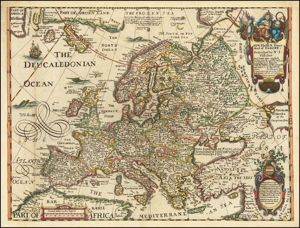
Rare English map of Europe, published in London by Robert Walton.
Walton's map shows all mainland Europe, extending northwards beyond North Cape to include Greenland, Nova Zemla, and Sir Hugh Willoughby's Land. This last place was named after the leader of an English expedition to find the north-east passage which ended in disaster, the participants starving to death on the Kola Peninsula in 1554.
The map includes the mythical the islands of Brazil and Frisland, in the north Atlantic.
Walton's map, unlike its Dutch counterparts, has a crude folk-art like quality, reflective of a period when English engravers were far less skilled than their Dutch counterparts.
If you are a student, write to us in telegram: @antiquemaps and indicate what material you need and for what work you need a map in high detail. We are ready to provide material on special terms. For students only!

![[Eastern Hemisphere Globe Gores] (Nova et integra universi Orbis descriptio)](/map/small/54480.jpg)
![[Signed Political Satire Artwork] Vietnam ... Vietnam ... Vietnam ...](/map/small/68726.jpg)